Scottish companies are finding creative ways to use the data captured by satellites orbiting the planet, writes Peter Ranscombe.
While Nasa’s Orion spacecraft has been to the dark side of the Moon and back, the north’s mini space race is also speeding up.
Sutherland’s plans are making another “small step” and Shetland’s project is taking a “giant leap”.
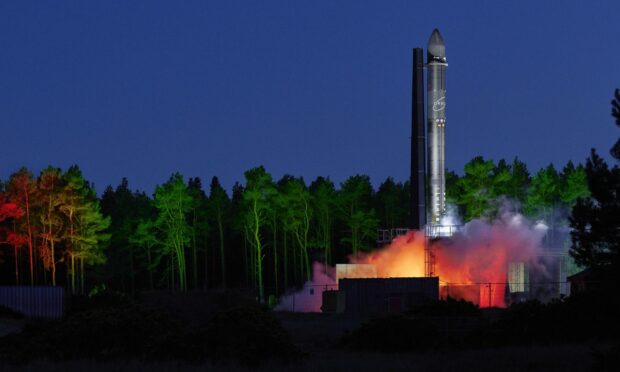
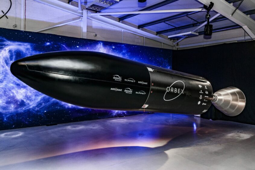
In October the Scottish National Investment Bank led a £40.4 million funding round for Orbex, the Forres-based rocket maker and launcher.
Orbex later signed a 50-year lease with Highlands and Islands Enterprise to build and operate Sutherland Spaceport on the A’ Mhoine peninsula.
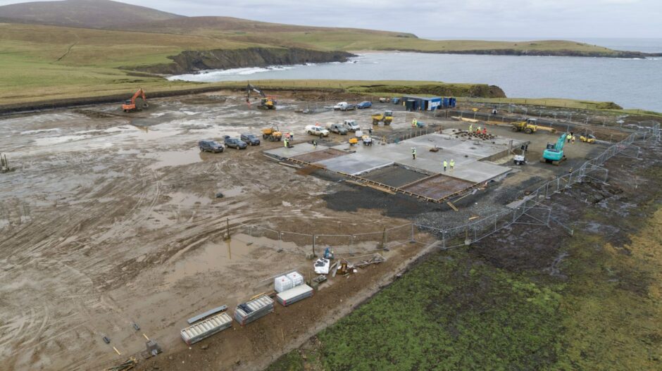
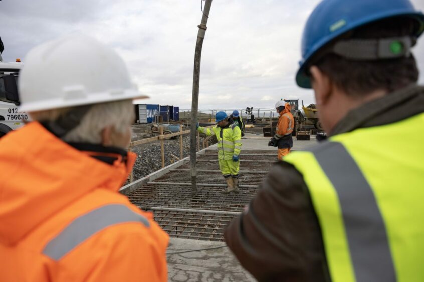
Meanwhile, the concrete base for the first launchpad of SaxaVord UK Space Port on Unst, Shetland, was recently completed.
And a Civil Aviation Authority consultation on the environmental impact of the site has just closed.
Both north spaceports aim to launch their first rockets during 2023, with Sir Richard Branson’s Virgin Orbit operation likely to pip them to the post by sending satellites into orbit from Spaceport Cornwall.
Rather than being launched vertically into the sky, Virgin’s horizontal approach involves a modified 747 jumbo jet carrying its rocket to a high altitude before releasing it to make its way into space.
Yet launching satellites is only part of the story, with many companies in the the north already benefiting from data transmitted back from space.
Data collection a key part of Shetland space plans
Collecting data from satellites is a key part of the business plan for SaxaVord UK Space Port, which is owned by Frank and Debbie Strang.
“Our business model is based on the four legs of a stool – you’ve got revenue from launches, data, accommodation and support services – so we’re not wholly dependent on launching satellites,” explained Mr Strang.
He added: “A satellite orbits Earth 16 times a day. Every time you see that satellite, you can bring data down from it and monetise that data.
“In the central belt you’ll see a satellite five or maybe six times a day if you’re lucky, but here on Unst we can see a satellite 12 or 14 times a day, so we can see it for longer and more often.
“Unequivocally, we’re the best site in the UK, because of our northern latitude, for bringing data down.”
As well as building its own ground station, SaxaVord UK Space Port is assembling a wider network of receiving stations in Alaska, the Falkland Islands, Faroe, Finland and Greenland.
In June 2021 the Shetland site joined the Leaf Space network – an Italian-led chain of 17 data receivers spread from Europe through India to Australia and New Zealand.
The Strangs have led the £19m private sector investment in Shetland’s launch site, which has already created 60 jobs on Unst and another 60 construction roles, with the total expected to top 200.
Estates and other landowners are among the businesses and organisations already harnessing the power of satellite images.
One of the companies helping them to use space data is Glasgow-based Eolas Insight, which was founded by Doug McNeil in 2020.
Mr McNeil hails from Shieldaig, in Wester Ross, and is a well-kent face with strong links to the land management sector.
As well as working on fast jets and helicopters in the aerospace industry before moving into Scotland’s burgeoning space sector, he also studied location data and mapping at university.
Nature studies
That combination of skills and background has allowed him to build a business that uses satellite images and artificial intelligence (AI) to monitor forests, peatbogs and other parts of the landscape.
Eolas worked with NatureScot – the Scottish Government agency previously known as Scottish Natural Heritage – through CivTech Scotland, a project that rallies digital technology companies to help solve challenges for public sector bodies and charities.
The company developed a method to count red deer in satellite images, with a follow-on project using aerial photography to distinguish between males, females and calves.
Eolas then worked with the European Space Agency to identify elephants, giraffes, wildebeest and zebras in Mozambique to help with monitoring and conservation.
Its work in Mozambique extended to monitoring forests and the firm is now using those woodland techniques in Scotland too.
Mr McNeil said: “As Scotland approaches its 2045 net-zero target, people and organisations are valuing peatlands, woodlands and other landscape features for their natural capital and the ecosystems services they provide, especially absorbing and storing carbon and preventing flooding.
“We’re working with companies including Caledonian Climate, Caorann Ecological Consultancy, Landfor Land & Forestry, and Omanos Analytics to provide a wide range of services.”
AI at the heart of hunt for Scottish minerals
The availability of space data is also inspiring entrepreneurs to create businesses that combine information from satellites with expertise on the ground.
Gavin Berkenheger, the Inverness-based managing director of Planetary AI, studied petroleum geology at Aberdeen University and wrote his dissertation on the geology of Mars.
While most of his classmates headed off to the oil and gas industry, Mr Berkenheger has spent the past 15 years exploring for minerals such as gold, copper and zinc in Scotland, Ireland, and Scandinavia.
Rather than twiddling his thumbs during lockdown, he and a group of colleagues began exploring how they could combine data gathered by satellites with their expertise in minerals and related fields.
Great article in the @geoscientistmag exploring how AI can be used in new geological mapping techniques.
"Thinking in terms of position in 3D space is the bare minimum when it comes to geological mapping."https://t.co/4q3GsonNGR
— GeoScience Limited (@GeoScienceLtd) September 8, 2022
The result is Planetary AI, which has been going through this year’s Engage Invest Exploit investor readiness programme at The Bayes Centre – Edinburgh University’s innovation hub for data science and AI.
The new company is working in partnership with London-based International Geoscience Services to integrate satellite data and AI into its existing software for finding minerals.
Satellites don’t just look at Earth using visible light but throughout the electromagnetic spectrum, including infra-red, ultra-violet and x-rays.
We’re on the frontline of finding new resources to allow the world to reach net-zero.”
Gavin Berkenheger, managing director, Planetary AI.
By looking at this “hyper-spectral” information, Planetary AI believes it can spot mineral deposits buried beneath the ground.
Mr Berkenheger said: “When you look at the Sahara Desert in the visible spectrum it’s just beige sand.
“But with a hyperspectral visualisation you can see all this detail, because the slight differences in the geochemical structure of the rocks mean they reflect electromagnetic waves at different wavelengths.
“One of the driving forces behind our idea is that we need more metals and minerals, including cobalt, lithium and nickel, to build everything from electric vehicle batteries to solar panels and wind turbines to make the transition from oil and gas to electrification.
“We’re on the frontline of finding new resources to allow the world to reach net-zero.”
