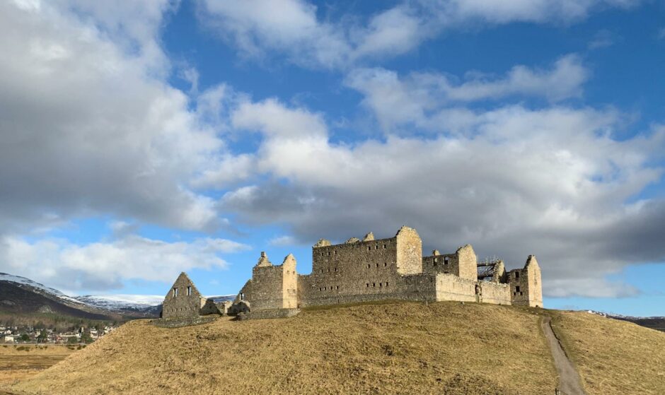
The dramatic ruin of Ruthven Barracks is a familiar sight to travellers on the A9.
It’s also the starting point for a fine and not too strenuous circuit walk into beautiful Glen Tromie and back through the Insh Marshes nature reserve.
This is a walk best kept for a fine day: apart from the constantly changing vistas, the route crosses high moorland and the path-finding down into the woods can prove tricky.
The Ruthven stronghold was built in the 18th Century to station Hanoverian troops, but was destroyed by Jacobite forces in 1746.
There is currently scaffolding along part of the barracks as important conservation work – long delayed by Covid restrictions – is finally able to get under way.
I had clear skies but there was a surprising icy crunch underfoot on the way uphill from the parking area and on to a farm track.
My presence seemed to excite a field of bullocks who obviously thought I was bringing breakfast, but it had the opposite effect on the flock of geese in the next field who took flight en masse.
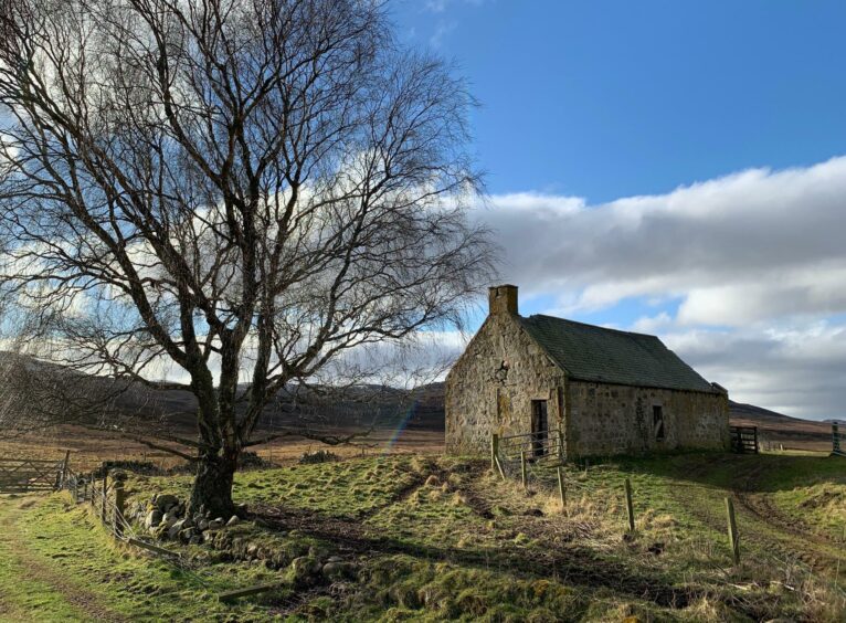
The grassy track twisted alongside drystone walls then up through a very muddy section before curving right in front of a ruined cottage. I peeled left of the ruin, climbed a high stile then crossed a stream before following the track up through the heather.
An inconsistent path
The track swung to the right of a hillside with a mast atop, then started to level out. This next section was heavily waterlogged, a common occurrence judging by the unofficial paths to either side.
Further on, I left the track at a fork and went left on a path. This passes a small cairn then rises to a larger one before the descent towards the woods and a stile over a high deer fence.
The path beyond can be faint in places, overgrown in others, but the tendency is always to head left and look for the occasional marker post, until one right turn leads to a small stile.
Once across this, follow the fence to a larger stile which gives access to a bridge over the River Tromie.
That first fork is the key: it’s easy to miss and carry straight on. If you find yourself starting to drop too far right, retrace your steps and begin again.
Even if you don’t, it’s not a disaster. Simply head down towards the river then turn left and follow the boundary fence round the lodge to find the stiles.
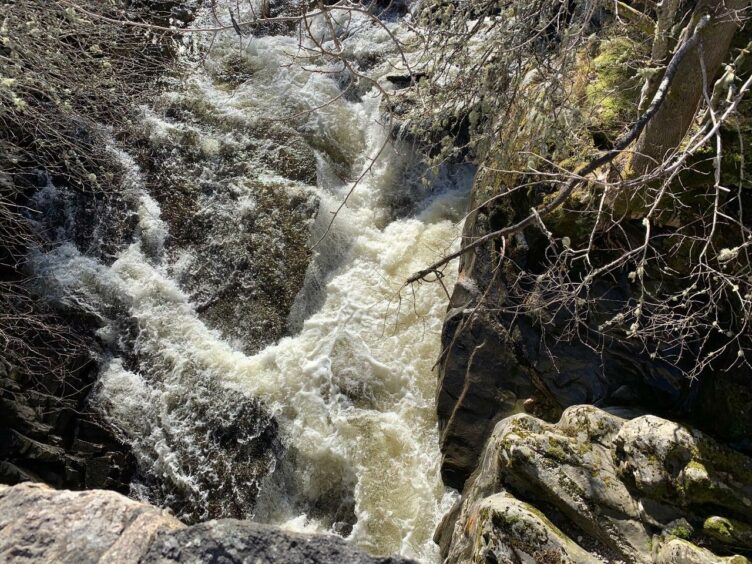
Once over the bridge, a left turn provides a pleasant stroll down to Tromie Bridge, where the waters thunder through the narrow ravine below.
The nature of the route changes again once over the old stone bridge. There are two metal gates – take the one on the right.
This crosses a grassy pasture before heading into the woods on a delightful path which weaves its way through the trees with the sound of birdsong all around.
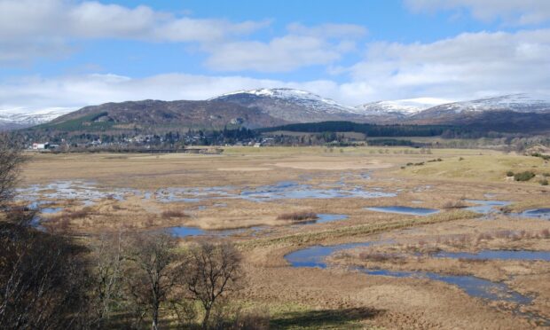
The path drops to a minor road where a gate opposite takes you back into the woods. There is a diversion to a viewpoint and picnic area high above the blue blotches of the Insh wetlands, plus benches at several locations, and there are plenty of marker posts to keep you on track.
I eventually emerged at the small car park near Invertromie Hide, and after a short detour to the viewing platform, I headed back along the road to Ruthven.
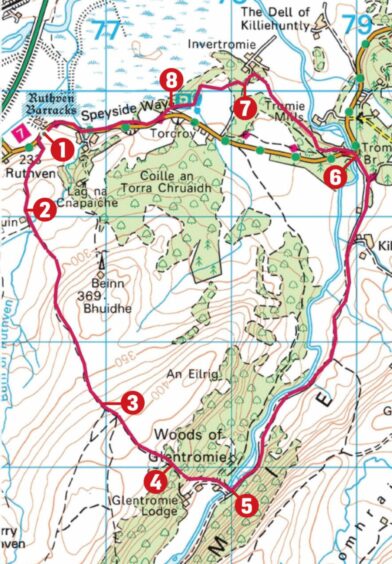
The route:
- Walk uphill for short distance from Ruthven Barracks parking to turn left on farm track. Go through metal gate then second gate, turn right on track running alongside walled field and continue as track turns uphill to left to reach ruined house.
- Leave track just before house and go left on grass to high stile giving access to heather track. Cross burn and keep heading uphill, aiming right of mast on hillside ahead.
- Near high point of track at junction, stay left following path down into Glen Tromie woods. Path can be vague in places, and it’s easy to find yourself heading further right on track down to river (don’t worry, you can always work your way back north-east to fence round lodge and follow it round).
- Cross deer fence by stile, then down through trees. At fork, go left at first then bend right (there are some marker posts) to another stile. Cross and follow fence to larger stile, climb and turn left to cross road bridge.
- Turn left and walk down minor road to Tromie Bridge, turn left over bridge then cross road to metal gates. Go through right-hand one (signed for RSPB).
- Now follow white arrow markers – they lead through woodland and a series of gates to reach minor road.
- Cross to gate opposite to continue on trail which runs above Insh Marshes before emerging at small car park.
- Follow road west by walk and cycle way to return to Ruthven.
Information
- Distance: 10.5km/6.5miles
- Ascent: 310m/1020ft
- Time: 3.5-5 hours
- Grading: Fine, varied circuit best kept for a good day, suitable for reasonable fitness levels on hill tracks, woodland paths, estate tracks and minor roads.
Path heading down to Glen Tromie can be hard to follow in places. Muddy and wet sections, good footwear advised. Route is through farmland and nature reserve – dogs under tight control. - Start/finish: Ruthven Barracks parking area (Grid ref: NN 764996) on B970 from Kingussie (signed).
- Map: Ordnance Survey 1:50,000 Landranger Map 35 (Kingussie & Monadhliath Mountains); Ordnance Survey 1:25,000 Explorer sheet OL56.
- Tourist Information: VisitScotland, Aviemore iCentre, 7 The Parade, Grampian Road, Aviemore, PH22 1RH (Tel 01479 810930).
- Public transport: None to start. Regular bus and train services to Kingussie from Perth and Inverness.
