Glen Coe has an extraordinary atmosphere.
I love being there, particularly on a moonlit winter night when its black walls tower up to end in snow-capped peaks and Orion strides across the deep blue sky above.
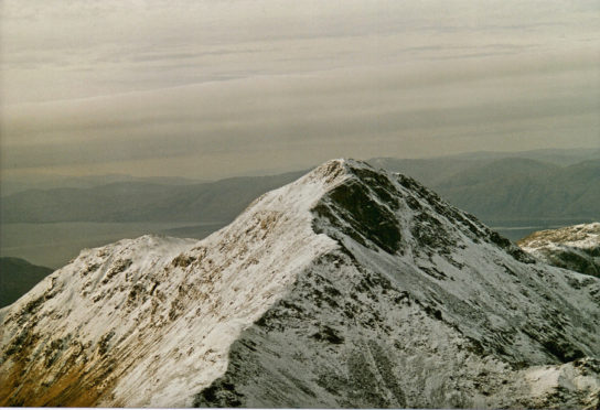
At the western end of the Glen Coe range is Beinn a’ Bheithir. The Gaelic translates as Bheithir’s (pronounced vay-heer’s) mountain, Bheithir being the goddess of winter and death. It is a rugged horseshoe ridge with half a dozen peaks, the highest two being Munros. These are Sgorr Dhonuill and Sgorr Dhearg, both over 1,000 metres. As the climb starts at sea level, any day on these mountains is going to be demanding.
Park in the forestry car park at south Ballachulish and follow the forestry track south into the huge corrie at the head of Gleann a’ Chaolais. The rocky cliffs are very steep and the climb up the path that zigzags up the corrie backwall is a hard slog. In winter, these cliffs are in deep shadow and draped with frozen waterfalls. Watch out for loose scree on the way up and avoid lobes of thick ice.
It is a relief to be on the ridge at last, particularly if you are back into sunshine. I suggest walking the extra distance to a top to the south-west of Sgorr Dhonuill’s summit as this gives a panoramic view of the whole ridge.
I was up on Sgorr Dhonuill one February day and sheltering from a cold wind behind rocks just under the summit when my companion touched my arm and said in a low voice: “Look up, quick.” It was a golden eagle, just a few metres above our heads. Its primary feathers were bent upwards like outstretched fingers and the sun turned its tawny colour to gold. We watched as it glided away silently, never once moving its wings, the most appropriate of all creatures for Bheithir’s mountain.
The views from the high perch of Sgorr Dhonuill are wonderful. To the east the eye is drawn to the rugged mountains of Glen Coe, dominated by the massive block of Bidean nam Bian, cut in its upper reaches by deep corries separated by sharp arêtes. Looking through Glen Coe, the distinctive pyramid of Schiehallion stands beyond Rannoch Moor. Sweep your gaze to the south and south-west over the sparkling sea to Ben More, head and shoulders above its fellow mountains on Mull. Turn north to see range after range stretching to Knoydart and Kintail, then north-east for the best view of all, Ben Nevis and the Mamores rising dramatically above the waters of Loch Leven.
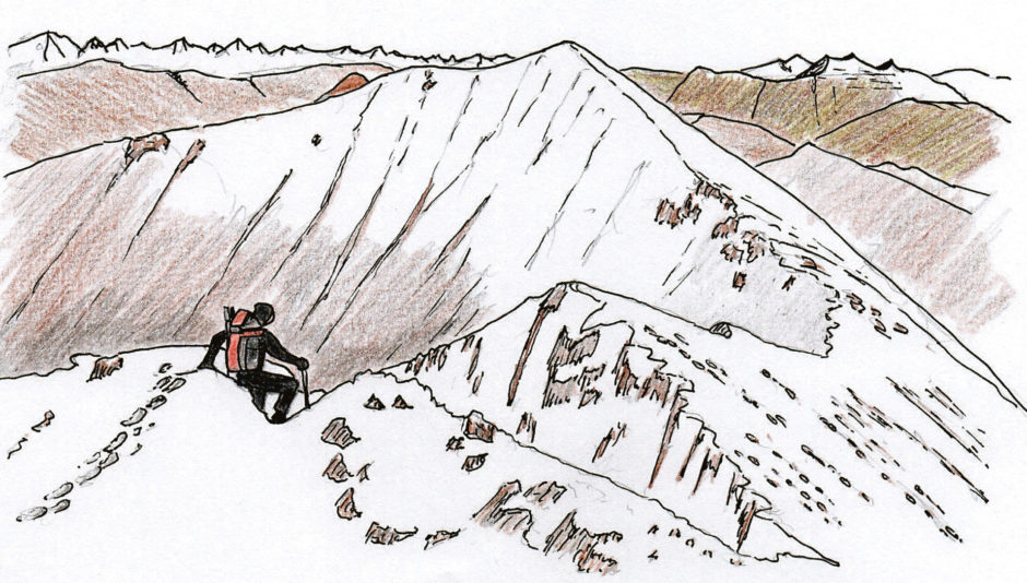
On that day when we were visited by the eagle, I was surprised to see a fox had recently passed over the summit, his (or hers) the only tracks in the powdery snow. The steep descent was a tricky business in the icy conditions, clambering down rocks and little gullies, very aware of the exposure on this narrow ridge. The drop down to the north in particular is considerable. The fox prints showed us the way down and I envied the creature’s sure-footedness.
The prints led us up the sharp ridge to Sgorr Dhearg, its summit the highest point on Beinn a’ Bheithir. I found myself thinking about the fox as I climbed. I had noticed fox tracks in the snow on other Munros – was it the same one and was this fox a Munro bagger?
The most straightforward way down is to back-track to the bealach between the two main summits then follow the path down, through the forest and return to the starting point. On both of my visits, however, a small stream had frozen, turning this particular path into a precipitous chute of shiny ice. Our solution was to descend by the keen-edged north ridge of Sgorr Dhearg. It looks intimidating in its upper reaches but don’t be put off, it is a fine alternative. After about two kilometres, turn west and scramble down slopes of grass and heather to the tree line. Thread between the conifers until you reach a forestry roadway and follow that down to the loch shore.
A good end to the walk is to stop for a hot meal at the Clachaig Inn in Glen Coe. The bar has long been a meeting place for climbers and hillwalkers after a hard day in the mountains. If you are lucky you will get a seat by the big stove.
This walk is included in Jack Harland’s book, Highland Journal 1, The Making of a Hillwalker, published by Troubador.
The lowdown
- Directions: From Fort William or from Glen Coe take the A82 to South Ballachulish where the bridge crosses the narrow entrance to Loch Leven. Follow the A828 through the village to the parking space at 044 595 on the shore.
- Distance: 13 kilometres
- Time: Six hours
- Difficulty: A steep 1,000 metre climb. Experience and the appropriate equipment are essential in winter conditions.
- Map used: Ordnance Survey Landranger 41

