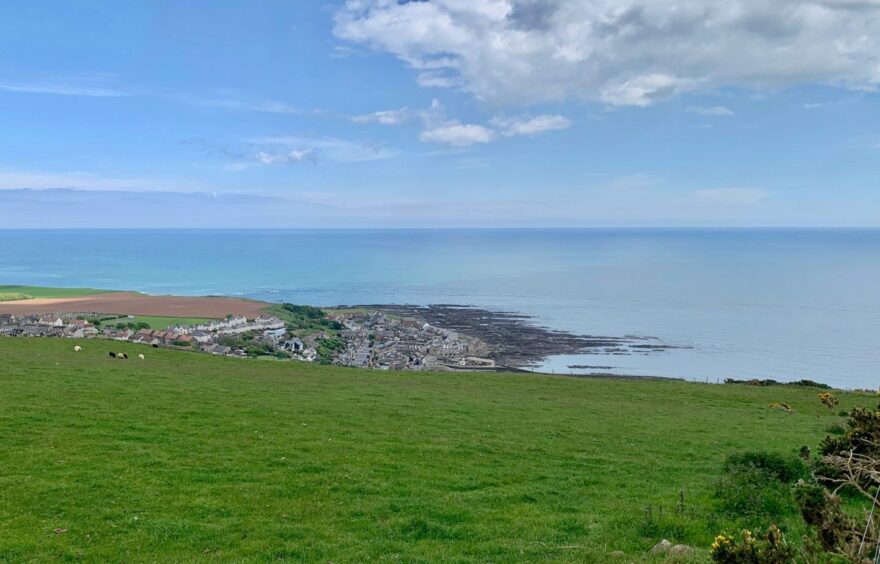
Gourdon coastal circuit, Aberdeenshire
The old fishing village of Gourdon is the centrepiece for a fine wander through time on a varied network of paths and tracks.
Starting in Inverbervie, this route heads down the North Sea coastline before taking a sharp turn inland through peaceful woodland, then follows the line of a former coach road over farmland to come full circle.
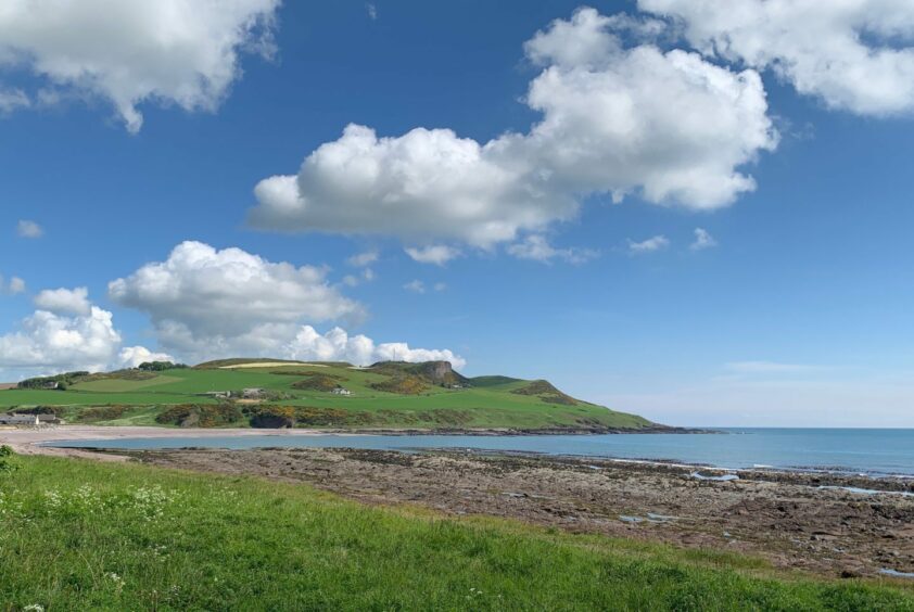
The pebble beach and sparkling waters of lovely Bervie Bay were my start point for this sunshine stroll, but those wishing a slightly longer day can continue further down to Johnshaven, or spend more time exploring the past in Inverbervie.
The town was granted royal burgh status by King David II in 1342, partly as a reward for the hospitality he and his queen, Johanna, received after their ship had been driven ashore in foul weather the previous year.
It also boasted the country’s first water-powered flax mill and is the birthplace of Hercules Linton, who designed and built the clipper Cutty Sark. There is an inscribed plaque and replica figurehead of the ship near the Market Square.
The surfaced path heads south and is popular with dog walkers, but if you prefer softer walking you can take the rougher, more meandering path closer to the shore.
En route, a grassy path on the right just beyond the last of the houses leads to a small waterfall, and above that sits Hallgreen Castle. This was once reputed to be one of Scotland’s most haunted houses, but it is now penned in by modern homes and mostly hidden from sight by tree growth.
Next stop was Gourdon, a major centre for herring in the 19th Century. Despite the decline of the industry, Gourdon remains a working harbour and there are several informative panels about the history and sealife of the area as well as a small maritime museum nearby (open weekends).
The track continued past the Harbour Bar with its befitting end-wall mural and along the former rail bed of the Inverbervie-Montrose line. This operated for more than 100 years with the last train passing through here in 1966.
After passing a row of cottages at the Haughs of Benholm, I followed a drystone wall to its end before leaving the main track by a sharp turn right on to a grassier track.
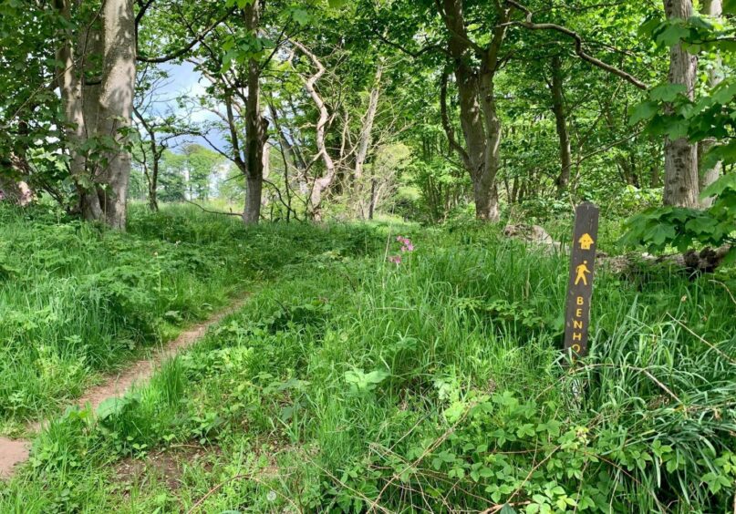
The next section led into the woods near Lathallan: the path was a delight, a narrow passage through lush greenery, butterflies and birdsong in abundance, fallen trees wrapped in creepers, not another soul around. It all ended way too soon when the path emerged from this haven of peace on to the busy A92 at Benholm Bridge.
I crossed and walked up the minor road past the entrance to the now sadly closed Mill of Denholm buildings and took a right at the corner before the arched bridge (there is a signpost for Inverbervie but it is buried deep in the undergrowth). The grassy track running between farm fields is part of an old coach road known as the Lang Rigg.
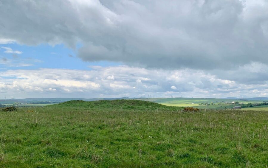
This climbs to pass along the edge of Gourdon, or Bikmane, Hill where there is a Neolithic burial site – the Long Cairn. The boulder mound is covered with turf and grasses, but it’s worth the short diversion if only to catch the splendid view down the coast.
ROUTE
1. Head south from parking on coastal path. Shortly after passing ornamental boat take shore path on left (you can stick with parallel surfaced path if preferred) and follow into Gourdon.
2. Head up by Seaview Park and through streets to harbour, passing to right of Harbour Bar for signed coastal path to Johnshaven.
3. Follow track alongside fields and after passing row of houses at Haughs of Benholm, continue by drystone wall until its end then take grassy track going sharp right.
4. After short distance go through gap on left into field, turn right and cross wall at low point to pick up path through trees. Follow this as it curves right, then watch for another small gap with stone steps on left leading to woodland path.
5. Head north-east through trees, crossing straight over one rough track, and continue on path as it eventually turns north-west to emerge on A92 at Benholm Bridge.
6. Cross bridge then road to head up minor road opposite signed for Mill of Benholm. When road swings left over stone bridge, take track on right (sign for Inverbervie, but difficult to see).
7. Follow track past Nether Benholm and then houses at Tillygrain to reach communications mast a short distance further on. Grassy track on right gives access to top of Gourdon Long Cairn.
8. Return to main track and keep heading north-east. At next junction, head right to A92 and cross to pavement. Take next right (Brighead) and when road ends continue on track, then descend wooden stairs back to coastal path.
INFORMATION
Distance: 13km/8miles
Ascent: 180m/590ft
Time: 3-4 hours
Grading: Varied and easy route for all ages and abilities along coastal path, woodland trails and farm tracks. Some sections on minor roads, some pavement walking by main road. Muddy in places, good footwear advised. Route passes through farmland, dogs under close control.
Start/finish: Bervie Bay parking, Inverbervie (Grid ref: NO 834725).
Map: Ordnance Survey 1:50,000 Landranger Map 45 (Stonehaven & Banchory); Ordnance Survey 1:25,000 Explorer sheets 382 and 396.
Tourist Information: VisitScotland, Aberdeen iCentre, 23 Union St, Aberdeen, AB11 5BP (01224 269180).
Public transport: Regular bus service between Montrose and Stonehaven (No 107).
