Glas Maol, Glen Isla, Angus.
It’s easy to understand why so many choose to tackle Glas Maol and Creag Leacach from Glenshee.
The high elevation start makes for an easy day, but it’s also a handy springboard for those with eyes on bagging multiple Munros.
It’s not the prettiest route, a plod up bulldozed tracks among the ski centre detritus from a busy car park.
An approach from Glen Isla, however, presents a wilder side to these sprawling hills which will delight lovers of solitude.
The mountainous terrain known as The Mounth is criss-crossed by a series of cattle drovers’ routes, historic rights of way that carve their way through the contours.
The Monega Path is the highest of these old roads, topping 1000 metres close to the summit of Glas Maol. It crosses featureless and exposed ground, and when winter storms are raging and the path is buried, it is a serious undertaking.
This is perhaps why it was a less popular route to Braemar than the almost parallel Tolmounth, and also why it was said to be favoured by smugglers.
Queen Victoria crossed here in 1861, just two months before the death of Prince Albert.
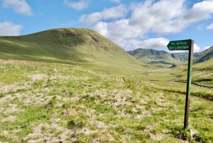
The walk starts from the Glen Isla road-end at Auchavan. I followed the track north by the River Isla for some four kilometres, before breaking off at a prominent sign to climb steadily up the grassy ramp of Monega Hill, following in the footsteps of the cattlemen.
There were no cattle but there was plentiful signs of mole activity, and every few steps I would spot something scurrying across the path beneath my feet, shrews or mice perhaps.
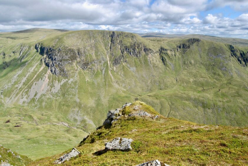
From the high point on the hill, the way curves towards Little Glas Maol, but following the cliff edge provides the spectacle of spiralling drops into the depths of Caenlochan Glen, and the craggy faces of Druim Mor.
Witnessing the snow-laden faces of this amphitheatre in winter would be well worth an admission fee.
As I began the short pull up to Glas Maol, I parted company with the Monega Path. It contoured off to the right to the remains of the county boundary fence and the meeting of three council areas, Angus, Perth and Kinross and Aberdeenshire, before dropping past the minor summit of Sron na Gaoithe and down into Glen Clunie.
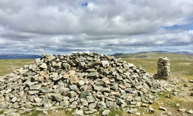
The faint sound of voices, the glimpse of figures on the skyline, confirmed I wasn’t too far from the spreadeagled cairn on the spacious summit dome, but the shared space was fleeting, and the walk over to Creag Leacach surprisingly quiet. I even had the summit rocks to myself for ten minutes.
The hordes of dashing hares which had been providing entertainment during the lunch break stuck with me over the next turn on the circuit to the twin cairns of Carn Ait and again for the more featureless walk over spongy ground to Mallrenheskein, a fairy tale name which seems wasted on such a benign lump.
The rise to Black Hill was over stretches of peat bog, but a recent dry spell made the walking quite pleasant. A sharp left was needed when the fence line ended, another reminder that this could be a more confusing moment in thick weather.
On the final push up the heather slopes of Monamenach only the faintest path could be found, but the summit was soon reached and the run down the other side took less than half an hour.
Route
From parking area, follow track north by River Isla for about four kilometres to a prominent sign for the Monega Path where the track splits.
Take the left branch which climbs steadily up Monega Hill. The summit is just off the path to the right and gives superb airy views to the crags across Caenlochan Glen.
Rejoin the path as it turns west to go over a slight dip and then rise to the small cairn on Little Glas Maol.
Continue on the path and when it starts going off right just beyond the next col, leave it and climb directly up to the massive cairn on Glas Maol.
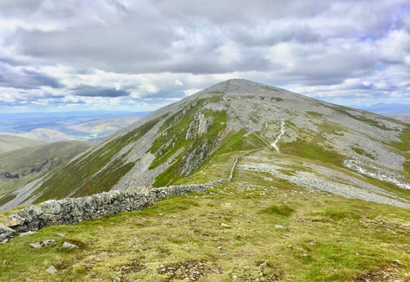
Descend along the ridge, passing a prominent cairn and then climbing again south-west alongside a wall which leads to the bouldery top of Creag Leacach.
Keep heading south-west, passing over the second summit of Creag Leacach, then down to a col for the short rise to the twin cairns of Carn Ait.
Drop east to follow a fainter path by a fence over boggy ground and then climb to the 767m summit of Mallrenheskein. Keep following the fence towards Black Hill, and make a sharp left when it ends to reach the top.
Drop to the Glack of Glengairney before the final push up a faint path to Monamenach, which is a Corbett.
From the cairn, drop south-east at first then east to return to Auchtavan.
Information
Distance: 20.75km/13miles
Ascent: 1190m/3900ft
Time: 7-9 hours
Grading: Strenuous high-level hike following estate tracks and hill paths over exposed terrain, suitable for experienced, well-equipped hillwalkers with good level of fitness and navigation skills. Dogs under close control around farm livestock and because of ground nesting birds.
Start/finish: Auchtavan at head of Glen Isla (Grid ref: NO 192696).
Map: Ordnance Survey 1:50,000 Landranger Maps 43 (Braemar & Blair Atholl) and 44 (Ballater & Glen Clova); Ordnance Survey 1:25,000 Explorer sheet 54.
Tourist Information: VisitScotland, Dundee iCentre, 16 City Square, Dundee DD1 3BG (Tel 01382 527527)
Tourist Information: VisitScotland, Ballater iCentre, Station Square, Ballater, AB35 5QB (Tel 01339 755306).
Public transport: None.


Conversation