Glen Girnock circuit, Deeside
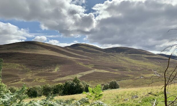
The heather had lost its purple lustre, the bracken was browning and dying back and despite the sunshine, the wind had an edge that confirmed the changing of the seasons had reached tipping point.
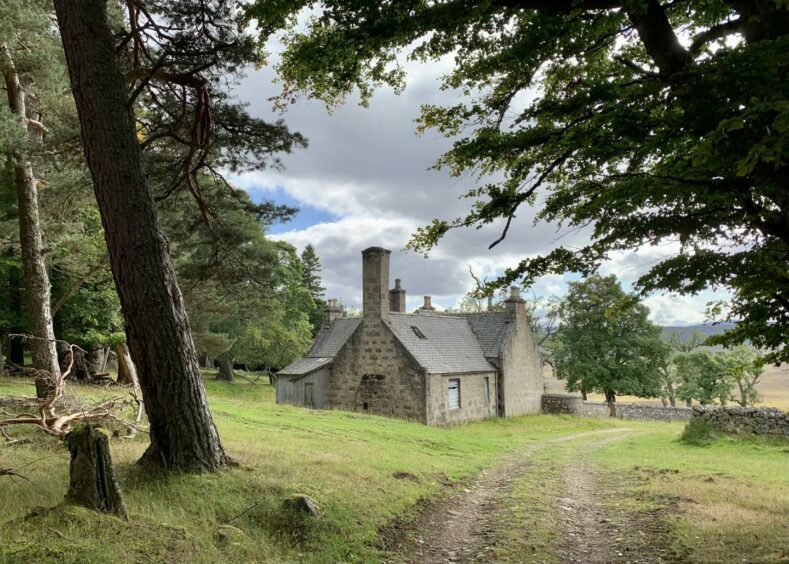
The conditions also seemed symbolic for a circuit through the quiet confines of Glen Girnock, a walk that passes a succession of poignant ruins long left behind, where the feeling of emptiness increases with every step.
The glen runs from Deeside towards Glen Muick and the greenery and country bustle of the former contrasts with the bare landscape of the latter.
It wasn’t always empty. The only person I met all day was a former resident who spent his childhood days of some 60 years ago in the glen, and he remembered the post van driving up to deliver the mail to all these then occupied farmhouses.
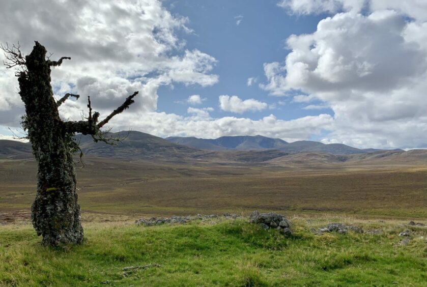
The one consolation of this emptiness is that the views are massive: the Coyles of Muick holding the high ground to the east, Lochnagar’s peaks and corries laid out in splendid array to cover the whole southern horizon, then Ben Avon taking on a similar task when the route turns north.
The route starts near Balnacroft, reached by a minor road off the B976 south of Balmoral. There’s a handy spot for parking carefully off to the right just before the road takes a turn left, directly opposite an access track to Abergeldie Cottages.
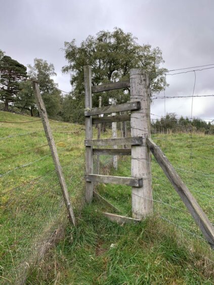
The track quickly turns to grass, and once through a gate takes a curve to the left to cross a field to reach two high stiles close together. Both need climbed and that could prove a barrier to those less mobile and for dogs.
Once over safely, I followed a path alongside a fence with the rugged slopes of Creag nam Ban on my right. When the path started to turn uphill, I left it and kept straight on through the woods.
It’s pathless but short-lived, easy enough to work your way past any fallen trees to reach a ramp heading up to the right. Don’t be tempted to stick with the earlier path – it soon disappears into seriously boggy terrain.
The correct path now cuts through the heather as it contours round the side of Creag Ghiubhais, south then turning east, before dropping down to catch the track heading up Glen Girnock at Mill of Cosh.
The first section is alongside verdant fields and through tree-lined corridors until the old house of Loinveg is reached. The view from the front of this property would be the envy of many, the Coyles of Muick filling the skyline.
Another old house, Camlet, is located in the pines just off to the left a little further on, but I left that for another day and carried on to the right as the track split to reach the abandoned property of Bovaglie then climb between the old buildings and through a stand of trees.
The way cut across the increasingly barren terrain where a couple of turns brought me to the edge of a forest and another high stile, although this one did have steps, albeit a little insecure.
The silence in this swathe of lifeless pines was almost eerie: even with the softness of the ground underfoot I swear I could hear the echo of my footsteps.
Eventually the path passes the houses at Khantore to emerge on the minor road which is followed back to the start. I had a look for the old chapel marked on the maps but little remains, stone foundations now well overgrown and topped with trees.
Five minutes and the solitude of the day was truly left behind as I passed through the tourist hordes wandering around the lower road at Balmoral.
ROUTE
Head up track for Abergeldie Cottages opposite parking, pass driveway on left and continue on grassy track to metal gate.
Go through and head uphill, following track as it turns left to go across field to reach fence and two high stiles.
Beyond second stile, walk along edge of fenced wood. When path starts to turn right, leave it and make short pathless walk through woods to reach path on right sloping back uphill.
Follow this path out of the trees and then around lower slopes of Creag Ghiubhais. This eventually curves east to reach wooden gate above Mill of Cosh.
Go through and turn right on to Glen Girnock track. Follow south to reach ruin of Loinveg.
Continue in same direction until split in track and go right as it bends round to reach ruin of Bovaglie.
Walk up track between buildings then through small wooded area. Continue onward across open ground and turn right at next junction.
Follow track for another 0.5km then turn right on strong path going through heather towards woodland.
Cross high stile to enter wood and follow path down through trees to emerge on minor road just past Khantore, turn left and walk down to parking.
INFORMATION
Distance: 13.5km/8.5miles
Ascent: 265m/870ft
Time: 3.5-5 hours
Grading: Clockwise circuit through ever-changing scenery from Deeside to Glen Girnock mainly on estate tracks and hill paths. One short pathless stretch, some overgrown and muddy sections – good footwear recommended. Some ascent but suitable for those with reasonable levels of fitness. Couple of high stiles that may prove difficult for those with mobility issues and for dogs. Farmland route so please keep dogs under close control and close all gates.
Start/finish: Small parking area on right near Abergeldie Cottages track entrance on minor road to Balnacroft off B976 (Grid ref: NO 287948). You can also park at Crathie and walk up.
Map: Ordnance Survey 1:50,000 Landranger Map 44 (Ballater & Glen Clova); Ordnance Survey 1:25,000 Explorer sheet 388.
Tourist Information: VisitScotland, Ballater iCentre, Station Square, Ballater, AB35 5QB (Tel 01339 755306).
Public transport: Nearest bus service to Crathie (No 203) on Aberdeen-Braemar route.


Conversation