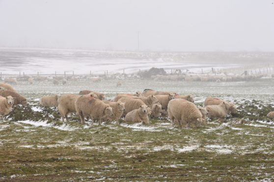
People across the north-east this morning woke up to a fine layer of snow covering the ground and a rough wind to make conditions even chillier.
It looks like we are in for more of the same tomorrow.
The Met Office yellow weather warning for snow, which covers most of the north of Scotland including Orkney and Shetland, is going to remain in place until 10am tomorrow.
⚠️ Yellow weather warning issued ⚠️
Snow across N Scotland
Tuesday 0000 – 1000 Tuesday
Latest info 👇 https://t.co/QwDLMfRBfs
Stay #WeatherAware pic.twitter.com/gS8ZTfvNHh
— Met Office (@metoffice) April 5, 2021
The meteorological body has said people in the area covered by the yellow warning can expect between 1-2cm of snow, or more if they live on higher ground.
It warns that some travel may be disrupted by the weather, with longer journey times by bus, train or road.
In both Aberdeen and Inverness, the temperature is expected to soon fall below freezing and remain there until quite late on tomorrow morning.
There will be precipitation beginning later this evening too, which should continue overnight with snow showers of varying intensity.
In Braemar the mercury is expected to drop down to -4C for most of the night, with Aviemore not much warmer.
In coastal towns such as Peterhead, Fraserburgh, Thurso and Ullapool, meanwhile, the temperature is predicted to stay around freezing point for most of the next 12 hours.
Neither Kirkwall nor Lerwick are forecast to dip much colder than -1C tonight.
By late afternoon tomorrow, any snow that has fallen will have begun to thaw, and the north of Scotland will begin to heat back up again.
This short second winter should be past by the middle of the week, with more familiar spring temperatures and weather returning.
