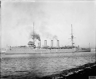
The wreck of HMS Hampshire is to be surveyed today ahead of the centenary of its sinking next month.
The cruiser went down off Marwick Head in Orkney after striking a mine laid by a German submarine on June 5, 1916 – with the loss of 737 lives.
Among those lost was Lord Kitchener, the secretary of state for war who was being transported to Russia for a secret meeting with Tsar Nicholas II.
Today a condition assessment will be carried out using a remotely operated underwater vehicle (ROV) – the first extensive mapping of the wreck site since the sinking in 1916.
HMS Hampshire played a minimal role in the Battle of Jutland between Mat 31 and June 1 before being reassigned as Lord Kitchener’s personal transport.
The wreck lies upside down in nearly 200ft of water andthe survey will attempt to assess her condition, the impact of illegal salvage activities and environmental factors on the integrity of the remains.
The survey is a collaborative project between ORCA Marine, University of the Highlands and Islands Archaeology Institute and Seatronics, an Acteon company.
Sandra Henry, UHI marine archaeologist, said “It is really significant in the run up to the centenary of the HMS Hampshire to carry out a condition survey and map the extent of the wreck site.
“This survey is being undertaken as a mark of respect and remembrance for those who lost their lives aboard, and all those who lost their lives at sea during World War I.”
