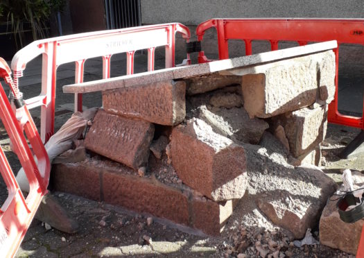
A tourist map showcasing attractions across Peterhead is to be demolished after being struck by a lorry.
It sits on the the corner of Prince Street and Back Street but a large part of its stone base was destroyed by the collision.
The map highlights more than 20 different places in the Buchan town including the Field Marshal Keith monument, the Arbuthnot museum and the police station.
The map was constructed in 2000 as part of a millennium improvement project in the town centre.
Now it has been cordoned off by the council, which said it had been “badly damaged” when a heavy goods vehicle struck it while delivering items to nearby shops.
The local authority has removed part of the map on safety grounds.
Town councillor and local historian Stephen Calder said the loss of the listing was unwelcome as the town prepares to welcome summer visitors.
Nonetheless, he said it also presented an opportunity to move the structure to the pedestrian zone in the town centre.
>> Keep up to date with the latest news with The P&J newsletter
Mr Calder said: “It must have been some collision because the structure is made of solid granite and it has been smashed on four sides.
“It is particularly concerning and could not come at a worse time as we are just entering the tourist season.
“If it does get rebuilt I would want it to be placed in Drummers Corner as it makes much more sense to be there.”
Chris White, Buchan area manager for Aberdeenshire Council, said officials were working on an insurance claim following the incident.
He said the local authority would not be splashing out on the repairs.
Mr White said: “Unfortunately the map and the support structure were hit and badly damaged by a vehicle.
“As a result we have had to remove what was left of the structure for safety reasons.
“We are in the process of claiming for the damage and and the subsequent repair bill will be sent to the responsible driver’s insurance company.”
