The stark differences in rail travel times for passengers from the north and north-east of Scotland compared to the rest of the UK and Europe has been laid bare in an interactive travel time map.
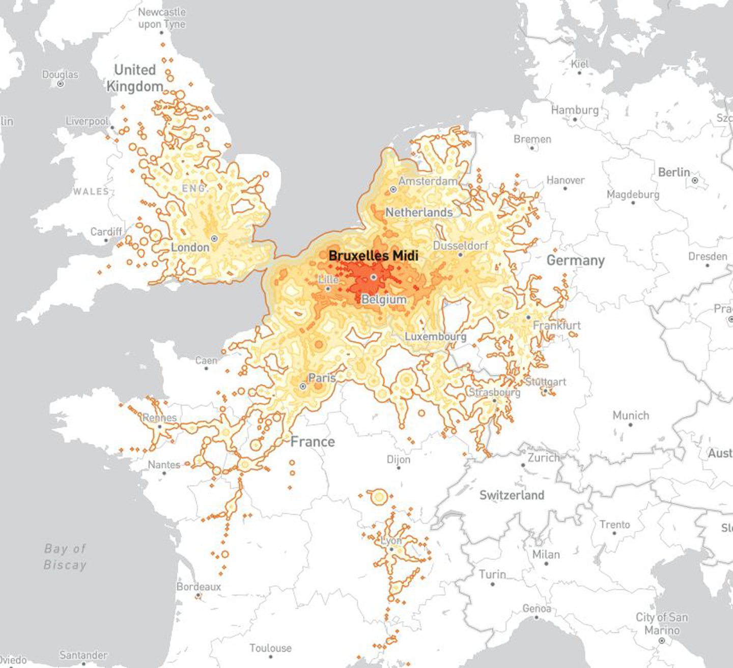
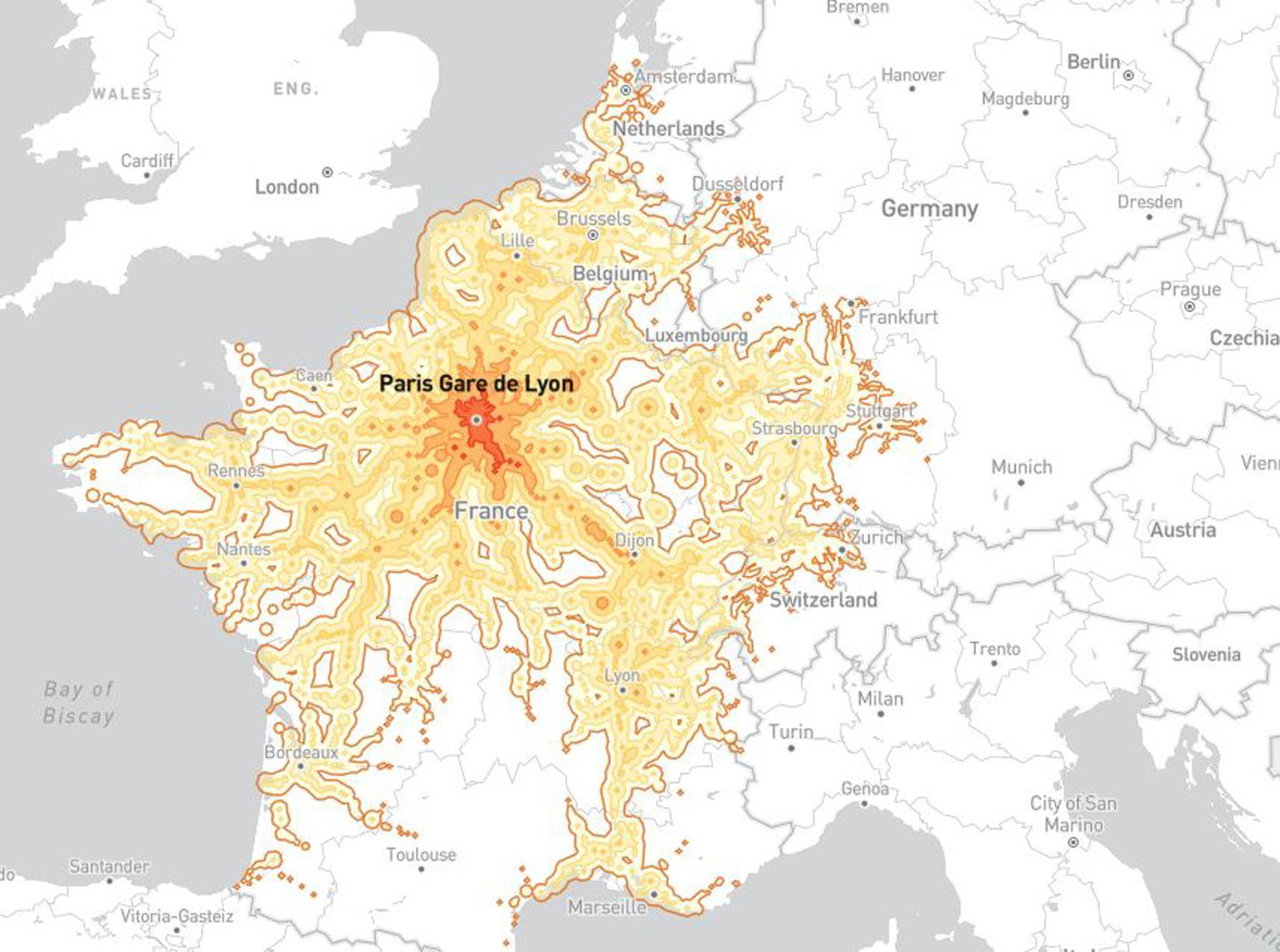
French software engineer Benjamin Tran Dinh created his Chrono Trains map using data that covers around 30,000 stations all across Europe.
He originally built it in order to illustrate disparities between different regions of France when it comes to how far you can journey on average within five hours.
But his creation has since been used by people from all across Europe to show how isolated their areas are from wider railway networks.
Read on to see how rail journeys for travellers departing from Aberdeen, Inverness and Thurso compare to others from across the UK and beyond.
You may be surprised to see just how little distance you can reliably cover within five hours when leaving from certain stations.
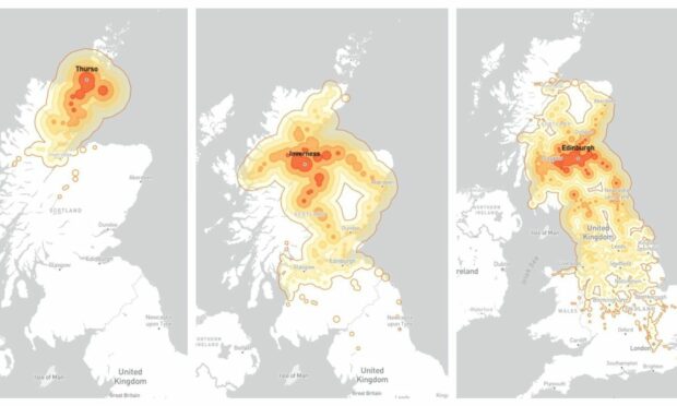
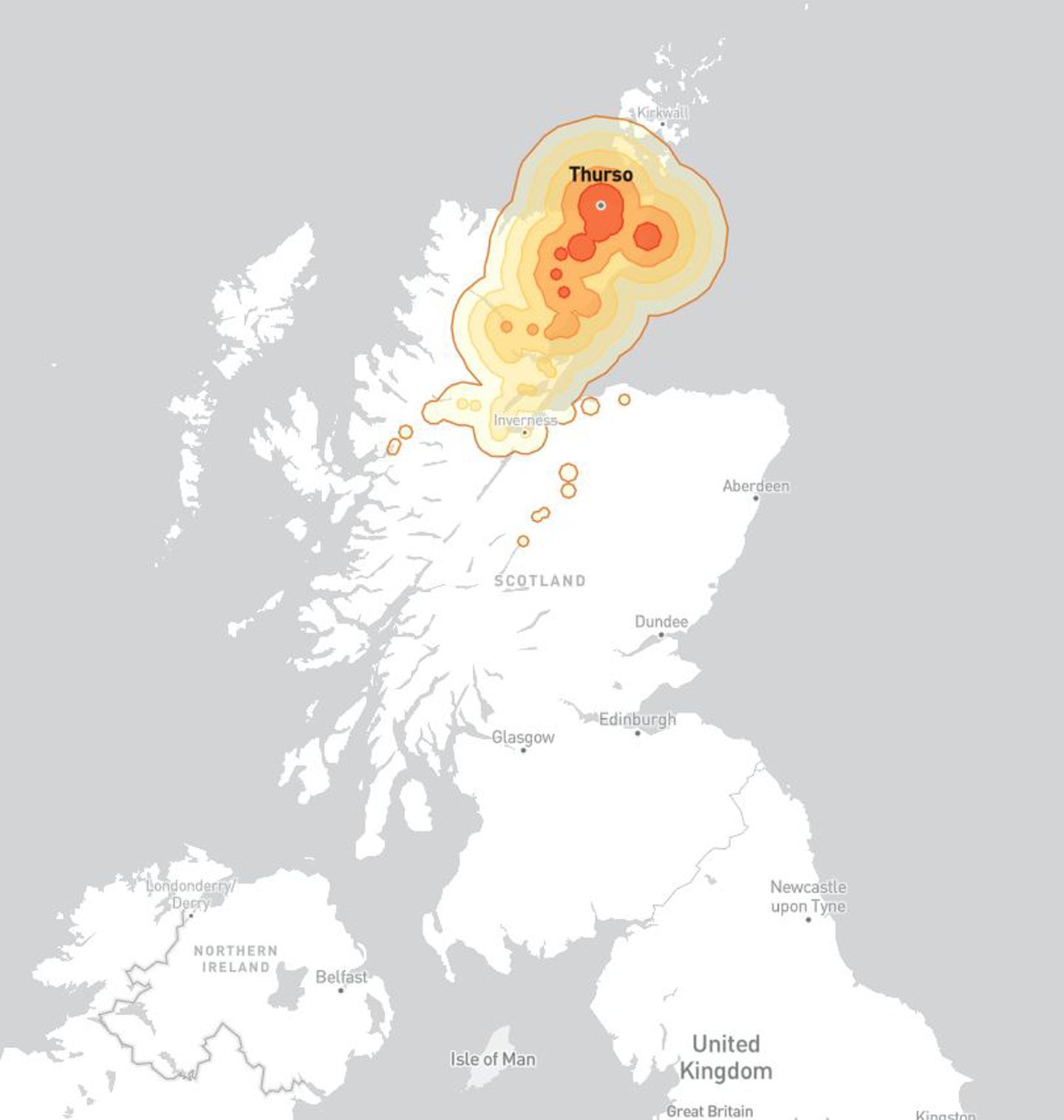
Thurso to Inverness within four hours — in ideal conditions
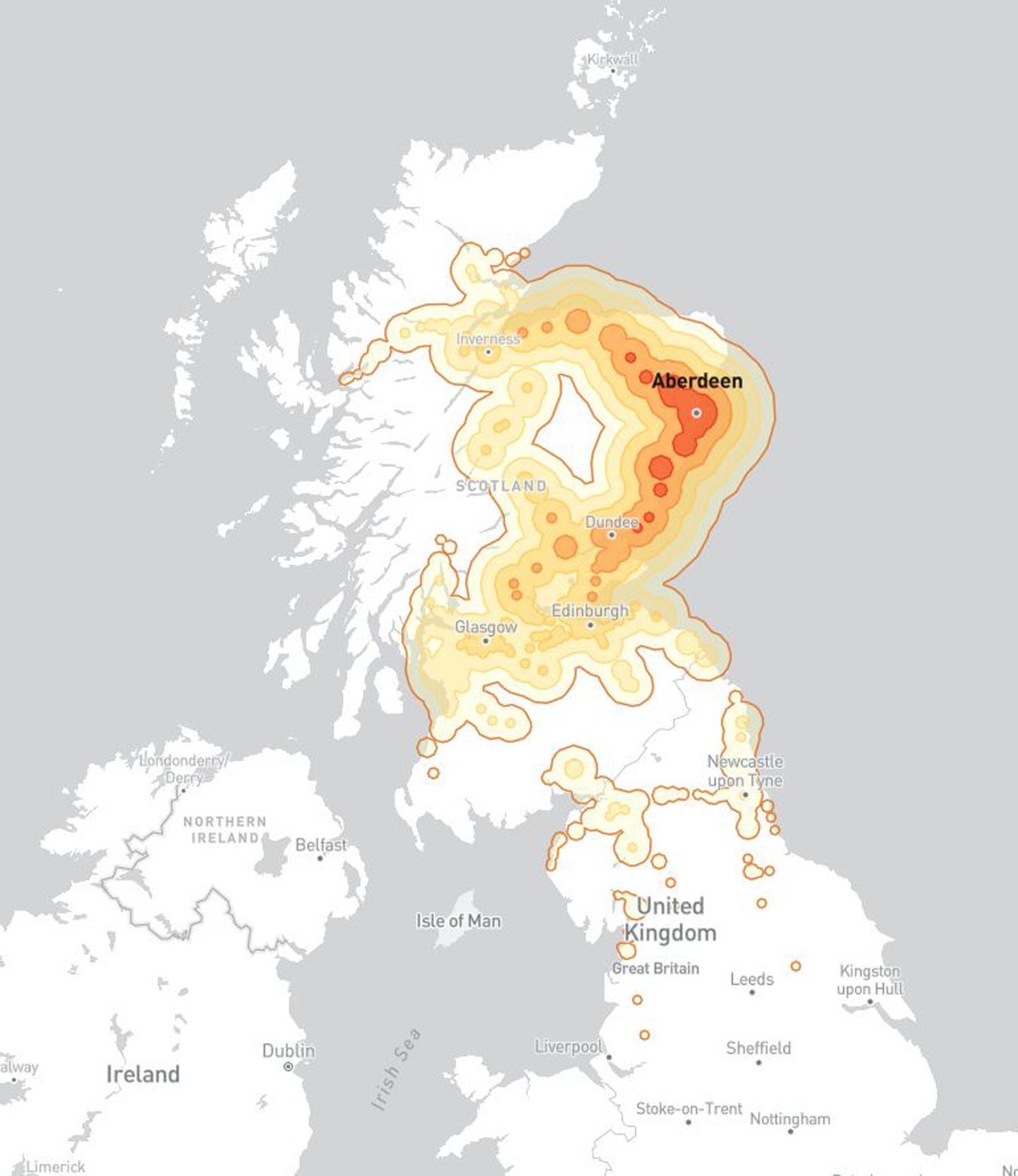
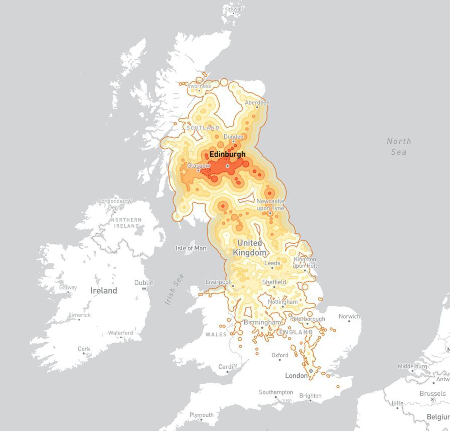
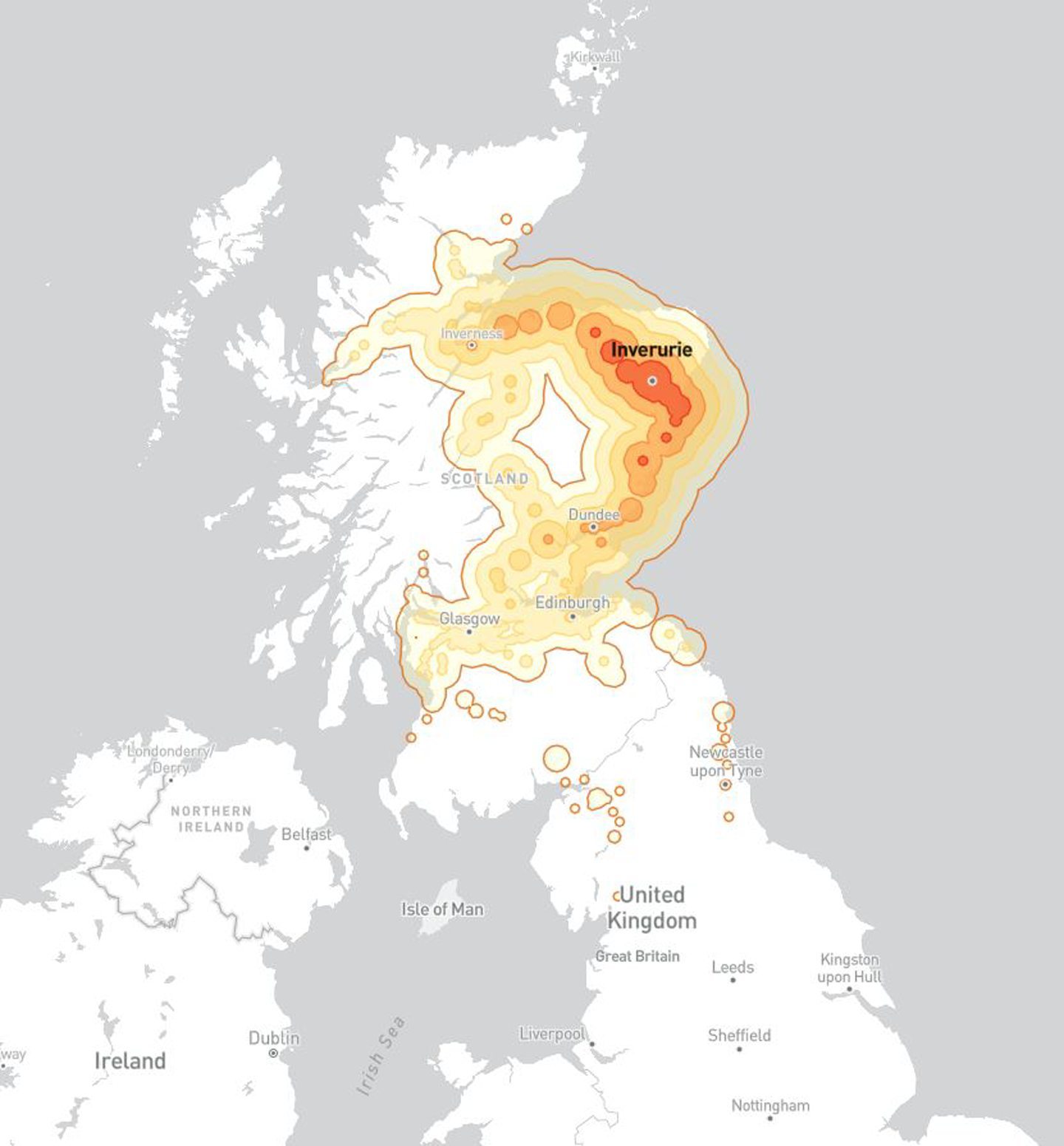
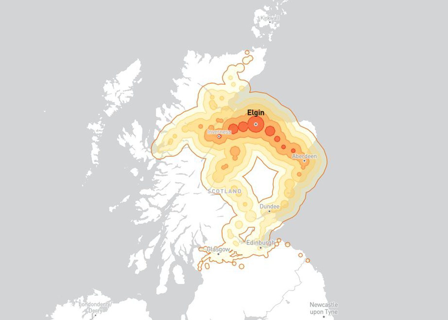
Benjamin’s map shows how far on average you can go from any station, broken down by coloured divisions of within one hour, two hours, three hours, four hours, or five hours.
It assumes interchanges take 20 minutes, and “transit between stations is a little over walking speed” — in other words, he intends the map to show “optimal travel times”.
However, the map does not take into account real life interchange times.
From Thurso, the furthest south you could potentially travel in these perfect conditions according to the data would be Dalwhinnie within fewer than five hours.
That’s a distance of 117 miles as the crow flies, or a 163-mile drive.
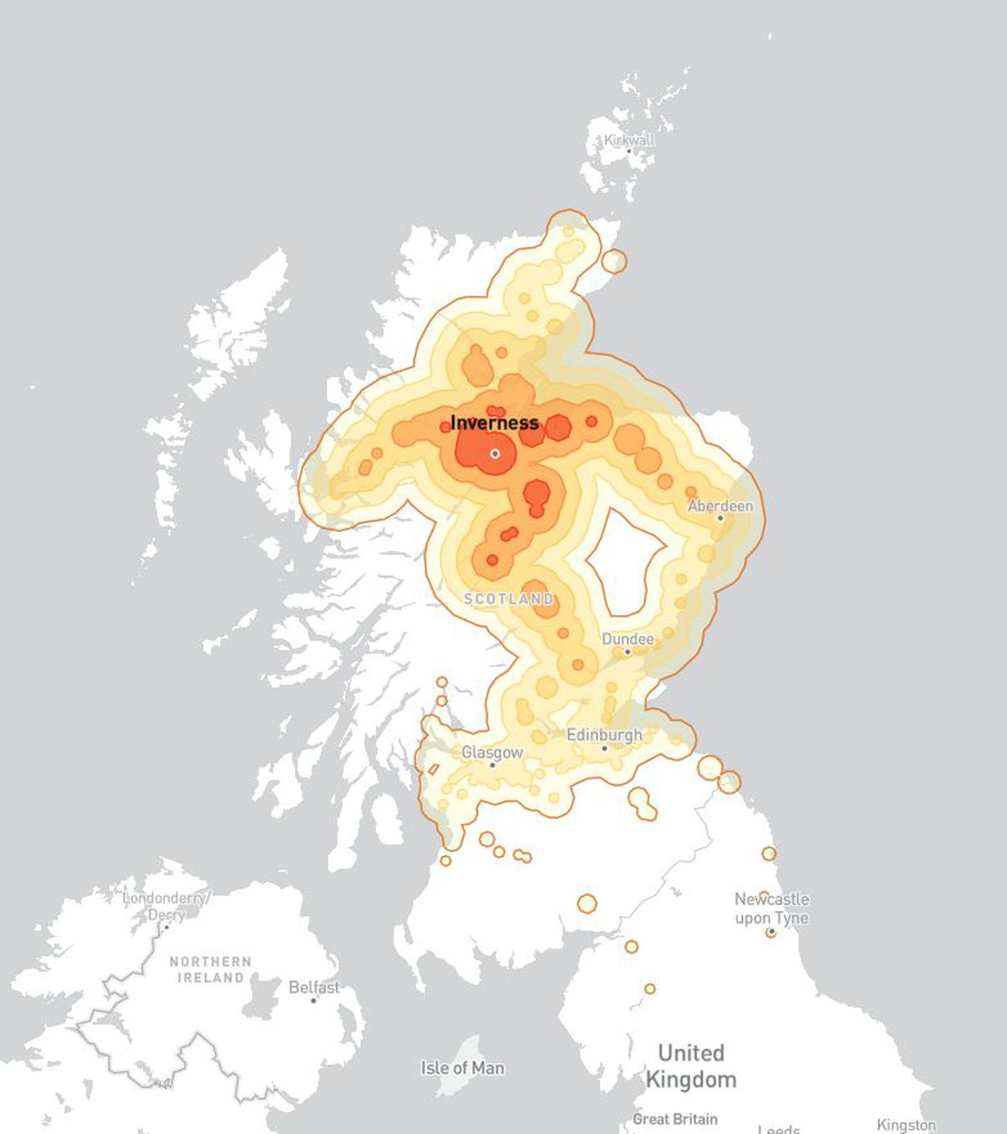
Travelling from Inverness? You could go as far south as Newcastle in optimum conditions
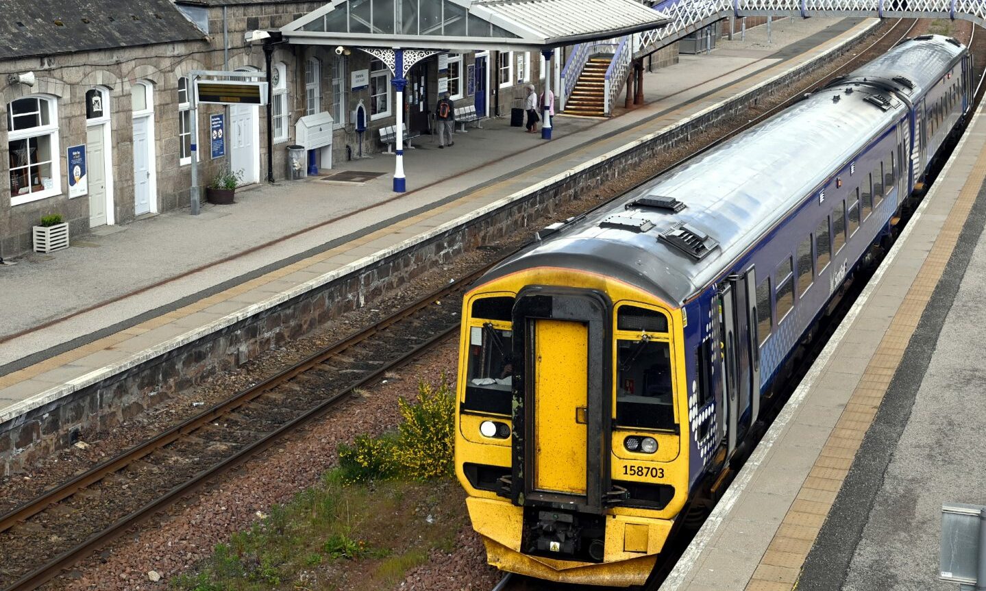
The picture is very different when looking at how far you can go by train within five hours from Inverness train station.
A journey from Inverness to Newcastle, a direct distance of 200 miles away, could be covered within five hours by rail according to the map.
The same journey would be 264 miles if travelling by road.
Starting your rail trip from Aberdeen could take you even further still
If you’re departing from Aberdeen, you could go as far south as York in under five hours in ideal conditions according to the map.
This is a direct distance as the crow flies of 359 miles.
If you were to drive from Aberdeen to York, the fastest route would be 318 miles.
From Edinburgh, you could almost reach the south coast of England
Trains departing from Edinburgh can travel all the way south to London Kings Cross within a four-hour window in ideal conditions according to the map, and other parts of London within five hours.
The direct distance from Edinburgh to London Kings Cross is 329 miles, or 371 miles by road.
How far could you get in five hours by rail on the continent?
Rail passengers on the continent have a much more first class service compared to the UK when it comes to how far you can get in a five-hour window.
For example, you can get from Brussels in Belgium all the way to Bordeaux in France within five hours, according to the map data.
That’s a direct distance of 473 miles, or 550 miles when going by car.
And you can even get from Brussels all the way north into England — as far as Newcastle within five hours.
That’s 377 miles as the crow flies, or 501 miles on roads.
Travellers taking the train from Paris Gare de Lyon station can get south to Marseille inside a four-hour period.
The direct distance from Paris to Marseille is 410 miles, or by car it’s 480 miles away.
Highland rail investment ‘falls way behind central belt’
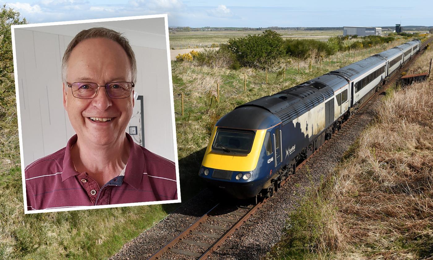
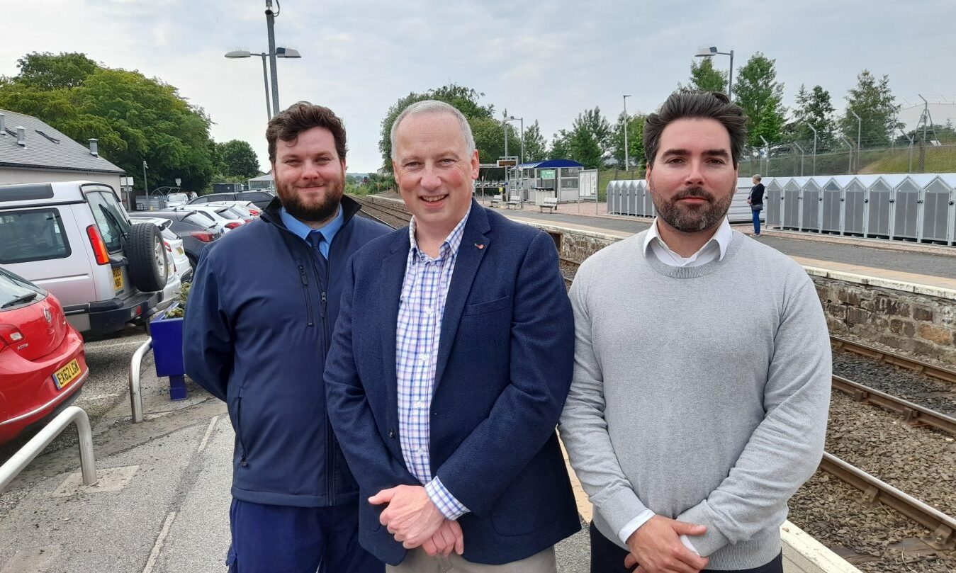
Ian Budd is convener of the Friends of the Far North Line campaign group, which seeks to get better rail services north of Inverness.
Ian said Benjamin’s map is a “beautiful graphic illustration of a problem common to most countries in varying degrees”.
He said: “Governments tend to look for the most value for money with infrastructure projects, but this has the obvious result that areas with a lower population get a far worse service.
“Scotland is a fairly extreme example of this where rail investments in the Highlands and the far north fall way behind that in the central belt.
“There is at least an understanding in Transport Scotland that measuring the benefits of an infrastructure investment should not be done simply in terms of the greatest number of people who will receive that benefit, and that those who live far from the main population centres are equally entitled to good public services.”
‘The most interesting thing is what this map does not show’, says campaigner wanting Fraserburgh and Peterhead back on track.
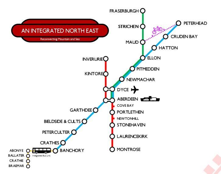
The Campaign for North East Rail (CNER) organisation is dedicated to returning rail links to the north-east communities of Peterhead and Fraserburgh.
Jordan Jack, one of the CNER founders, said the interactive map “demonstrates just how impactful rail connections can be”.
He said: “Take a look at Inverurie for instance, a small town on the somewhat rural Inverness line.
“Step on a train at your local station and you can be in the capital within three hours, Glasgow by four, or across the border and in Newcastle, or as far as Durham and well on your way further south by five hours.
“The most interesting thing however is what this map does not show.
“Peterhead and Fraserburgh are the largest towns and the furthest from a railway station anywhere in the UK.
“Bus connections to Aberdeen from both towns run at 90 minutes, on top of that, locals know to build slack into their travel times to account for the unpredictability of our busy roads so we can ensure connections are made.”
He added: “Folk travelling from Peterhead, the largest town in Aberdeenshire, can only just reach Edinburgh and Glasgow within five hours, much of the surrounding central belt is cut off in the time limit, as is some of the best of the country.
“West to Kyle and the islands, the Borders, Ayrshire and the West Coast are not accessible within five hours, encouraging travellers to drive.”
Jordan compared this to Elgin, where locals can get on a train and “comfortably travel to all seven Scottish cities” within the five hour window, as well as Thurso, Ayrshire and even across the English border.
‘Railways make our world larger and our connections shorter’
He added: “Connecting Peterhead and Fraserburgh to the rail network will provide a reliable, less than an hour, connection to Aberdeen.
“This opens up rail connections across the country, as far as Newcastle, Carlisle, York, Preston, Penrith and the Lake District.
“An extra hour and you’re in Liverpool, Manchester and Leeds, a few more and you can reach Birmingham and London.
“Railways make our world larger and our connections shorter, if we want to invest in our communities that need regeneration, rail is the way to do it.
Conversation