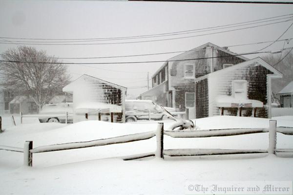
Around 2ft of snow has fallen in some parts of the USA as the north-east of the country is battered by a huge snowstorm.
It comes as Scotland braces itself for more snowfall, with a Met Office yellow “be aware” warning for snow in place for the north and north-east tomorrow and Thursday.
Between 1.9in and 4in of snow could fall in Aberdeen, Aberdeenshire and Moray tomorrow, while higher ground could be hit with up to 6in.
Stateside, however, Boston could receive up to 25 inches of now, which would top the city’s record snowfall of 27.5ins set in February 2003.
Vesper Lane in color! #AckJuno @InkyM #Blizzard2015 pic.twitter.com/KG6O0xts3M
— Nicole Harnishfeger (@HarnishfegerIM) January 27, 2015
Drifts surround the rental cars at #Nantucket Memorial Airport @InkyM @ACKAirport @AirportACK pic.twitter.com/Fi1rL4VCmo
— Nicole Harnishfeger (@HarnishfegerIM) January 27, 2015
@TownofNantucket DPW plows seen here on Surfside Rd moving snow @InkyM #Nantucket #AckJuno pic.twitter.com/4cngc2q59B
— Nicole Harnishfeger (@HarnishfegerIM) January 27, 2015
Massachusetts and Connecticut were among the worst hit areas today, while an awful forecast for New York City did not come to fruition.
Travel bans in New Jersey and New York – which saw the Big Apple’s subway system come to a standstill for ten hours – have been lifted.
Blizzard warnings are still in force for Massachusetts and Rhode Island, with around 2-3in snow expected to accumulate every hour throughout today.
Shelter is open at #Nantucket High School pic.twitter.com/dEBrdlDamj
— Nicole Harnishfeger (@HarnishfegerIM) January 27, 2015
Line crews escorted by @NantucketPolice up Main St @InkyM #Nantucket #AckJuno #Blizzard2015 pic.twitter.com/iCj0FSM2oM
— Nicole Harnishfeger (@HarnishfegerIM) January 27, 2015
