It might have been feeling a bit milder recently, but don’t put the big coats and woollies away just yet.
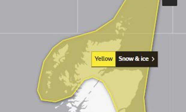
The Met Office has issued a yellow warning for snow in the north and north-east next week.
The 24-hour weather warning comes into force at midnight on Monday.
It covers the whole east coast to the west and includes the Northern and Western Isles and majority of the Highlands.
People are being told to prepare for travel disruption and potentially, some small power cuts.
Temperatures are also expected to dip to as low as -7C in Braemar on Tuesday.
Monday forecast
The Met Office said the forecast for Monday was “snow showers are likely to cause some disruption to travel with a small chance of more widespread disruption for some.”
A spokesman said: “There is a small chance of travel delays on roads with some stranded vehicles and passengers, along with delayed or cancelled rail and air travel.
“There is a slight chance that some rural communities could become cut off. A small chance of injuries from slips and falls on icy surfaces.
“There is a small chance that power cuts will occur and other services, such as mobile phone coverage, may be affected.”
⚠️ YELLOW WEATHER WARNING⚠️
The @metoffice has issued a YELLOW weather warnings for SNOW and ICE affecting parts of the country.
Monday (06/03) 00:00-Monday (06/03) 23:59
Tuesday (07/03) 00:00-Tuesday (07/03) 23:59
More Information can be found here: https://t.co/PHeHkgYE8x pic.twitter.com/2ShL8gYA7c
— Traffic Scotland (@trafficscotland) March 3, 2023
Frequent snow showers will continue on Tuesday, causing further disruption in places.
Temperatures are expected to dip to -7C in Braemar and -6C in Tomintoul, while Ballater is likely to be around -5C. Forres and Findhorn are expected to be a chilly -4C and -3C.

Conversation