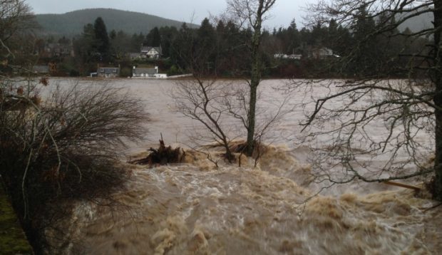
Scientists at Aberdeen University are appealing for people to send in their photographs of flood damage in an effort to prevent to prevent future destruction.
Torrential downpours caused by Storm Frank wreaked havoc in communities close to waterways all across the north-east, and shut down many major routes and river crossings.
One area which severely affected was Aboyne Bridge, which had to be closed after the surging River Dee dug up the ground beneath the structure and damaged its foundations on December 30.
To prevent a repeat occurrence, Dr Clare Bond and professors John Howell, Rob Butler and Chris Soulsby from the university’s school of geo-sciences have joined forces with Aberdeenshire Council and the Scottish Environment
Protection Agency to investigate the cause of the flooding around the bridge.
And the team have asked for the public’s help in the first stage of their research, by launching an appeal for videos and photographs of the flooding so they can build an accurate picture of just how the waters built up so quickly.
Ms Bond said: “What we are aiming to do is produce a hydrograph, which is a plot of water level through time, at Aboyne Bridge.
“In general the data for these charts comes from gauges in monitoring stations along the river, but in order to build the kind of accurate 3D picture we’re looking for, we need help from people who took pictures of the flooding as it happened
on the morning of December 30.
“Every photo of the river will carry information on water level that will be useful as long as it retains information on the time and date it was taken, which most smartphones and digital cameras do.”
Videos and pictures can be e-mailed to deeflood@abdn.ac.uk
