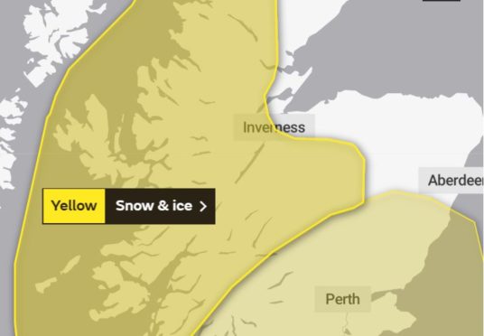
The Met Office has issued a weather warning as snow and icy conditions are forecasted for the west Highlands and southern parts of Aberdeenshire.
The alert says frequent showers will affect the northwest of Scotland overnight Sunday and through Monday.
“Falling snow will reach low levels away from the western coastal fringes by dawn. Some spots may see accumulations of 1-3 cm below 150 m, with more widely 5-10 cm above 150 m and 15 cm above 300 m”, it continues.
“Strong winds may also bring temporary blizzard conditions in association with the showers. Also icy patches becoming widespread away from western coasts, bringing some travel disruption.”
Commuters are being warned some roads and railways may be affected with longer journey times by road, bus and train services.
Residents are urged to take care on the icy surfaces on pavements and cycle paths.
Meteorologist Helen Roberts said: “It will be colder than recent days but nothing too out of the ordinary.
“We were looking at lows of around -3C overnight into Monday and then tonight it could get down to -5C or so.
“The ice warning covering parts of Aberdeenshire is only valid until 10am but it is likely that further warnings will be issued later in the day.”
Councils and roads authorities are planning ahead, promising midnight gritting patrols on the Aberdeen bypass and early morning outings across Aberdeenshire ahead of rush hour traffic.
But the Met Office forecaster promised milder temperatures were on the way, adding: “This will be a bit of a shock to the system after the recent weather.
“But it will be a fairly short-lived cold snap with temperatures beginning to recover on Wednesday.
“The milder air should stay with us for the foreseeable future then.”
