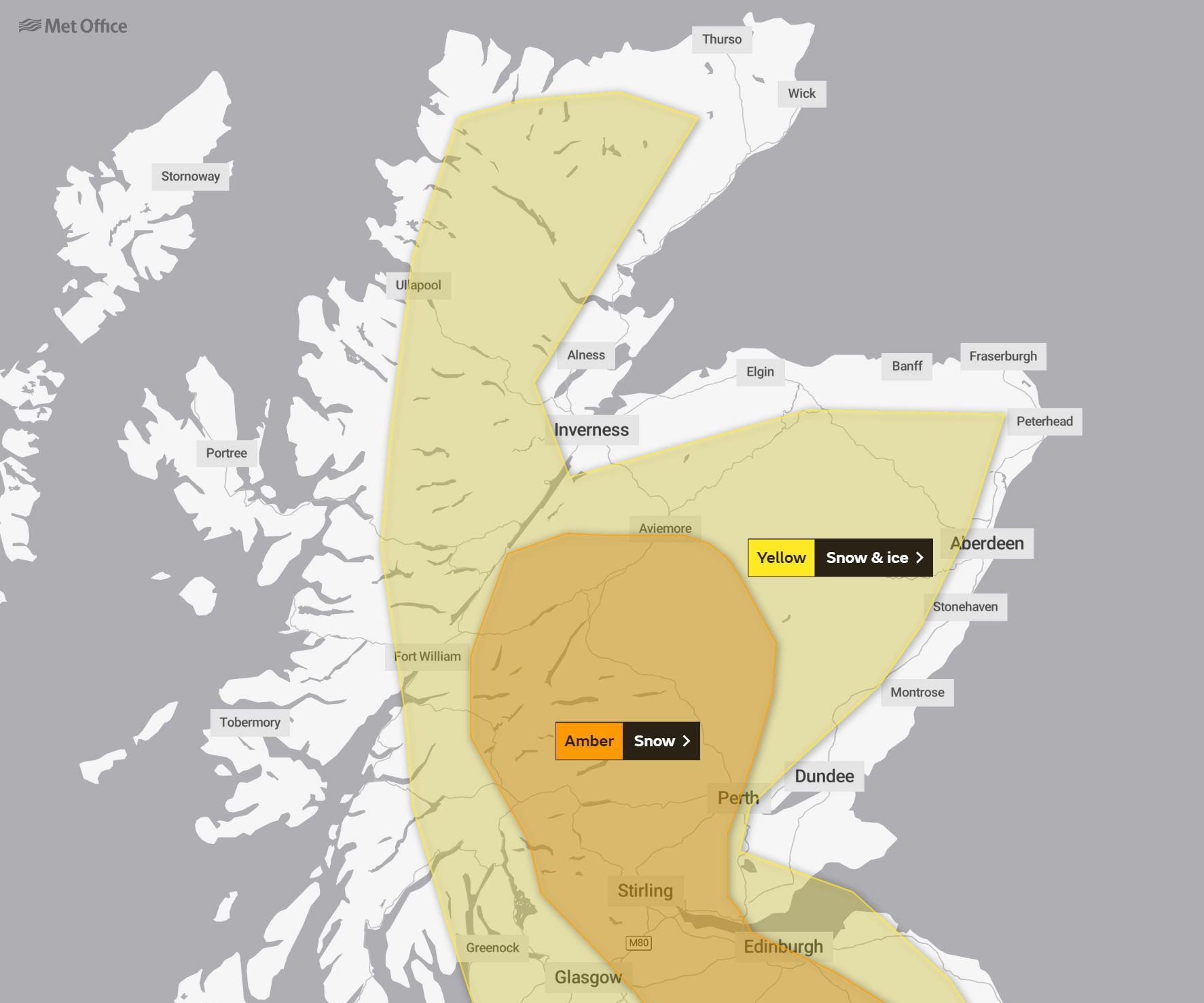
An amber warning for heavy snow has been issued by the Met Office.
The alert will come into force at 3pm and remain in place until 10am tomorrow.
It covers much of the central Highlands, Cairngorms and parts of Perthshire, descending down through the central belt and into the borders.
 A separate yellow-level warning for snow and ice is also in place for much of the country, with only coastal areas outside the alert. This will remain in force until 9pm tomorrow.
And a new snow and ice warning has been issued for Saturday, covering the period between 3am and 9pm.
The amber warning means the forecast snow is considered both more likely and will have a greater impact than a yellow alert.
According to the Met Office, the heavy snow is expected to cause disruption on roads and rail.
There could also be power cuts and issues with mobile phone coverage.
⚠️The @Metoffice has issued an Amber weather warning for heavy snow across parts of the country.
Please follow the advice from @policescotland and @trafficscotland
For live updates follow the @metoffice & @trafficscotland.
Please take care. Stay #WeatherAware https://t.co/6ym17sEbd0
— Michael Matheson MSP (@MathesonMichael) January 13, 2021
Traffic Scotland is advising motorists to “only drive if essential” with Bear Scotland asking people to “drive to the road conditions and stay weather aware”.
The forecaster added: “Rain will turn to snow across Scotland on Wednesday afternoon and evening, initially on high ground, but increasingly to lower levels.
“During Wednesday evening and night the risk of snow will extend southwards into more of northern England. 10 to 20 cm snow is likely to accumulate above 200 metres with greater amounts at higher elevations.
“Amounts at low levels (below 100 metres) are less certain, but 5 to 10 cm is likely in some places by Thursday morning.
“Snow will persist into Thursday morning, slowly dying out during the afternoon.”