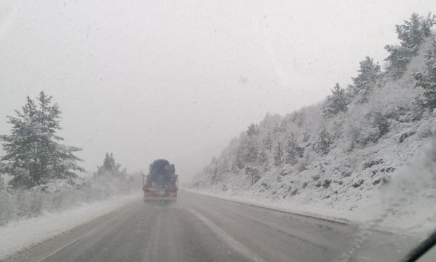
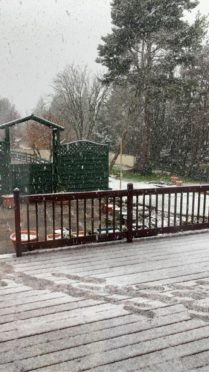
Parts of the Highlands were covered in snow this morning – with forecasters warning it will be a chilly May Day weekend for many.
Drivers on the A9 Inverness to Perth road were surprised to find a reasonably thick layer of snow covering the trees and ground between Carrbridge and Tomatin.
Several social media users in the region posted pictures of the unexpected wintry scene.
Forecasters are now warning there could be some more snow showers to come over the weekend – although with it being the first weekend since hospitality was allowed to reopen, they have assured people it should not stop the fun.
I don’t think we got the memo that it’s May next week 🤔 #Highlands #Snow #BitLateForLambingSnow pic.twitter.com/heD0XhJZVJ
— BlackIsleWildfowler (@highlandfowler) April 29, 2021
It’s nearly May and it’s snowing here at Slochd. I have my @HarryGowBakery tattie pie though, so all is well 🤣 pic.twitter.com/rmnAZMX1f0
— Train Driver JT (@JAT74L) April 28, 2021
A Met Office spokeswoman said: “The snow in the Highlands is mainly above 300-400 metres (984ft-1,341ft) altitude.
“There’s more possible over the next few days, so we may see some more showers with hail or wintry mix in the region, but no accumulations.”
She added: “On Monday, we’ll start seeing a change with a low pressure system coming in from the west which will bring windy conditions with spells of rain, some of which could be heavy.
“The far north will start off clearer, but there will be rain later on in the day.
“Once that low pressure system has passed, we’re going to see a colder air mass so overnight rural frosts again and some strong winds around the coasts.”
The Met Office forecasts that afternoons and evenings will be wet in both Aberdeen and Inverness on Saturday, Sunday and Monday.
Places closer to the west coast, such as Ullapool and Fort William, are likely to see the same.
Rain is also forecast over the weekend and into the bank holiday on Lewis, though Orkney and Shetland are predicted to stay dry.

