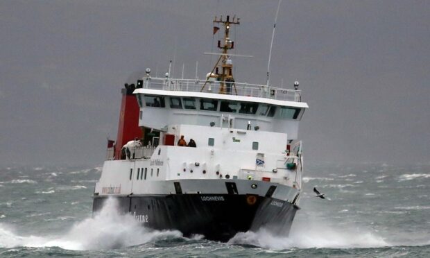
The Western Isles is bracing for potential flooding tomorrow as high winds will continue to batter the west coast of Scotland.
The Scottish Environmental Protection Agency (Sepa) has issued a flood Alert for the Outer Hebrides as high water is expected from around 7pm on Thursday.
Flood warnings have been issued to specific areas, including Eriskay Causeway, which connects Eriskay with South Uist, and the Braighe near Stornoway Airport.
Both areas are vulnerable to large sea swells which can be whipped up from strong southerly winds.
Sepa is warning residents of potential flooding at the Braighe at around 7.45am on Thursday during high tides.
This could make it hard for people travelling to and from Stornoway to the Eye Peninsula.
This follows some turbulent weather that has hit the west of Scotland today with strong winds of 41mph recorded in Mallaig this afternoon.
Other West Coast communities, including Oban, experienced similar conditions with gusts exceeding 30mph.
Changes in tidal conditions prompted CalMac bosses to cancel and amend timetables across their fleet.
ScotRail has also been forced to take action to maintain passenger safety across its network in light of the forecast.
What services were impacted by the weather?
Ferry crossings between Oban and Lochboisdale were also cancelled on Wednesday.
Meanwhile, amended timetables have been implemented for crossings between Oban and Castlebay, Mallaig and the small isles, Ullapool and Stornoway, and Oban and Lismore as well as Uig to Lochmaddy.
Several ferry sailings were cancelled including the 4pm sailing from Uig to Tarbert and the 5.15pm service departing from Oban and the 6.15pm service from Lismore.
Train services on the West Highland Line faced delays of up to 60 minutes as a result of the conditions.
ScotRail implemented speed restrictions along the Glasgow to Mallaig railway line as strong winds sweep across the west coast.
Officials warned commuters to expect disruption on the line until around 3pm.
The calm before the storm
Wind speeds are expected to intensify overnight and into Thursday.
Mallaig will be hit with gales of up to 56mph on Thursday afternoon with Oban experiencing highs of 51mph.
The strong winds across the region are likely to lead to further disruption across the transport network.
Tomorrow, we expect to see 10-20mm of rain widely, with western areas of the Mallaig route seeing 25-30mm. Wind gusts of 40-50mph are expected across the country, with 60-70mph gusts possible across the Highlands. /3 pic.twitter.com/up7ubl71yC
— Network Rail Scotland (@NetworkRailSCOT) November 9, 2022
Network Rail warned passengers that the Highland line and Kyle of Lochalsh line could see the worst of the weather on Thursday with wind gusts of up to 70mph.
Transport operators have already begun to issue warnings about possible disruption to services in the coming days.
CalMac has confirmed sailings from Mallaig both to the Small Isles and Armadale will be cancelled on Thursday due to the forecast.


Conversation