More than 27 hours of persistent and heavy rainfall is forecast to fall across the Highlands from Sunday evening.
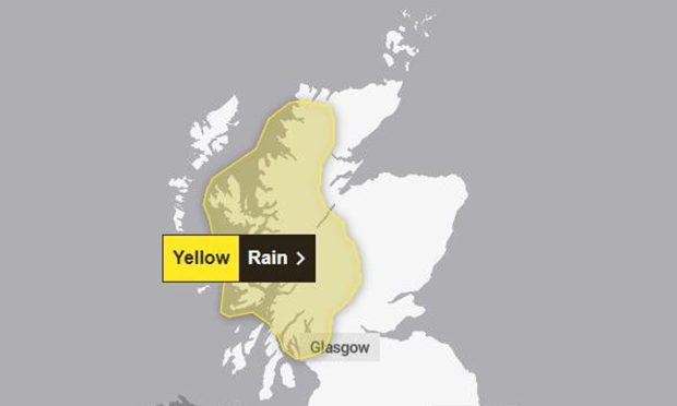
The Met Office issued a yellow weather warning for rain, while flood alerts have been put in place for a number of areas.
River levels in some locations could exceed those hit during Storm Isha, according to the Scottish Environment Protection Agency (SEPA).
The agency said the Speyside and Great Glen areas may be particularly at risk.
The yellow weather warning came into effect at 6pm on Sunday with heavy rainfall expected to last until 9pm today.
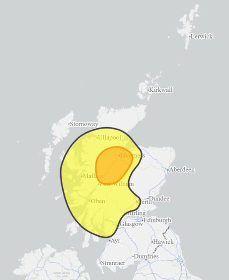
Between 40 and 75mm of rain may fall widely in the warning area, which includes Ullapool, Portree, Tobermory and Fort William.
The Met Office has predicted parts of Argyll, Lochaber and Wester Ross to be the wettest with up to 170mm of rain.
This will be followed by “icy patches” forming overnight and into Tuesday.
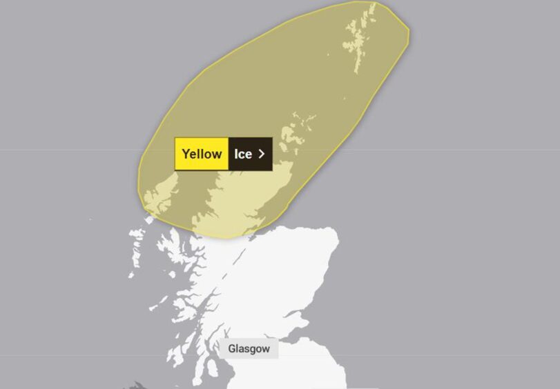
A further yellow weather warning for ice has been issued across the north of the Highlands, Orkney and Shetland from midnight until 9am tomorrow.
The warning states: “Wintry showers are expected during the early hours of Tuesday morning bringing a risk of ice on untreated surfaces along with a slight covering of snow in places.”
Rain warning in Highlands could lead to flooding
Residents have been warned there is a chance homes and businesses could be flooded as a result of the weather.
Mark Franklin, Flood Duty Manager for SEPA said in a statement: “Flooding from surface water is possible on Sunday evening into Monday.
“River levels are also expected to be high overnight on Sunday into Monday and Tuesday, particularly around Speyside and Great Glen.
“We could see rivers reach the same heights as Storm Isha last month, but possibly higher in some locations. Travel disruption is possible, as well as flooding to land and properties.”
Flood alerts and warnings are in place for Argyll and Bute, Caithness and Sutherland, Easter Ross and Great Glen, Findhorn, Nairn, Moray and Speyside, Skye and Lochaber and Wester Ross.
The warning shared by the Met Office states: “A lengthy period of rain looks likely to develop across parts of western Scotland on Sunday and Monday.
“Initially, rain will slowly push north through Sunday, before pivoting and then returning south later on Monday.
“Some southern parts of the warning area may see a drier interlude for a time on Monday and there is some uncertainty as to how far north the rain gets.
“40-75 mm of rain may fall quite widely in the warning area, but there is potential for 120-170 mm in the wettest areas, this perhaps most likely in parts of Argyll, Lochaber and Wester Ross.”


