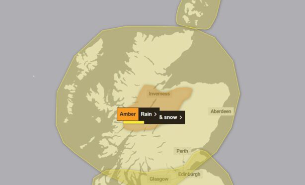
An amber weather warning has been issued for Hogmanay, with Highland and Moray residents warned heavy rain could spark flooding, power cuts and disrupt travel.
The new Met Office alert is the fourth to impact the north and north-east over New Year and will last for 15 hours from midnight on Tuesday til 5pm.
A yellow weather warning for rain and snow has been ongoing since 12am on Monday and will continue until just before Scotland rings in the New Year.
Three severe flood warnings have also been issued for Speyside.
The extreme weather has already begun to impact public transport, with roads closed and trains cancelled today.
Justice and Home Affairs Secretary Angela Constance will chair a Scottish Government crisis meeting this evening, and Police Scotland has advised drivers to avoid the roads.
Superintendent Jennifer Valentine said: “Following significant and continuing rainfall across the Highlands and Moray, we are dealing with challenging weather conditions, as well as rising river levels, and are asking people to take care.
“We are working hard with a range of multi-agency partners to support communities and those who need our help.
“Roads across the area are affected by surface water, and overnight we expect a number of roads, particularly around the Aviemore area, will become flooded.
“Our advice is to avoid these areas due to hazardous conditions.
“Please consider if your journey is really necessary or if it can be delayed until conditions improve.
“Stopping distances can be at least double on wet roads compared to dry conditions, and spray can reduce driver visibility.
“If you need to travel, please drive to the conditions, take extra time for your journey, and find alternative routes if needed.
“Please do not ignore closed signs – they are in place for your safety.”
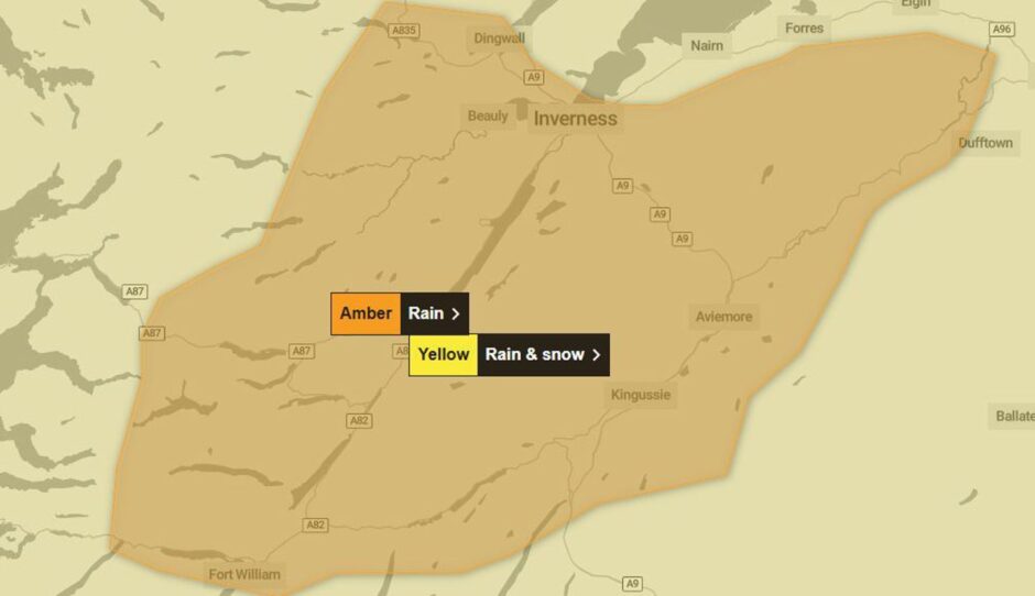
Amber weather warning for Highlands and Cairngorms
Heavy rain will fall in places like Inverness, Fort William, Aviemore and Dufftown in Moray.
The Met Office says it is “likely to cause some property flooding and travel disruption”.
This includes major travel routes such as the A9 between Inverness and Perth, and the Highland Main Line.
The warning reads: “After a brief lull during Monday afternoon, another period of heavy rain is expected to develop during Monday night and persist through Tuesday morning before turning to showers on Tuesday afternoon, giving another 50-70mm on top of what has already fallen.”
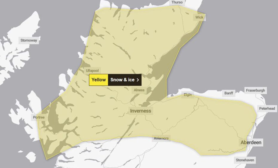
Snow and ice warning for Highland, Aberdeenshire and Moray
In addition, a new yellow weather warning has been issued to follow on from the extreme weather on New Year’s Eve.
Snow and ice are expected to impact most of the north and north-east stretching from the West Coast to the East Coast .
“Rain turning to snow is likely to lead to some travel disruption and difficult driving conditions on New Years Day.”
It is likely to impact areas such as the Cairngorms and central Highlands extending northwards to Caithness and Sutherland.
The warning comes into force from midnight on Wednesday, January 1 and will last until 9am on Thursday, January 2.
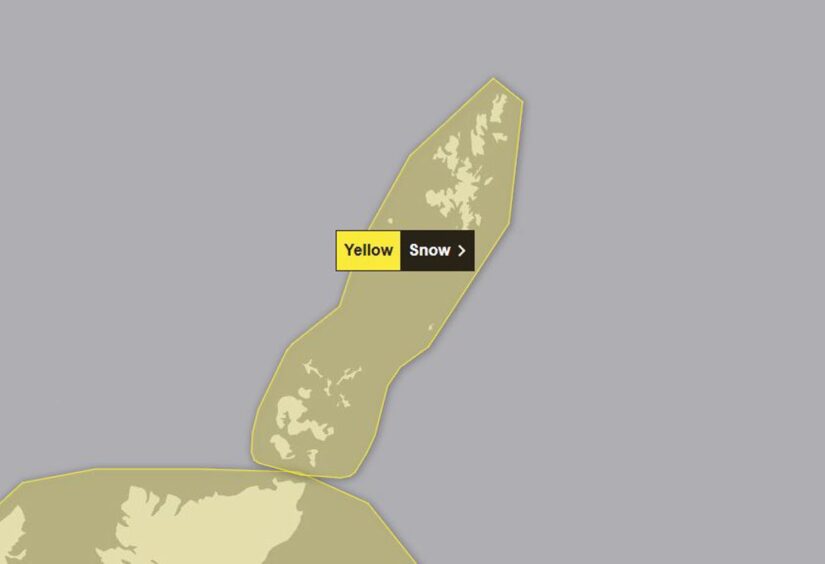
Snow warning for Orkney and Shetland
A yellow snow warning will also affect Orkney and Shetland from 5am on Tuesday December 31 until 11:59pm.
The Scottish Environmental Protection Agency (Sepa) has also issued 20 flood warnings, mostly near the River Nairn and River Spey, which are likely to flood.
Other areas include the Great Glen, Easter Ross, Wester Ross and Skye and Lochaber.
Flood alerts have also been issued for the Aberdeen and Aberdeenshire region.
Cordelia Menmuir, SEPA’s Duty Flood Manager, said: “Extremely high water levels are expected in Speyside, the Great Glen and Tayside, resulting in disruptions to transport and to communities.
“It is possible we could see similar levels to those experienced in early October 2023, when places like Aviemore and Perth were severely affected.”


Conversation