Around 130,000 people tackle Ben Nevis every year, but most will never see the secret life hidden away on its rugged North Face.
However, around 20 botanists, geologists, mountain guides and Nevis trainee rangers are hoping to persuade the UK’s highest mountain to reveal some of its hidden arctic-alpine gems.
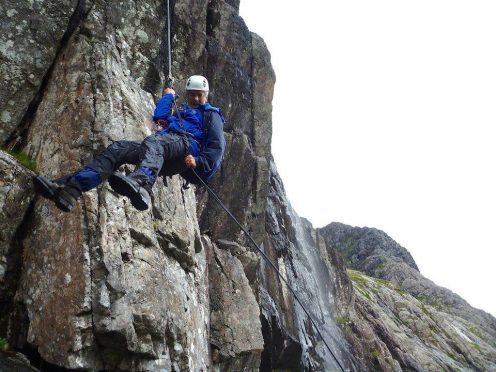
Next week, the team will be dangling from ropes to enable them to record the rare plants tucked away in some of the 4,412ft peak’s most inaccessible ledges and crevices.
They will be taking part in the third and final year of an ambitious project to survey more than 300 acres of difficult to reach terrain to create a 3D map of the famous Lochaber mountain.
It is also aimed at raising the profile of Ben Nevis, looking at the pressures imposed by climate change and providing a blueprint for other landowners wanting to survey mountainous terrain.
Nevis Landscape Partnership (NLP) environmental projects officer Lewis Pate said: “We are trying to map and define how the mountain formed and became what it is today.
“But the main focus of the survey is knowledge sharing, developing working relationships and increasing the public’s understanding of what’s on their doorstep.
“This has never been done before. It’s a completely new concept bringing together these knowledge bases.”
The North Face, which has multiple designations, including Site of Special Scientific Interest, Special Area of Conservation and National Scenic Area, had not been surveyed since the early 1900s.
