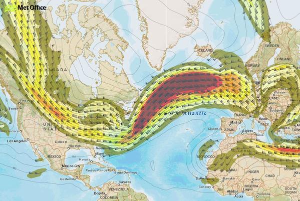
Lightning storms and hurricane force winds could hit the Highlands and islands tonight as a double whammy of major storms rush in from the Atlantic.
Huge seas with “phenomenal” waves are expected off the Hebrides and the west coast of Scotland as the two storms are set to batter the area.
The Met Office has issued an amber “be prepared” warning for the north today and tomorrow, prompting a major power company to draft in hundreds of engineers from the south of England to deal with any power cuts.
And travellers are being warned to expect significant disruption, as high winds and a huge swell yesterday forced many ferry services to be cancelled.
The worst conditions are expected to hit tonight when the first area of low pressure reaches the UK.
The second storm will arrive overnight on Friday into Saturday morning, bringing similarly difficult conditions.
A Met Office spokesman said: “The north will bear the brunt of the weather.
“The winds will gradually ease off on Friday but there will be potential disruption to transport and power supplies, as well as possible structural damage and huge waves.”
The amber warning is in place for Caithness, Sutherland, Skye, Ross-shire and Lochaber until midday tomorrow.
The rest of the region, Moray and Grampian is covered by a yellow “be aware” warning, with winds of up to 80mph predicted.
Scottish Hydro Electric Power Distribution (SHEPD) said it has begun preparing for Friday’s severe weather, adding it expected gusts of up to 100mph and lightning strikes across northern Scotland, the Western Isles, Shetland, Caithness, Moray Firth and Tayside.
The company said it had mobilised “hundreds of additional staff on the ground and in customer call centres”. It is understood that extra staff have been sent to the islands also.
It is also transferring some resources from its sister company in the south of England in anticipation of the severe weather. They include tree-cutting teams, linesmen and scouts. Rodney Grubb, head of SHEPD operations, asked the public to take their own precautions.
He said: “With wind speeds of around 100mph it is ever so easy for garden furniture and farm equipment to be carried by the wind at high speed, which then becomes tangled in our power lines.
“I would urge customers, especially in rural areas, to ensure anything that has the potential to become wind borne debris is secured.”
The Western Isles Emergency Planning Group is convening this morning to discuss weather reports and consider contingency measures, including the possibility of shutting public buildings.
And last night The AA advised drivers to heed travel warnings.
John Seymour, national manager of the AA’s severe weather team, said: “Scotland, particularly, is going to take something of a battering and drivers need to be prepared for possible widespread travel disruption and challenging driving conditions across the affected areas.
“We would encourage people to check the weather and traffic updates before departing and to heed any police warnings about whether it is safe to travel.”
Mr Seymour added: “If you have no choice but to drive, keep your speed down as gusts can catch you out and there is a risk of debris on the roads.
“Take particular care on hills and coastal areas and leave plenty of extra time in case of diversions; and always carry a fully-charged mobile phone and warm, weatherproof clothing.”
