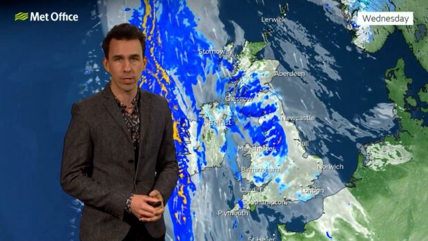
This week’s weather across the north, north-east and the islands will mainly be cloudy with rain.
But by the time the weekend comes, it could be a different story, and we could be basking in gentle sunshine.
Temperatures are expected to be around or just above average for many. That means 8C or 9C.
Meteorologist Aiden McGivern has said a mixture of high and low pressures means dull and damp weather might take a time to shift.
By the time the weekend comes it will be frosty overnight, but both Saturday and Sunday should see sunny days with highs of 8C and 9C.
Today
Scotland and Northern Ireland seeing bright intervals and showers, winds easing.
Tonight
The northwest still seeing scattered showers, perhaps heavy and wintry.
Tuesday
Showers in the north easing, with more sunshine.
It will be a wet start to this #MondayMorning for many western areas as a band of locally heavy rain edges eastwards pic.twitter.com/E3gQ9NAByI
— Met Office (@metoffice) February 27, 2022
Outlook for Wednesday to Friday
Fine start in the north Wednesday, but cloud and rain elsewhere spreading to all areas overnight then lingering through Thursday.
Probably brighter in the west and north again on Friday.
Long term forecast
From March 5-14 it will be a largely settled start, with sunny spells across the north.
Light winds are expected through the weekend with daytime temperatures near average, although colder in the south.
For the following week, there is likely to be a northwest-southeast split in weather conditions.
The south-east is most likely to be dry and settled for the longest, with the northwest most likely to see the wind and rain.
Overall however, conditions likely to remain relatively benign when compared to recent weeks and most areas will see a mixture of conditions to some degree.
Temperatures are expected to be around or just above average for many.
