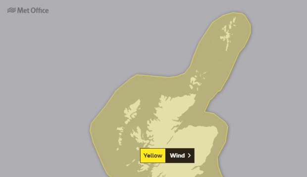
People in the north and north-east have been warned the region will be hit by extreme wind and snow as Scotland’s most intense storm in years sweeps through the country.
Residents in Moray and the Highlands have been told they could be among the worst affected by Storm Ciara, with an expected eight inches of snow left in its wake.
Blizzard conditions are expected on Monday and Tuesday, and ferry services have been rearranged today as the trouble begins. Experts have said it will be the worst storm experienced in the country since 2013.
Met Office forecasters have issued a yellow weather warning which extends until Tuesday – predicting that 80mph winds will cause significant disruptions on road, rail and ferry services across the north-east.
ScotRail has advised passengers that this weekend’s conditions are expected to impact routes to and from Inverness, Oban, Fort William and Mallaig.
David Horne, the managing director of LNER, confirmed that the firm was advising customers not to travel on Sunday as services are expected to face “significant disruption”.
He added: “Customers with tickets booked for Sunday should instead use their tickets to travel on any LNER service on Saturday before 6pm, or on Monday.
“For customers who do not wish to travel, a full refund will be available without charge.”
As a result of the forecasted high winds, speed restrictions of 50mph have been imposed by Network Rail across its routes.
Northlink has rescheduled its sailings between Scrabster and Orkney “due to forecasted adverse weather conditions”, with ferries leaving earlier to avoid the worst of the conditions.
And the company has warned people that ships may be late arriving in Aberdeen, depending on the weather.
Steven Keates from the Met Office said today was expected to get off to a fine start before the north bears the brunt of Storm Ciara.
He added: “Late Sunday into early next week attention we could see a unpleasant wintry mix of rain, sleet and snow.”
Meanwhile, a “danger to life” warning has been issued to some of the southern parts of the UK.
Damage to buildings, such as tiles blown from roofs and and beach material being thrown onto coastal roads, sea fronts and properties is expected.
In the north-east, conditions are expected to affect high-sided vehicles on exposed routes and bridges.
