Aberdeen’s Rapid Transit (ART) scheme is one step closer to hitting the road now that the route maps have been approved, but where exactly would it take passengers?
Although the idea of creating the new transport system has been in discussions for years and years, Nestrans only launched the official campaign to make it a reality in November 2022.
Since then, the regional transport body has been working hard with First Bus and Stagecoach, as well as both Aberdeen and Aberdeenshire councils, on the plans.
So far, ART proposals have suggested a fleet of specialised vehicles, similar to normal buses but much larger, which would run along two routes that criss-cross in the city centre.
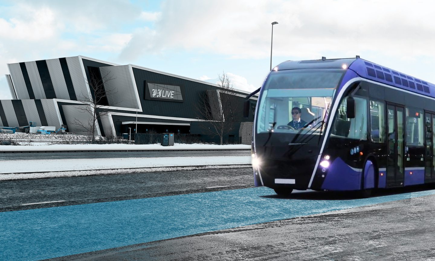
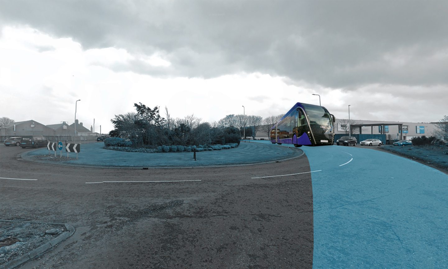
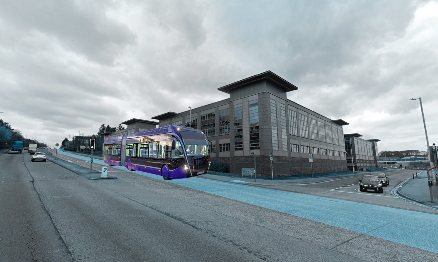
In practice, the system could look like the Belfast Glider project, which launched in 2018 and has resulted in a big jump in public transport use in the Northern Irish capital.
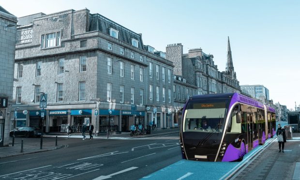
We’ve superimposed images of the Belfast Glider over the routes in Aberdeen to give you an idea of what the ART could look like in real life.
The vehicles, and their associated infrastructure of larger stops, dedicated lanes and off-board ticketing, are designed to be more efficient than typical bus services, and more like a tram in function.
They use wheels and regular roads, instead of travelling along rails like a tram, and they’re intended as an attractive alternative to just taking the car.
And now, the two proposed ART routes have been given the green light from councillors across the two local authorities — meaning the ambitious project is one step closer to hitting the road.
Take a look at the details for where the routes could take passengers, and see our artist’s impressions of what the ART could look like across the city below…
What do the new Aberdeen Rapid Transit routes look like?
The project could be similar to the £90m Belfast Glider public transport service, which has brought dozens of big purple vehicles to the Northern Irish city.
The ultimate goal is anyone would be able to turn up at an ART stop and never have to wait more than a few minutes to jump on board.
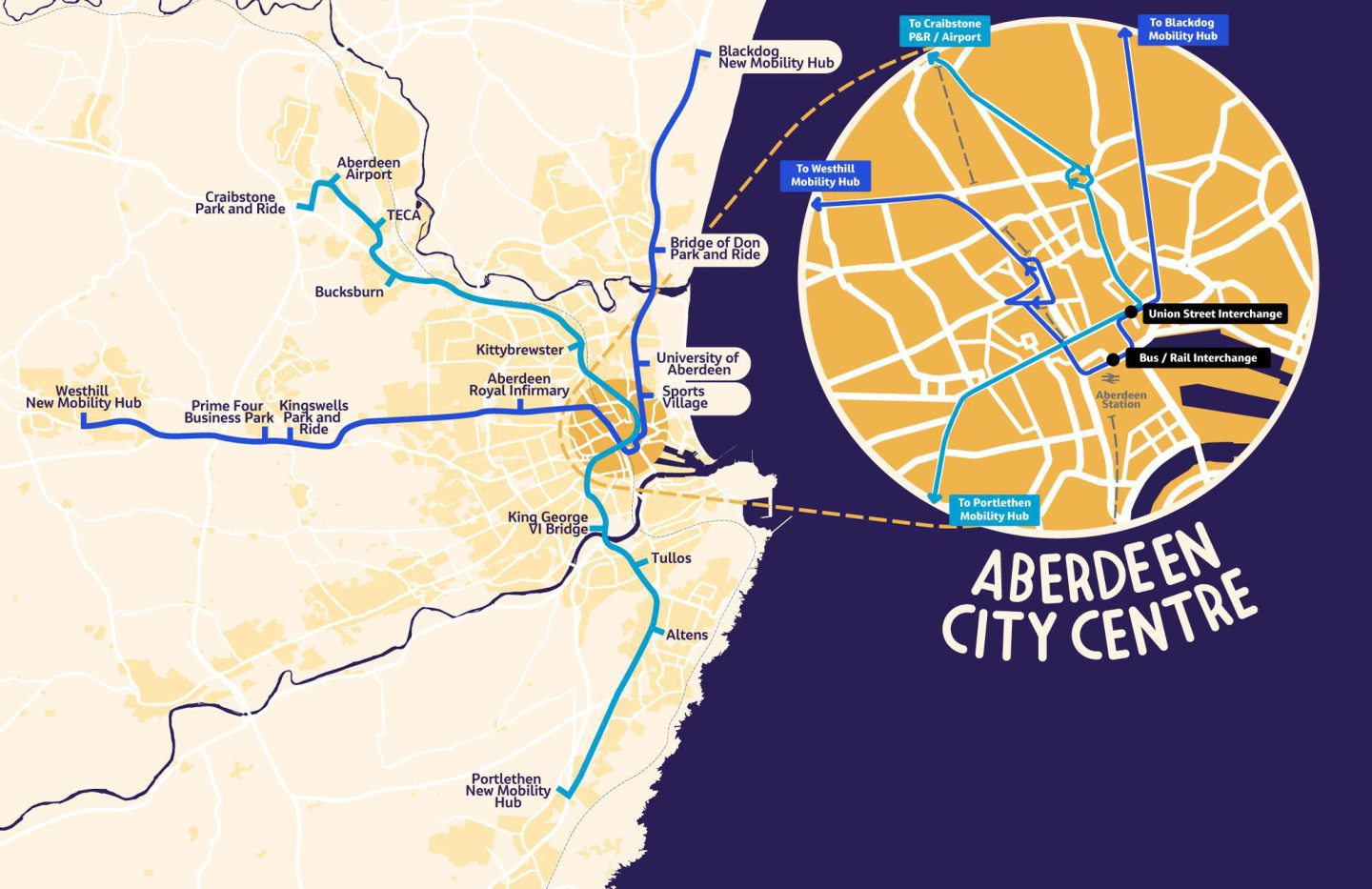
The latest plans involve two main routes…
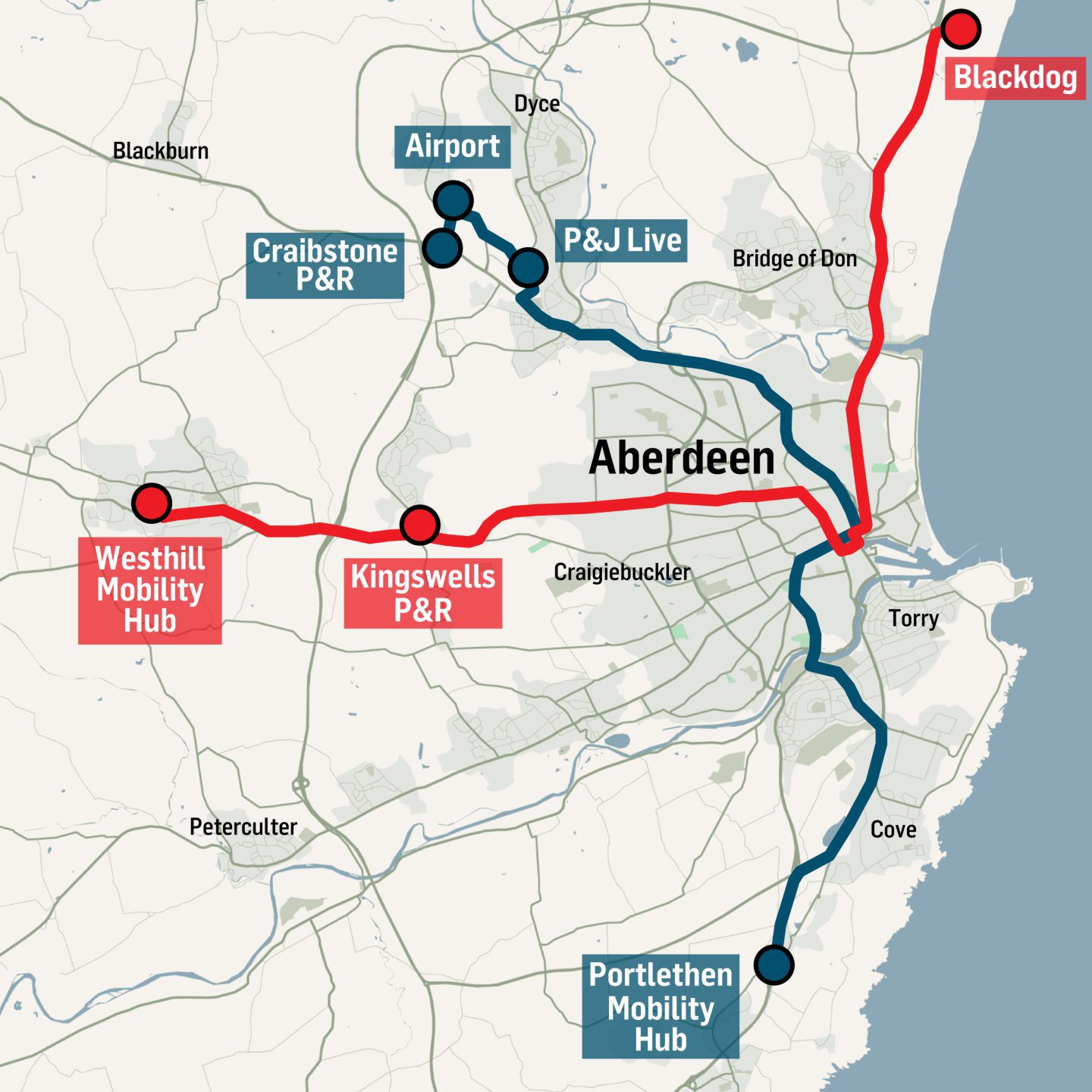
- One going from the Blackdog to Westhill
- And the other from Craibstone to Portlethen, intersecting in the city centre.
Following engagement with the bus operators, a detailed study of the area and 10 different test routes, the final two routes have now been approved for the next stage of the plans.
Here’s a zoomed-out view of both of them…
And here’s a zoomed-in view of what they’d look like in the heart of the Granite City where they cross over.
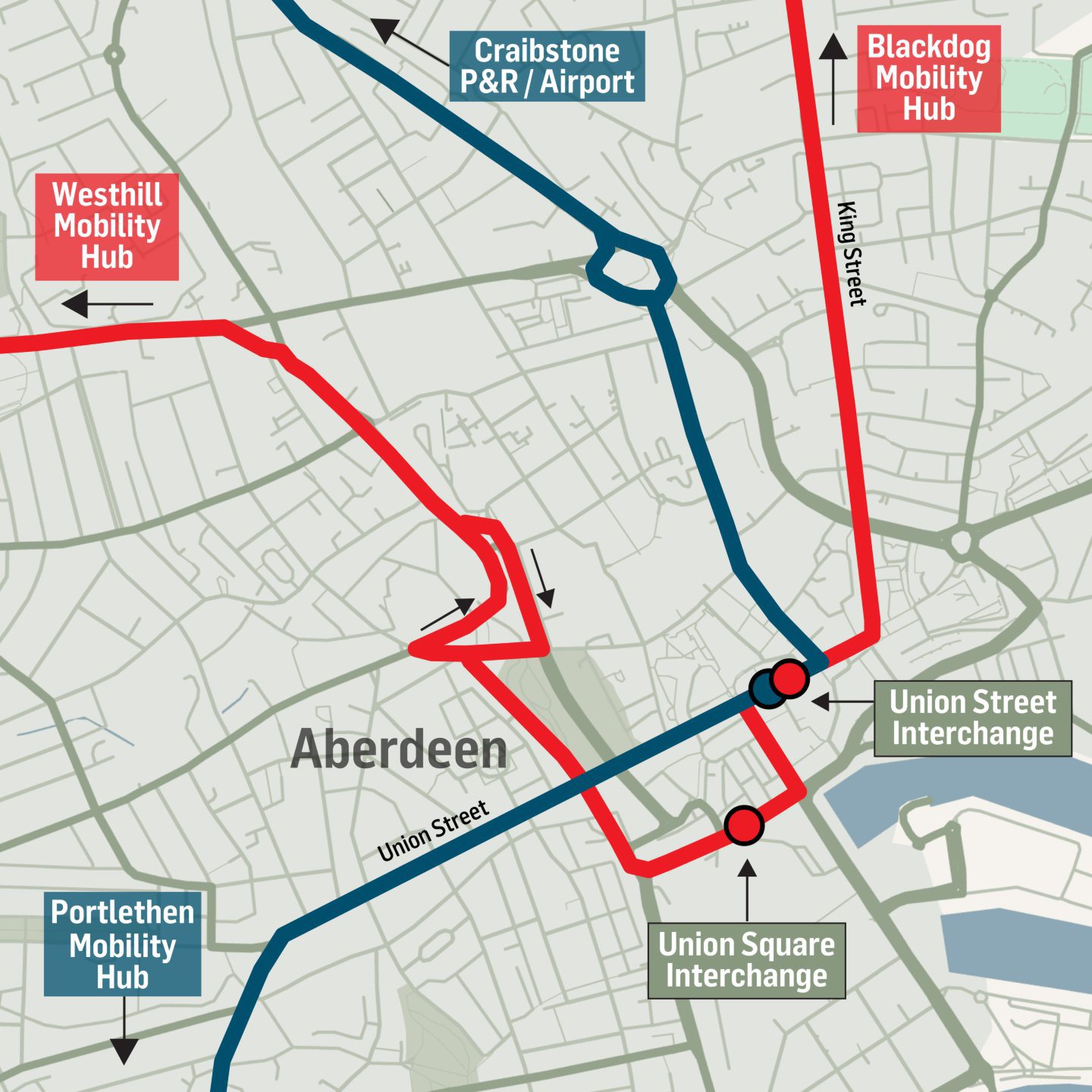
Here is a breakdown of the new routes and plans, street by street, and some of the key stops along the way:
Route 1: Blackdog to Westhill
A new “mobility hub” (essentially a park-and-ride, but with more community facilities) would be built, incorporating the current park-and-ride facilities at Blackdog. The existing park-and-ride site at Bridge of Don could also be utilised.
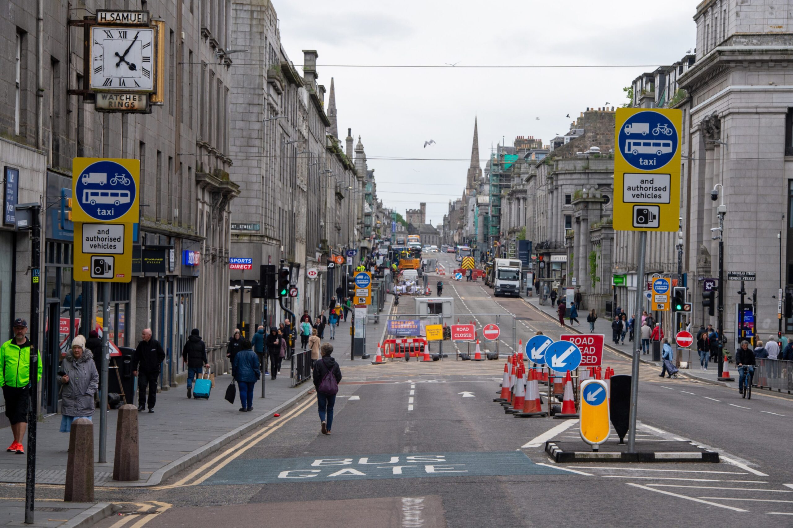
The route would run along the A92, before weaving along King Street, Union Street, Market Street, Guild Street, Bridge Street, Union Terrace and Skene Square.
It would then go along the A944 Lang Stracht and connect to the Foresterhill Health Campus before heading to Kingswells park-and-ride.
Instead of terminating there, it would carry on the A944 until Westhill, where another new mobility hub would be built.
This line would connect commuters from Westhill, Kingswells and Blackdog with Aberdeen, but it would enhance access to some key destinations including:
- Aberdeen University
- Frederick Street Health Village
- Union Square — including the bus and train stations
- Foresterhill Health Campus
- Prime Four
It would also connect to the new development sites at Blackdog, Cloverhill and Maidencraig.
Route 2: Craibstone Park and Ride to Portlethen route
This line is planned to start at the park-and-ride facility in Craibstone, with connections to the airport and Teca.
It would then run along the A96, Great Northern Road, Powis Terrace, Powis Place, Broad Street, Union Street and Holburn Street.
The line would then take passengers south along Great Southern Road, West Tullos Road, Wellington Road and the A92 before terminating at a new park-and-ride in Portlethen.
And again, while it would serve commuters from north and south of the city, it would also enhance access to some key destinations including:
- Aberdeen College
- Union Street
- The west end of Union Street
- Kincorth
- Wellington Road
What do you think about the Aberdeen Rapid Transit route? Let us know in our comments section below…
What areas or key destinations have been missed?
While the new route has four very distinct corridors, it misses areas like Torry, Northfield, Tillydrone, Garthdee, Cults, Bieldside and Peterculter.
And so Robert Gordon Univerisity is missed off the route, as is the beach, the South Harbour and the Gordon Highlanders Museum.
However, the report highlights that both RGU and the beach could be included in ART at a later date.
Aberdeenshire Councillors pointed out concerns for smaller communities and stressed that public transport to these so-called mobility hubs would need to be just as efficient to get people to ditch their cars and opt for the ART.
The proposals also include an emphasis on linking up the ART with existing transport infrastructure like bus stops, train stations and cycle routes.
What next for Aberdeen Rapid Transit project?
While this is a great step, the wheels aren’t quite in motion just yet.
At recent council meetings Kirsty Chalmers, transport executive at Nestrans, explained the business casework for ART is being progressed in partnership with the North East Bus Alliance.
This includes looking into a couple of different “delivery mechanisms” and fleshing out the costs.
According to Nestrans’ timeline, the final business case could be made for the project in 2026/27, and if all goes to plan, the infrastructure for the ART could be built, and the vehicles could be on Aberdeen’s roads by 2030/31 at the latest.
Read more on the ART and transport in the north-east:
-
Our initial story on the launch of the ART plans, detailing the original aspirations with an interview with Nestrans chiefs
-
What can Aberdeen’s proposed £150 million rapid transport network learn from the Belfast Glider?
-
‘No longer sustainable’: Stagecoach forced to axe bus services in major shake-up for the north-east
-
The ‘secret’ second beach burning of Aberdeen’s trams in May 1958
You can also watch this video from Nestrans showing an animation of how the ART could work:
And you can find out more from ART on the official Nestrans FAQ here.
Conversation