People have complained about Aberdeen’s roads being difficult to navigate long before the LEZ came into force — but it seems the latest scheme has just added to the confusion for some drivers.
On June 1, the cameras enforcing the clean air zone were turned on meaning anyone caught driving a vehicle that does not meet the strict requirements will be hit with a £60 fine — reduced to £30 if paid within 14 days.
Since then (and even before it was launched) drivers bemoaned the latest change-up, with many being left feeling disorientated and bewildered by the new road rules. Some have even said it’s just “too much hassle” and now avoid coming into Aberdeen city centre because of it.
Aberdeen City Council had previously estimated only 14% of drivers would be impacted by the scheme.
But, we revealed that 1,956 rulebreakers were caught driving a non-compliant car going through Aberdeen’s LEZ in the first 11 days of it going live.
That means £117,360 worth of £60 fines were sent out.
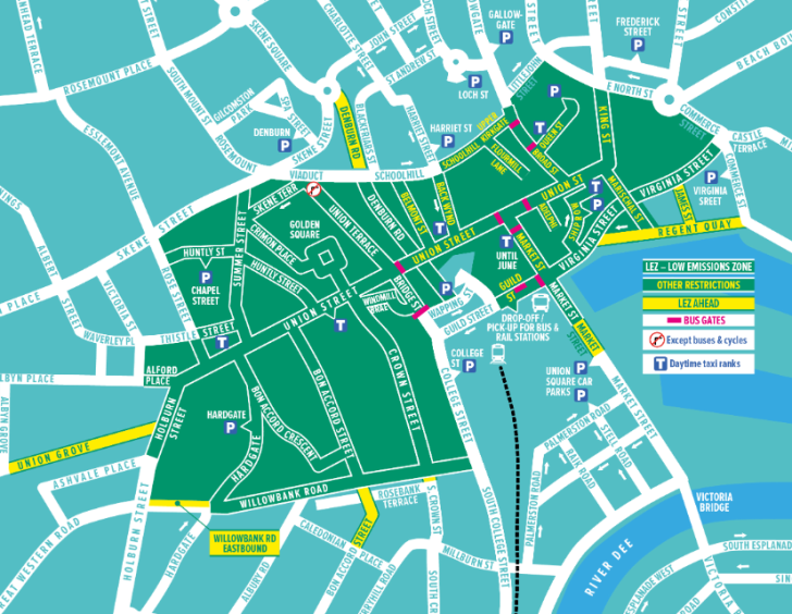
I have to admit, I was feeling pretty surprised by this data from the local authority and was left wondering why there were hundreds of fines issued on Virginia Street, Denburn Road and Alford Place in particular.
It seemed especially odd when going by this initial data, drivers didn’t seem to have an issue on other busy, main roads, like King Street or Gallowgate.
With that in mind, I wanted to find out why more than 500 fines had been clocked at each of these three roads — was it a problem with signage or the road layout, or could there be some other reason?
I headed out to see for myself…
1. Virginia Street (via Commerce Street)
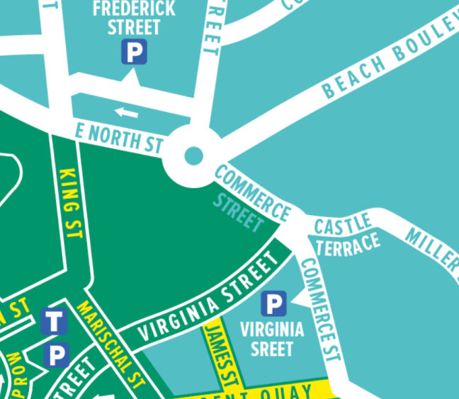
Virginia Street, accessed via Commerce Street, had the most fines in the 11 days, coming in at 579 fines, so it was my first port of call.
I headed down West North Street first and walked towards the roundabout to see what the signage was like in the run-up to the LEZ.
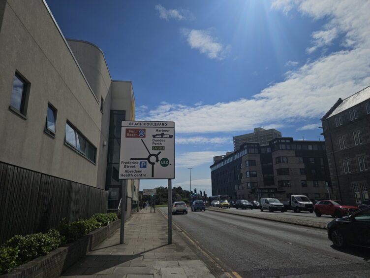
The sign just before approaching the roundabout had the LEZ symbol on the fifth exit (Justice Street).
Although it isn’t on Commerce Street, I think it could perhaps lbe made more clear that the fourth exit leads into the zone before drivers approach the roundabout.
However, Aberdeen City Council disputed this and said including the green symbol at that stage would be “misleading” as it would give the impression the boundary is at the roundabout junction with Commerce Street.
A spokeswoman argued this could cause confusion for drivers of non-compliant vehicles legitimately looking to use Commerce Street and access local roads.
Once drivers come off the roundabout and onto Commerce Street there is a sign that shows the LEZ to the right, on Virginia Street. However, the signs above the road on the bridge do not show any warning.
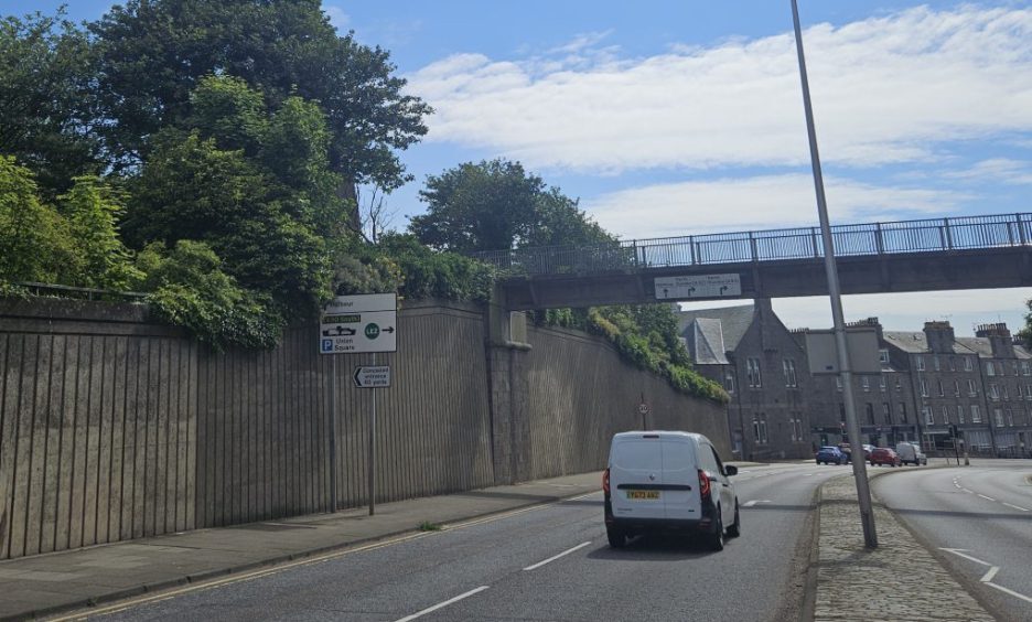
Do drivers turn right onto Virginia Street LEZ before realising their mistake?
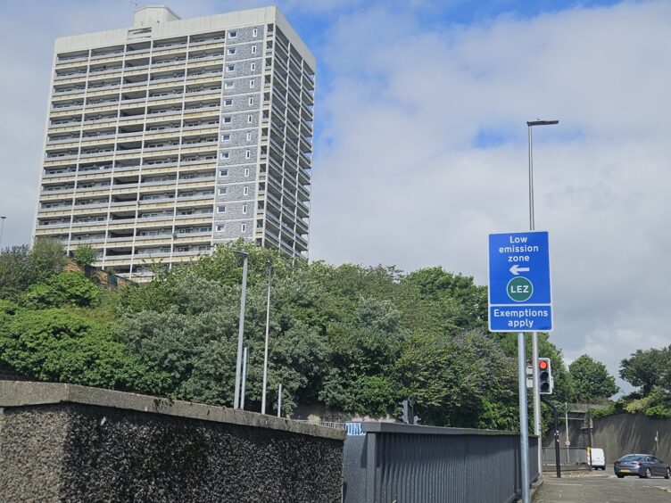
There is no further warning until you turn right to go onto Virginia Street and are met with road markings and signs on either side letting you know you are entering a low emission zone.
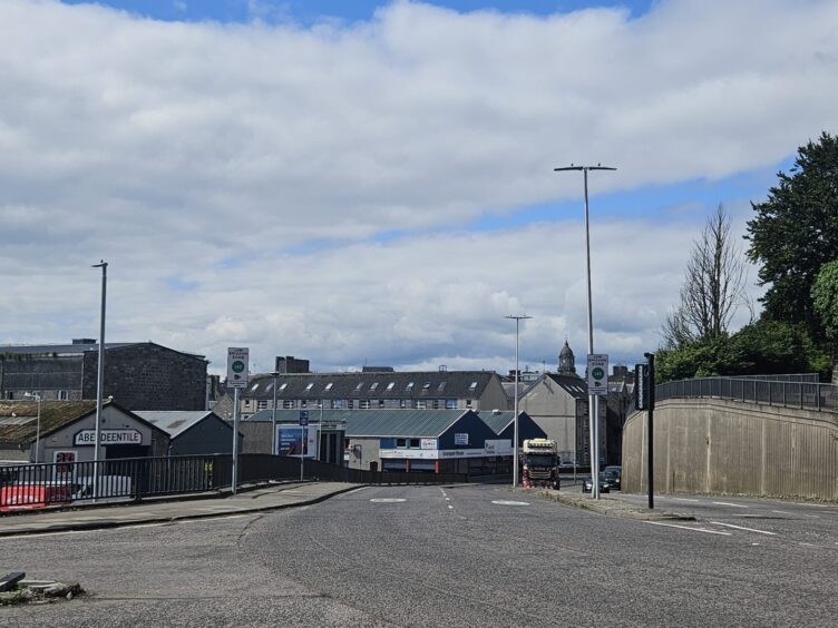
This is not the same travelling north on Commerce Street, where there is a very clear sign showing the LEZ to the left alerting drivers in plenty of time.
I think most people travelling along the dual carriageway would have little choice but to commit to the right turn and enter the zone.
It could be that people might not imagine a dual carriageway going through quite an industrial area, albeit with some residential properties nearby, would be an obvious candidate for being inside the clean air zone.
Let us know what you think about this road…
2. Alford Place
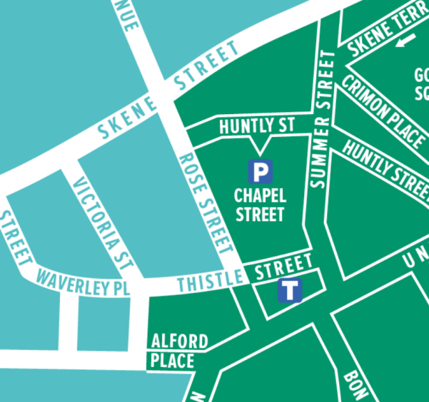
At 534 fines, Alford Place had the second-highest number of rulebreakers caught out in 11 days.
So I took a walk up to Albyn Grove and found there was no warning of the LEZ for drivers looking to turn right onto Alford Place.
But, there was a warning sign on the other side of Albyn Grove for those turning left onto Union Grove…
Again, there was no warning sign for drivers turning left on Rubislaw Place either, which is much closer to the low emission zone.
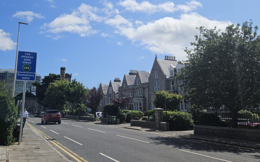
It’s not until you start coming up to the junction with Victoria Street that the signs showing the LEZ appear. There is a sign warning of the zone ahead at the bus stop on Albyn Place, but it’s not that far away from the boundary.
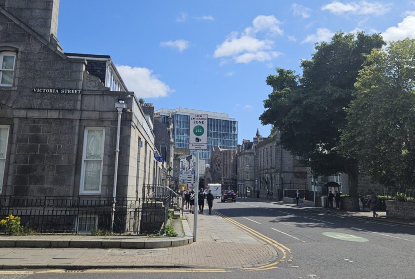
Is there enough signage far enough ahead to warn drivers?
For anyone wanting to avoid getting a fine, your only option is to turn left and go up Victoria Street.
Personally, I don’t see why there aren’t more warning signs along Albyn Place offering an earlier escape route, or on the adjoining streets showing the clean air zone ahead.
It’s such a busy residential area, with a mix of offices and businesses around about too.
And it’s one of the main routes from the west of Aberdeen into the city centre so I can only hazard a guess that there’s always a lot of traffic.
So why are so many people being caught here?
It could be that people who don’t know about the upcoming boundary panic when they come upon it and don’t notice their escape route until it’s too late.
Plus, nearby streets, such as half of Thistle Street and most of Rose Street, are further east than the Alford Place boundary, yet aren’t in the zone — this could also be creating confusion.
The spokeswoman for the city council said the LEZ ahead sign located immediately east of Albyn Place’s junction with Rubislaw Place provides a forewarning to drivers of non-compliant cars giving them ample opportunity to turn left onto Victoria Street.
She said it wasn’t “considered necessary” to put an advance warning sign on Rubislaw Place.
Additionally, the local authority did not want to put a warning sign at the end of Albyn Grove because it would be “misleading”. She went on to explain when turning left from Albyn Grove onto Union Grove there is “no escape junction”, meaning the only option would be a three-point-turn to avoid the LEZ on Holburn Street.
Whereas turning right from Albyn Grove onto Albyn Place there are other roads that drivers can use to avoid entering the clean air zone, such as Victoria Street or Rubislaw Place.
Let us know what you think about this road…
3. Denburn Road
Not long after the LEZ went live, I counted vehicles travelling along Denburn Road one morning during rush hour and was surprised to find only 23 out of 873 were non-compliant.
I originally chose the Denburn for my count because it is one of the main routes connecting the north and south of the city.
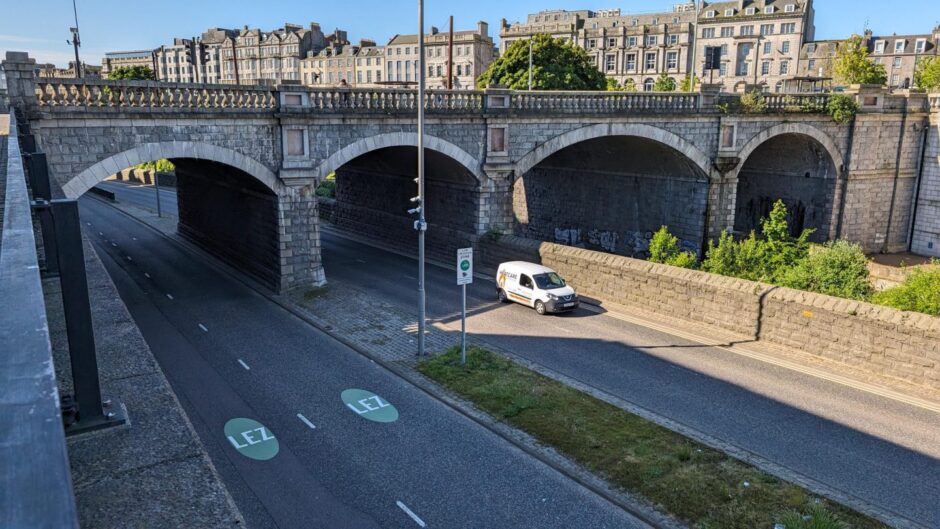
It’s heavily used by cars, buses, lorries and taxis and, at least in my opinion, is the best way to get to the South College Street car park to access Union Square without being slapped with a bus gate fine.
So, when the data from Aberdeen City Council showed 505 fines had been dished out during those first 11 days I couldn’t help but wonder why.
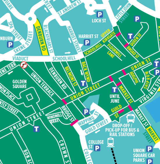
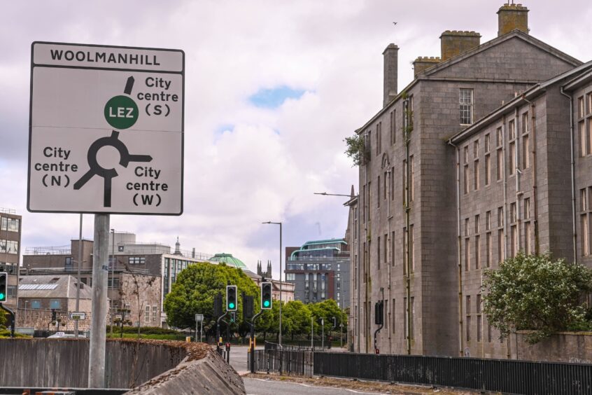
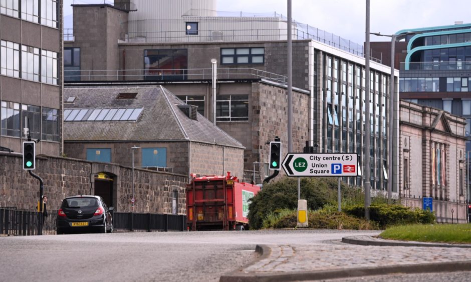
For those travelling along Skene Square down to the Woolmanhill roundabout, there seem to be plenty of signs indicating the clean air zone on the Denburn dual carriageway.
But, if you’re travelling from South College Street it seems to be a different story.
Accessing the Denburn via South College Street
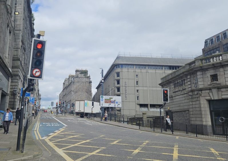
The first sign I saw while walking along South College Street was a huge advertising billboard, somewhat blocking the road signs behind it to oncoming traffic.
The next sign then shows drivers which lane accesses City Centre (W), Inverness (A96) and His Majesty’s Theatre, and the other lane for the A90 North, Trinity Centre and both bus and train stations.
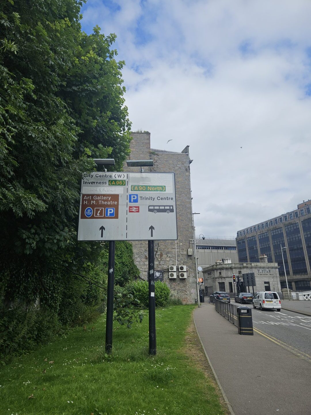
There was no mention of the bus gates on Bridge Street or the upcoming LEZ on this sign, which I found surprising.
There’s actually no mention of the clean air zone until you’re approaching the traffic lights to cross over to Bridge Street or turn right in the direction of the Denburn.
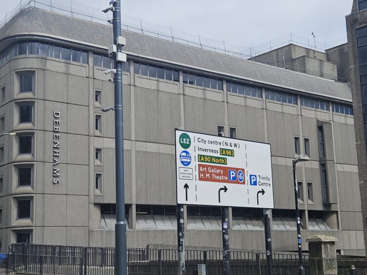
And, the road sign there only shows the green symbol on the lane for Bridge Street, there’s no indication that by heading towards His Majesty’s Theatre you will find yourself in the clean air zone.
It isn’t until drivers are in the left lane preparing to turn onto the Denburn that the signs show the zone ahead.
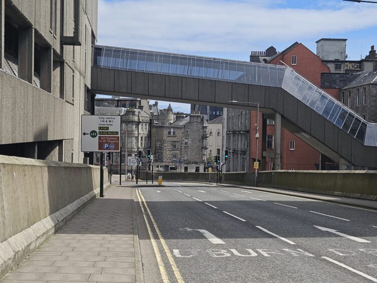
Likewise, if you’re travelling along Guild Street the signage at the end of the bridge only shows the LEZ on Bridge Street, with no indication of it being on the Denburn.
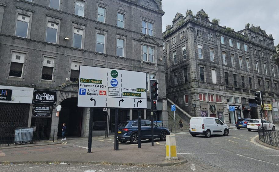
Does the LEZ on Denburn Road take drivers by surprise when they turn the corner?
I think this could take unwitting motorists by surprise, particularly visitors to Aberdeen who may not know about the bus gate on Bridge Street.
It forces anyone travelling north to turn right, and the built-up area can be confusing enough at the best of times with drivers trying to get in the correct lane for the Denburn, Trinity Centre car park, or to loop around and get to the train station.
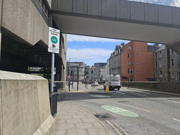
Perhaps people are surprised to find the low emission zone tucked away around a corner and, because the traffic can be so busy there, have no option but to stick to the lane they’re in.
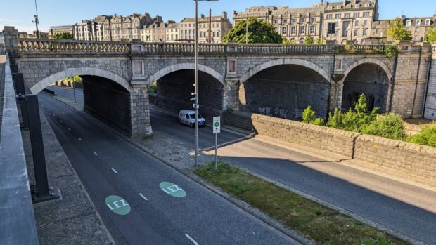
Or maybe no one expects the road rules to apply on the Denburn, which goes underneath Union Street, because it is such a major thoroughfare for so many people, and is such a small stretch of the road.
The council spokeswoman said the council “continues to monitor the LEZ, and this is a site, in terms of the exclusivity of the lane leading to Denburn Road from College Street/Wapping Street, where additional LEZ symbols will be considered.”
Let us know what you think of this road…
Conclusion: My thoughts on why so many are being caught out
Aberdeen’s roads have changed so much over the past couple of years, that once simple trips now need to be planned out on Google Maps to avoid being slapped with a fine.
While aiming to tackle air pollution is without a doubt a noble goal, in my opinion it’s not unreasonable for people to see the LEZ as yet another obstacle making their journey more difficult in the city centre.
Particularly those visiting Aberdeen, or anyone who doesn’t drive in the city centre often, who may not know if they can enter the low emission zone and what it means if they can’t.
Although the signs are technically correct, I do think there could be more of them and some could be made a bit clearer.
For example, there could be more “LEZ ahead” signs, particularly when it’s around a corner and drivers can’t see what lies ahead — like on Virginia Street or Denburn Road.
It could be that drivers are caught off guard, and when they do realise they are approaching the boundary it’s either too late to do anything about it or they panic and can’t find an escape route quick enough.
If there were signs saying how far ahead the zone was this could maybe help those unfamiliar with the new layout of the city centre.
But council says it’s monitoring the situation, and may introduce more signs or changes to help drivers…
A spokeswoman for Aberdeen City Council explained when drivers become “accustomed” to the new road signs it is expected the contraventions will fall.
However, the local authority is monitoring the low emission zone and more signs or other modifications could be introduced.
She said: “In this respect, the LEZ has been subject to enforcement for approximately seven weeks and the council is monitoring the number of contraventions and public feedback. Consequently, additional signs or modifications remain a possibility if it’s considered they will further aid a driver’s interpretation of the LEZ.”
Read more about Aberdeen’s LEZ:
- More than £100,000 of LEZ fines issued in just 11 days, but which Aberdeen road is worst so far?
- We count how many drivers get caught out on Denburn during rush hour
- ‘It’s not a cash cow’: Council chief defends Aberdeen LEZ that ‘only affects 2% of drivers’
- ‘We just invested all our money opening dream Aberdeen cafe – now LEZ could ruin it’
Conversation