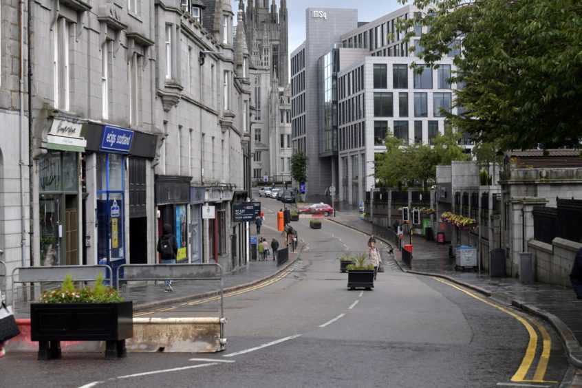
It might be hard to imagine today, with the glass towers of Marischal Square and concrete bulk of the Bon Accord Centre, but Upperkirkgate is one of Aberdeen’s oldest streets.
Found on medieval maps, it is an echo of the ancient city of Aberdeen before modernity swept it away.
Offering a route to the Mither Kirk it was a narrow street dotted with lanes and courts that would have made it, and the surrounding area, reminiscent of York’s famous Shambles.
In recent years it has been home to a range of shops, restaurants, pubs and cafes. Join us as we step back in time to look at Upperkirkgate.
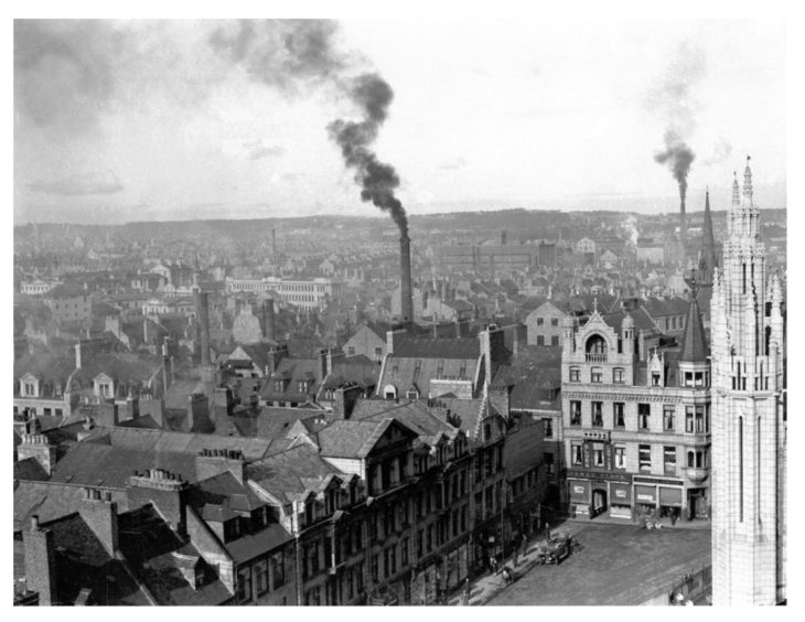
A view of Aberdeen as it was in 1932. This picture from our archive was taken from the Greyfriars Church tower on Broad Street, looking towards Upperkirkgate. One of Marischal College’s towers can be seen on the right.
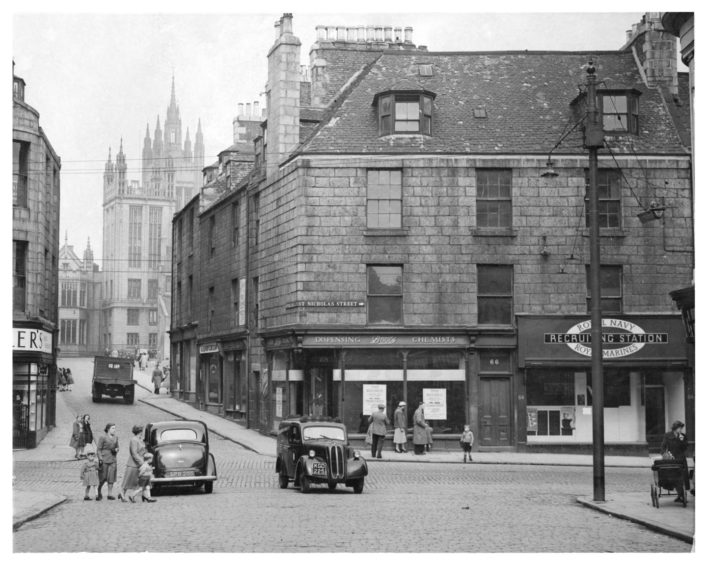
You’d hardly recognise it today, but take a look at this picture from June 1953 and you’ll realise it’s the junction of Schoolhill, St Nicholas Street, and Upperkirkgate. Boots’ corner shop had just closed and moved to Union Street.
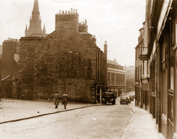
The Upperkirkgate as it was in 1953, looking down from its junction with the Gallowgate and Broad Street, in the days before the Bon Accord Centre.
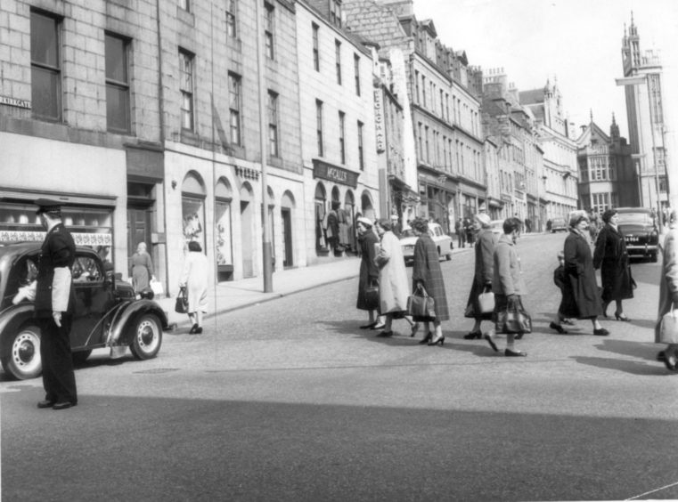
This scene dates from the 1950s and shows Upperkirkgate with a policeman complete with armbands on point duty directing the traffic – not that there was much for him to do in those days.
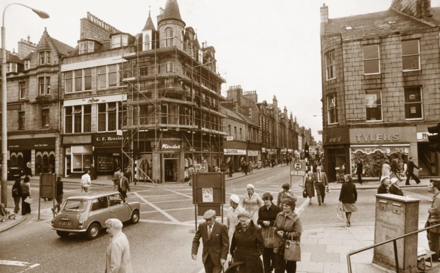
The junction of George Street and Upperkirkgate in 1978 was soon to change dramatically with the building of the St Nicholas and Bon Accord shopping centres.
