Aberdeen has many lost streets, most of which only exist in memories or a handful of archive photos.
When these streets were demolished in the name of progress, heritage was an afterthought, and few were photographed for posterity.
Now, using artificial intelligence technology to colourise these lost streets, we’ve taken a look back at our archives in a different light.
While AI can be a controversial, and at times concerning advance, perhaps it can be used to enhance our view of the past?
It might not be completely accurate, but as these streets no longer exist, it’s our best guess at how bygone Aberdeen looked and felt.
Join us as we don, not so much our rose-tinted glasses, but our technicolour glasses for a new insight into auld Aberdeen…
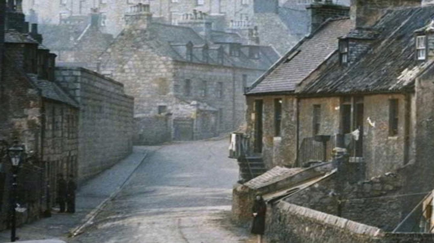
1. Albion Street in the 1930s
There is no trace today of Albion Street in Aberdeen, which ran from Justice Street to Links Road where the Beach Boulevard is today.
Unrecognisable, this 1938 photo looks more Dickensian than 20th Century, with buildings hemmed in together.
The view here is looking back towards the city centre, with the Salvation Army Citadel visible through the chimney smoke in the background.
By 1830, the street had acquired such a bad reputation, the landowners petitioned the police commissioners to change its name.
As Wales Street already adjoined, it was decided the new street should be named after Britain, hence Albion Street.
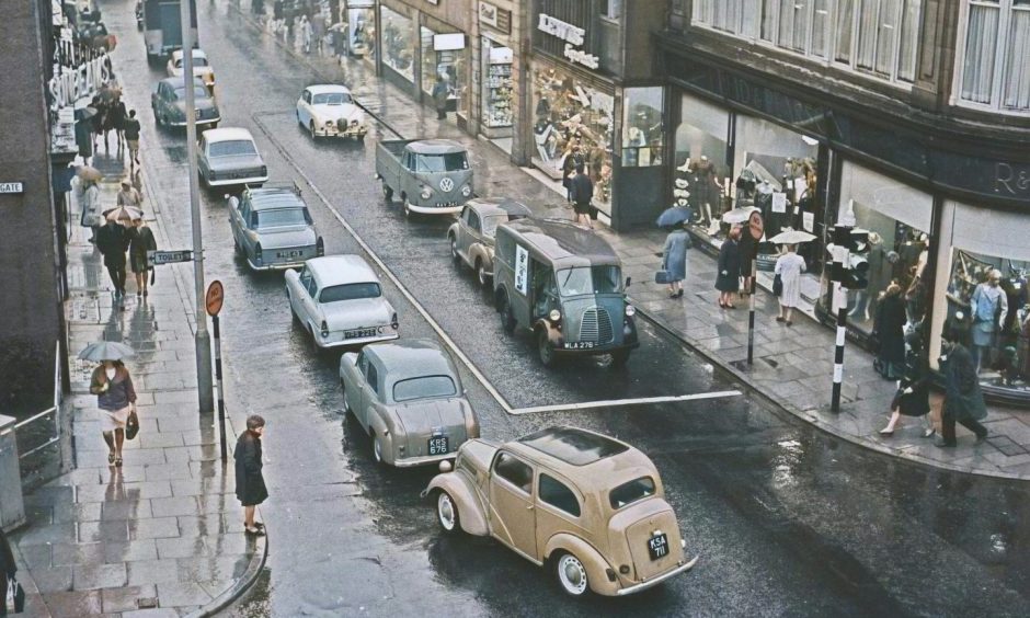
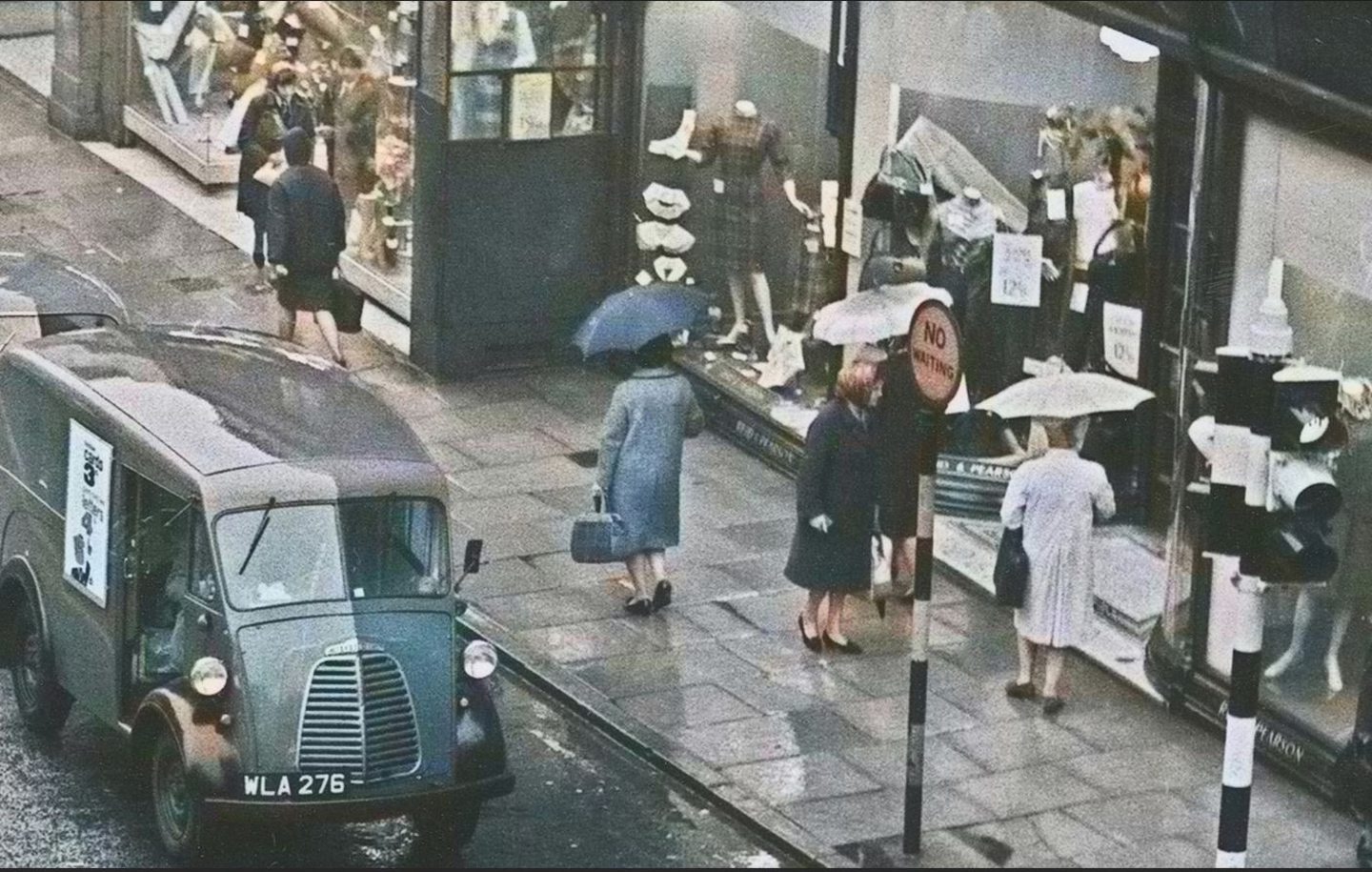
2. St Nicholas Street in the 1960s
St Nicholas Street, as many Aberdonians remember it, is a long-gone and often lamented street that ran right through the heart of Aberdeen.
It was a busy shopping street that linked Union Street at the top of Market Street with Schoolhill at its junction with George Street.
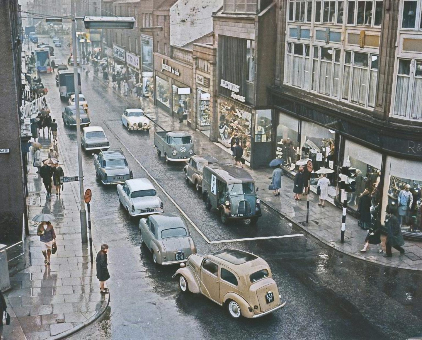
The street was lined with well-known family businesses that had stood for decades.
Reid and Pearson’s department store, with its windows full of goodies, wrapped elegantly around the corner of Schoolhill and St Nicholas Street.
But it was all demolished in 1982 to pedestrianise the street and build the covered St Nicholas shopping centre instead.
Our photo from 1965 looking towards Union Street shows St Nicholas Street as many will remember it: a busy thoroughfare with lots of independent businesses.
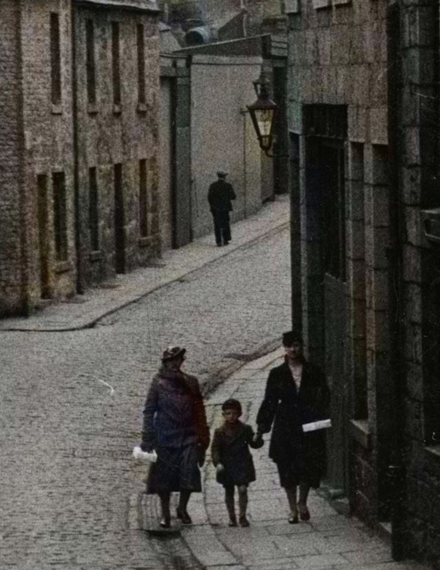
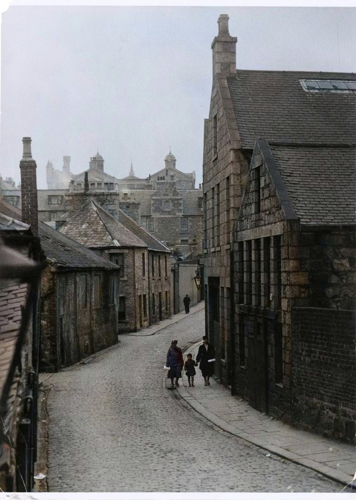
3. Broad Street in the 1920s
Home to Marischal College, Broad Street is still an important city-centre landmark, but it looks very different.
The Broad Street that existed for centuries, with its tall, granite buildings and ancient narrow lanes, was lost bit by bit between 1945 and 1965.
Traditionally, it was a busy street for shopping and commerce, and the historic home of Aberdeen Journals.
In colour we can see the detailed signwriting on windows. James Mutch reads ‘hobbies agency for fretwork goods’.
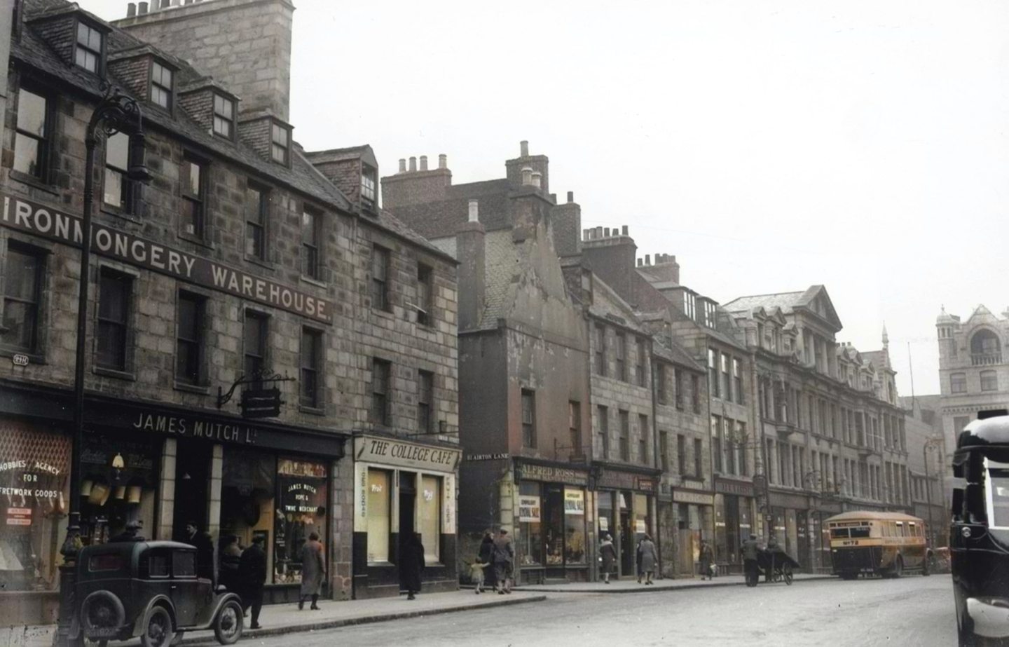
Next door the College Cafe is advertising ‘iced sodas’ and ‘fruit ices’.
The corporation bus in the background is number 72.
In this entire photo, the only building still standing is the old Aberdeen University Students’ Union at the top of Upperkirkgate.
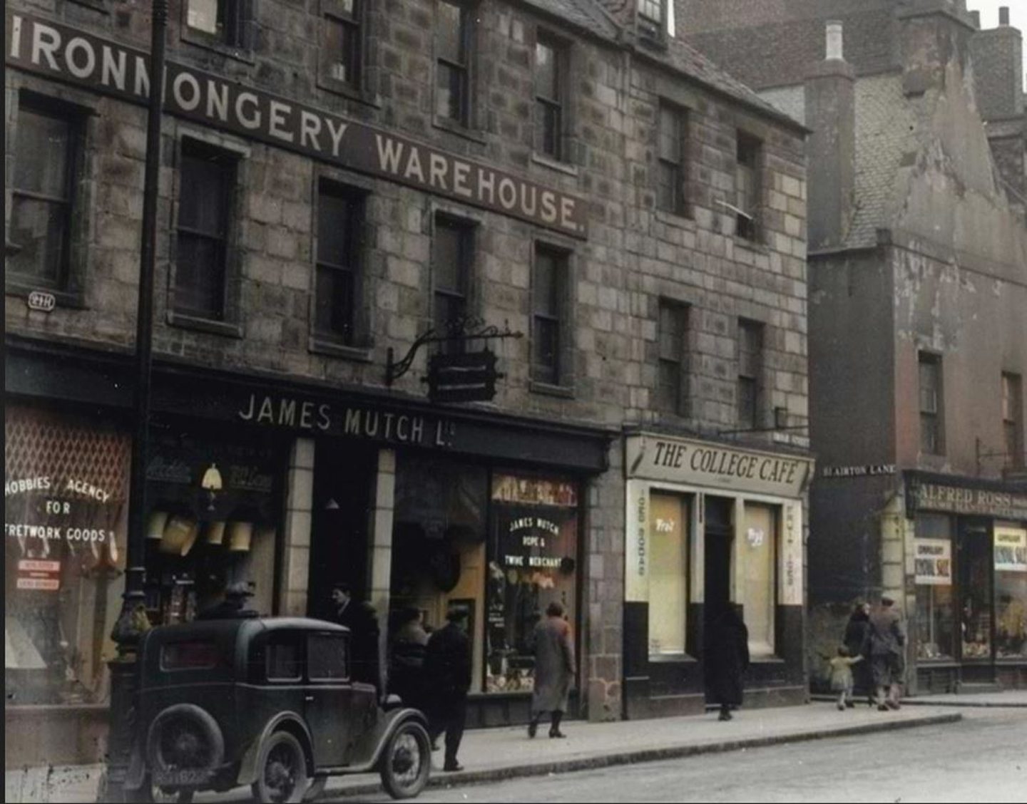
Everything else on Broad Street was demolished in a piecemeal fashion to make way for the new council headquarters, St Nicholas House.
Eventually, it too came down, and now the site is occupied by Marischal Square.
4. St Paul’s Street in the 1970s
St Paul’s Street is a lost street in Aberdeen city centre behind Upperkirkgate that used to link Gallowgate with Loch Street.
These days it’s a short deadend from Gallowgate to the loading bay behind the Bon Accord Centre.
But in the late 1800s, St Paul’s Street was home to a church, two chapels, a school and a small hospital.
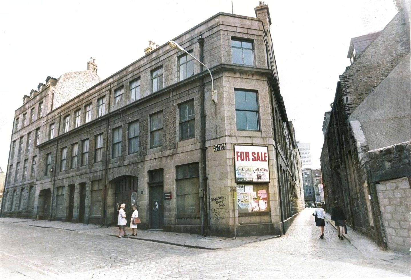
Worshippers at old St Paul’s Episcopal Church included a young Lord Byron, but the only remains of the church is an arched gateway, which was moved to nearby Berry Street.
St Paul’s Street School closed in 1960, becoming the education department’s music department, while St Paul’s Episcopal Church was flattened in 1966 to make way for a car park.
The street, including buildings like Farquhar and Gill’s colourworks, was demolished entirely in the 1970s for the development of the Bon Accord Centre.
In colour and high definition we can even read the football graffiti on the side of the building.
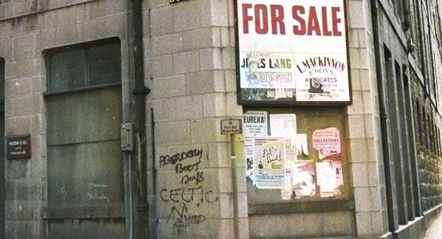
Thankfully it appears fairly tame, a territory has been marked by “Aberdeen Boot Boys”, and someone else has sprayed “Celtic” as a come back.
Boot boys was apparently 1970s slang for gangs of hooligans who wore Bovver boots and cropped hair.
The boarded-up window next door is scrawled with the name ‘Malcolm’ and the poster to the right is advertising a production ‘Fit like!’ at His Majesty’s Theatre.
5. Queen Street in the 1960s
Once regarded as the ‘genteel Queen Street’, this busy scene below is not the city centre-street we know today.
Here, it’s a bustling thoroughfare, which ran between Broad Street and a junction with King Street at the Arts Centre.
The shops on the right – including the famous McKay’s – are bursting with wares.
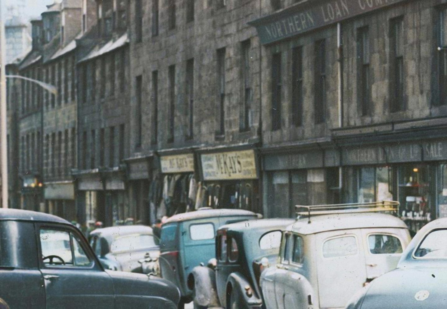
All these buildings in Queen Street were demolished shortly after this photograph was taken in October 1960.
More clearance work took place in 1971 to widen the road to better link it with the new Grampian Police headquarters.
However, the winds of change are blowing down Queen Street again, as the area is set to undergo a huge redevelopment.
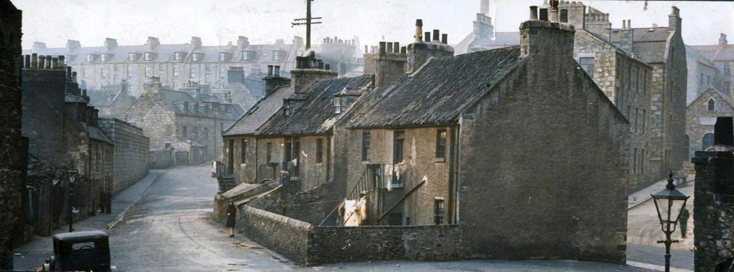
6. Fore Close, Old Torry, in the 1960s
When Old Torry was lost, part of Aberdeen’s rich and unique heritage was also lost forever.
Fishing was one of the main industries on which Aberdeen was built, leading to the establishment of tight-knit coastal communities.
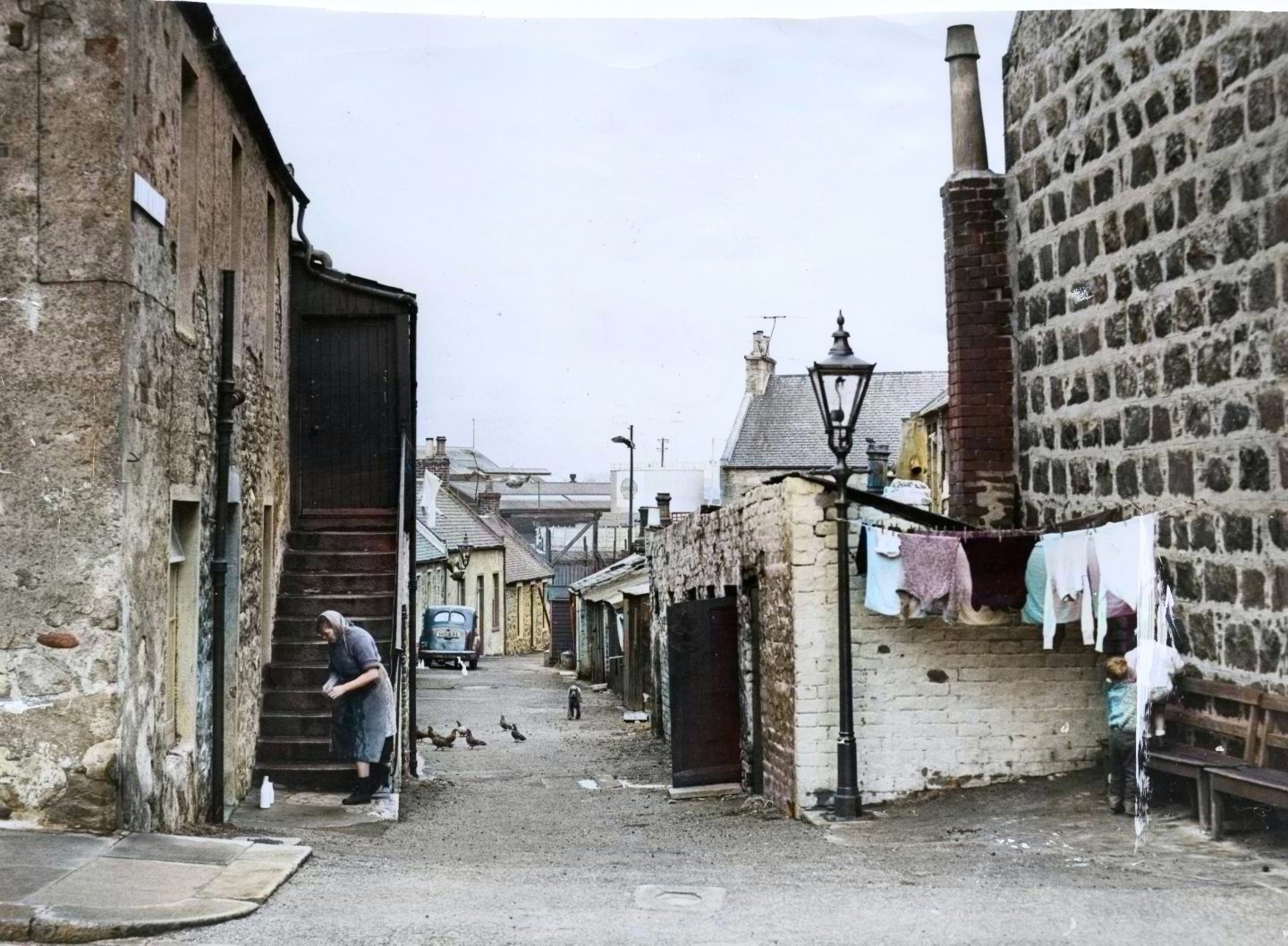
Torry was one of the oldest parts of the city, a steadfast, standalone community thought to date to the 12th Century.
The fishing village of Old Torry grew in the 17th and 18th Centuries, before it officially became part of Aberdeen in 1891.
But over the centuries it suffered in the name of progress; some of the most historic houses were lost when the River Dee was diverted in 1971.
And 100 years later, streets like Fore Close, characterised by quaint cottages, were flattened to make way for industrial oil and gas developments.
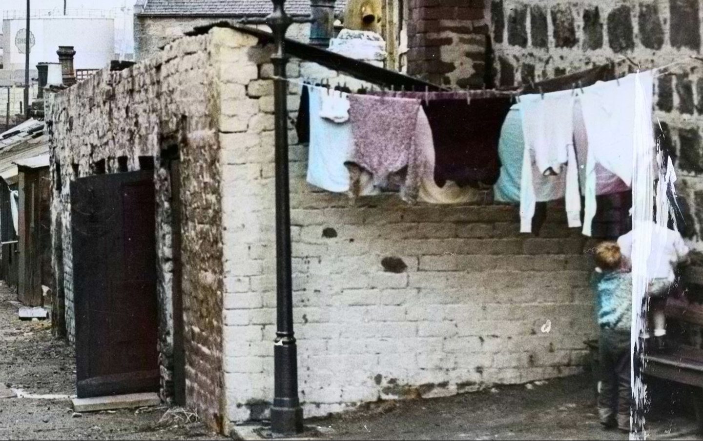
This photo not only shows a lost street but a lost way of life, when washing was hung up in the street outside washhouses.
The enhancement not only brings out colour in the washing, but it also reveals a little boy on the right who was camouflaged in black and white.
If you look really closely, he is holding on to a younger infant standing on the bench, although the original photograph is a little damaged.
7. The Hardweird, in the 1920s
One of the city’s more unusual lost streets (and names) was the Hardweird, which ran between Skene Row off Skene Street, and Jack’s Brae near Gilcomstoun.
Hardweird, or Hard Ward, was the name given to a street adjacent to an old cottage of the same name.
Gilcomstoun was an ancient hamlet, and the Hardweird was more like a rural community, with the Den Burn flowing through it.
The mid-18th Century weavers’ crofts were rare relics of Aberdeen’s typical historic housing stock, featuring forestairs outside which gave access to the upper floor.
But this was no rural idyll, the Den Burn resembled an open sewer and the houses were slums.
Slum clearance began in 1908 and continued until the area was swept away by the early 1930s. Nowadays, Gilcomstoun Primary School’s playground occupies part of the Hardweird.
Our colourised photos shows two young lads standing on the left with what looks like a football at their feet.
Clothing is draped over railings of the houses, some of which show roofs with slipped slates.
8. Gallowgate in the 1950s
Gallowgate is a familiar name in the Aberdeen of today, but visually, it’s unrecognisable from archive photos.
Once rivalling Edinburgh’s Royal Mile in terms of built heritage and businesses, the Gallowgate was a thoroughfare of Medieval Aberdeen.
It was the route taken to Gallow’s Hill for the condemned to be executed, and it was the entry point into Aberdeen from Brig o’ Balgownie, when the city was gated.
With no thought to heritage, many of the ancient buildings were condemned and demolished in the name of slum clearance between the 1890s and 1930s.
Even the large Porthill Factory, dating back to the 1750s, was also pulled down in the 1960s and the street was flattened out, because it didn’t suit vehicular traffic.
The Gallowgate sustained 40 closes and courts, but nothing remains of an area which was said to have been “systematically destroyed” by the council over the years.
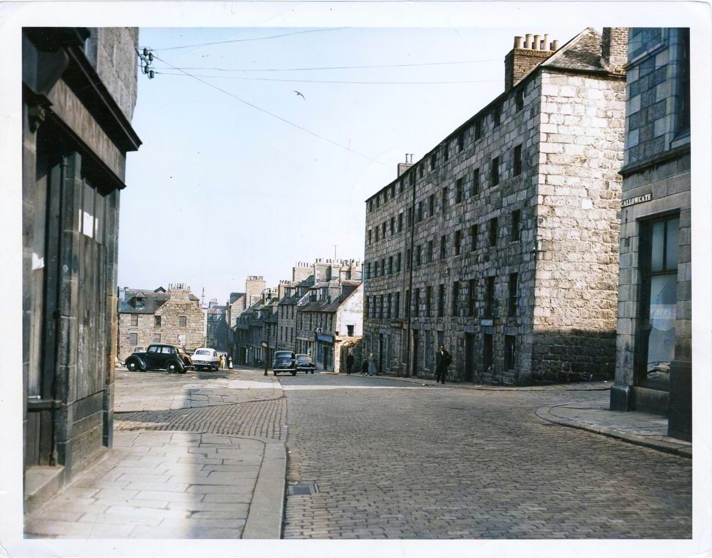
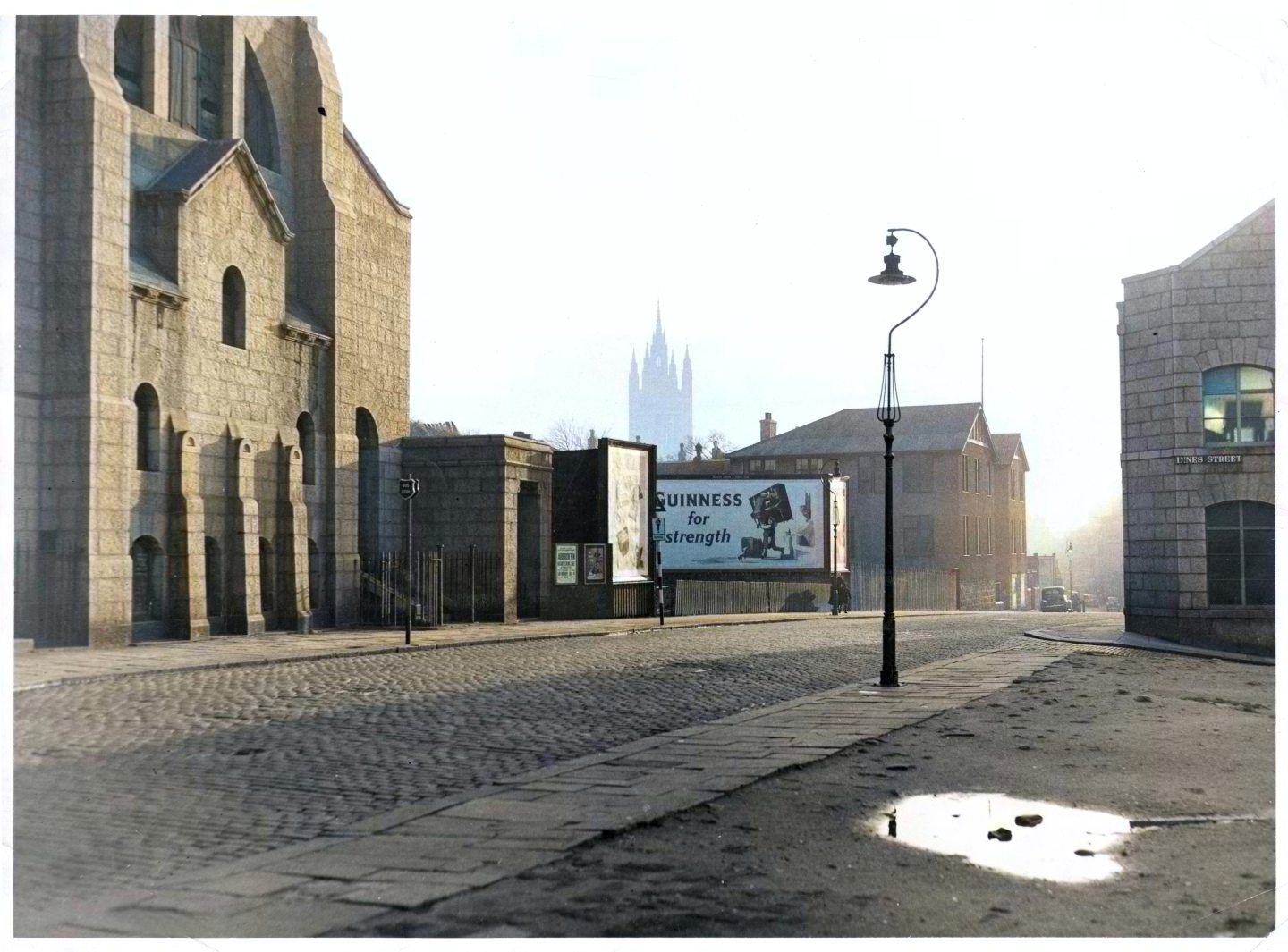
9. Innes Street/Gallowgate in the 1950s
Another lost street was Innes Street which ran from Gallowgate to Loch Street, a site now occupied by North East Scotland College.
Innes Street was a narrow street with a mixture of houses and industry, like the dye works, Edible Fat Factory and an iron foundry.
Opposite the Innes Street/Gallowgate junction originally stood Mar’s Castle, another medieval building demolished in 1897.
The area was bombed during the Second World War, with Gallowgate Church, opposite Innes Street, taking a direct hit.
Aberdeen Town Council approved the closure of Innes Street in 1972 to facilitate the expansion of the Technical College.
It was later demolished, despite opposition from local pensioners from Seamount Court who used Innes Street as a shortcut to the shops to avoid high winds on Gallowgate.
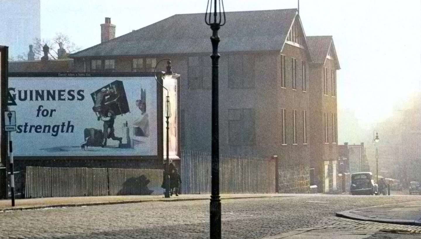
This colourised photo captures a peaceful scene at dusk; the sun is low in the sky casting shadows along the street.
A particularly beautiful detail is the light shining through the window of the edible fat factory on the right.
The Guinness sign stands out on an otherwise old-fashioned streetscape as a woman and young boy walk past it.
10. Flourmill Brae in the 1970s
Instantly recognisable, you’d be forgiven for thinking Flourmill Brae is not a lost street.
However, while Flourmill Lane still runs behind Marks and Spencer behind St Nicholas Street, the Flourmill Brae of yore is gone.
This photo below shows the short Flourmill Brae that joined St Nicholas Street to the closes off Upperkirkgate.
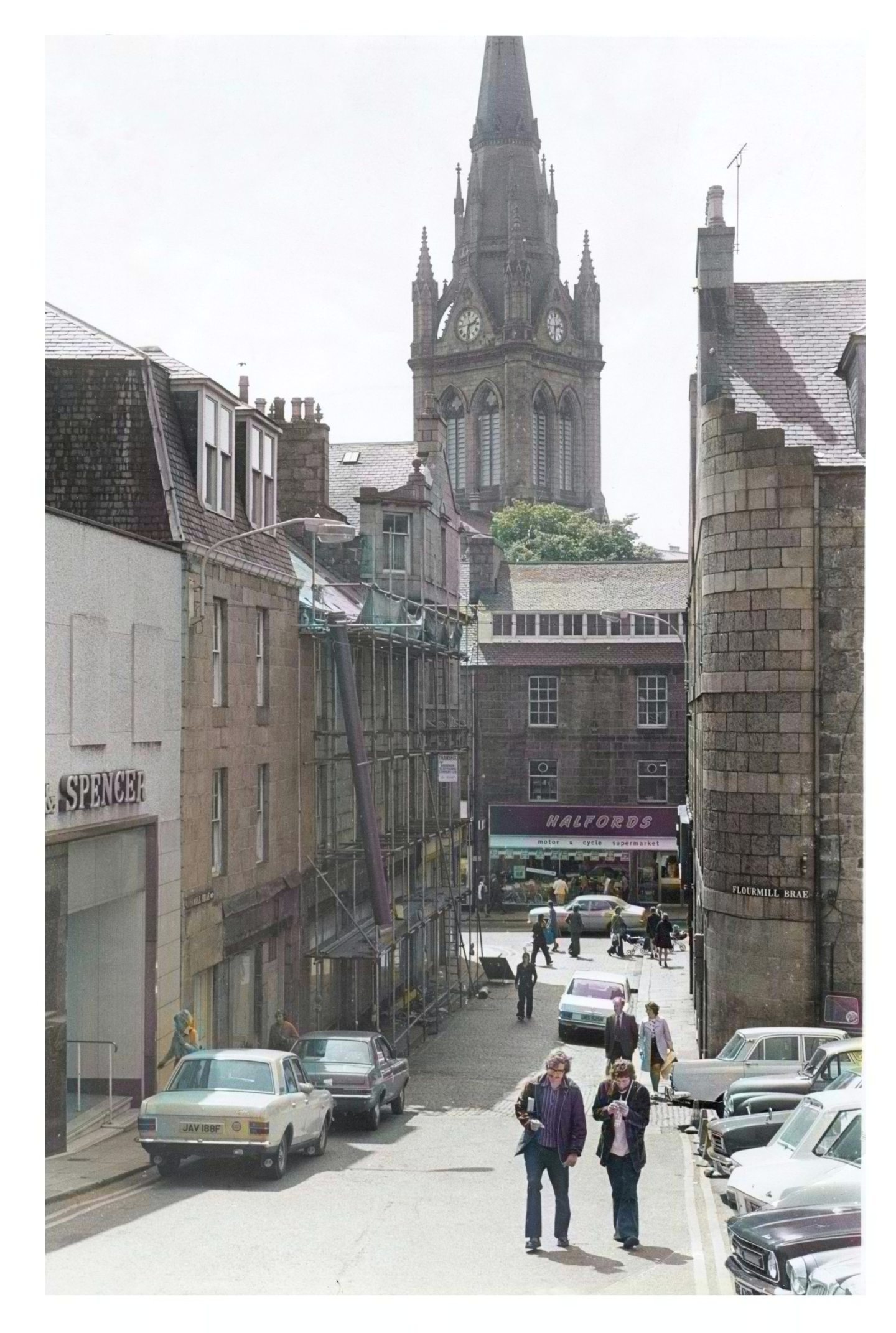
Enhanced, the photo shows gleaming cars in the foreground and two men smiling as they stroll up the brae in their 1970s bellbottom trousers.
But the buildings were flattened in 1982 as part of the £15 million shopping centre developments.
The demolition site was described as “a happy hunting ground” for DIY enthusiasts and antique collectors, as buildings were stripped of marble fireplaces, doors and lintels.
There’s no heritage to see at the same view towards St Nicholas Kirk nowadays, just the delivery yard for Marks and Spencer.
ALL IMAGES IN THIS ARTICLE ARE COPYRIGHT OF DC THOMSON. UNAUTHORISED REPRODUCTION IS NOT PERMITTED.
To purchase archive photos, contact archives@dcthomson.co.uk
More Past Times stories
Photos of Aberdeen at war seen in colour for the first time
In photos: Snapshots of the life and times of 1960s Aberdeen
Visit a lost Elgin with black and white photos colourised for first time
Conversation