Aberdeen from above: 16 aerial photographs of the Granite City in the 1960s
It's only really in seeing Aberdeen from above that you can see how much parts of the city have changed since the 1960s. These photos capture the city before oil, when change was happening at a gentler pace.
Kirstie Waterston
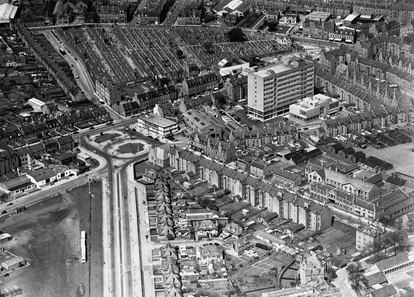
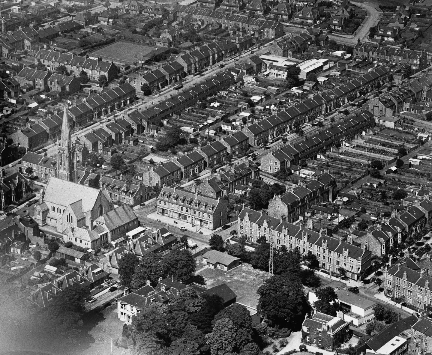
1964: A view looking west from the left, with Urquhart Road, Seaforth Road and Trinity Cemetery with the King Street bus garage in the centre. Image: DC Thomson
Some parts of Aberdeen have changed beyond recognition as the city has sprawled in recent decades. But it’s only really from above you can truly appreciate how the city has evolved.
Aberdeen in the 1960s was a postwar city quickly enveloping surrounding farmland to cope with increasing populations.
But this was Aberdeen before oil, when change was at a more gentle pace.
While newbuilds like the College of Commerce and the Gallowgate appeared on the skyline, a lot the city’s built heritage remained.
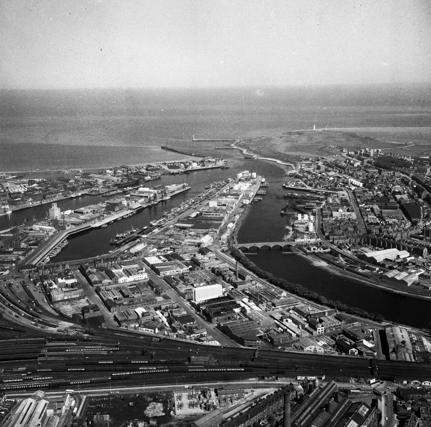
1969: A view looking east towards Aberdeen Harbour with the River Dee on the right. The trains in the foreground look like Hornby models, but you can see how vast the railway freight yard used to be. Image: DC Thomson
In some of these aerial photographs you can see the old prefabs – relics of Aberdeen’s postwar housing stock which lasted far beyond their intended lifetimes.
This was Aberdeen before shopping malls, but on the brink of change, as can be seen in the aerial photo of Broad Street when St Nicholas House was being erected.
There’s something fascinating about Aberdeen from above: the regimented granite villas of the West End; pockets of industry dispersed throughout the city, then the circular planned housing at Torry.
Perhaps you’ll spot your own house?
Gallery: Aberdeen from above in the 1960s
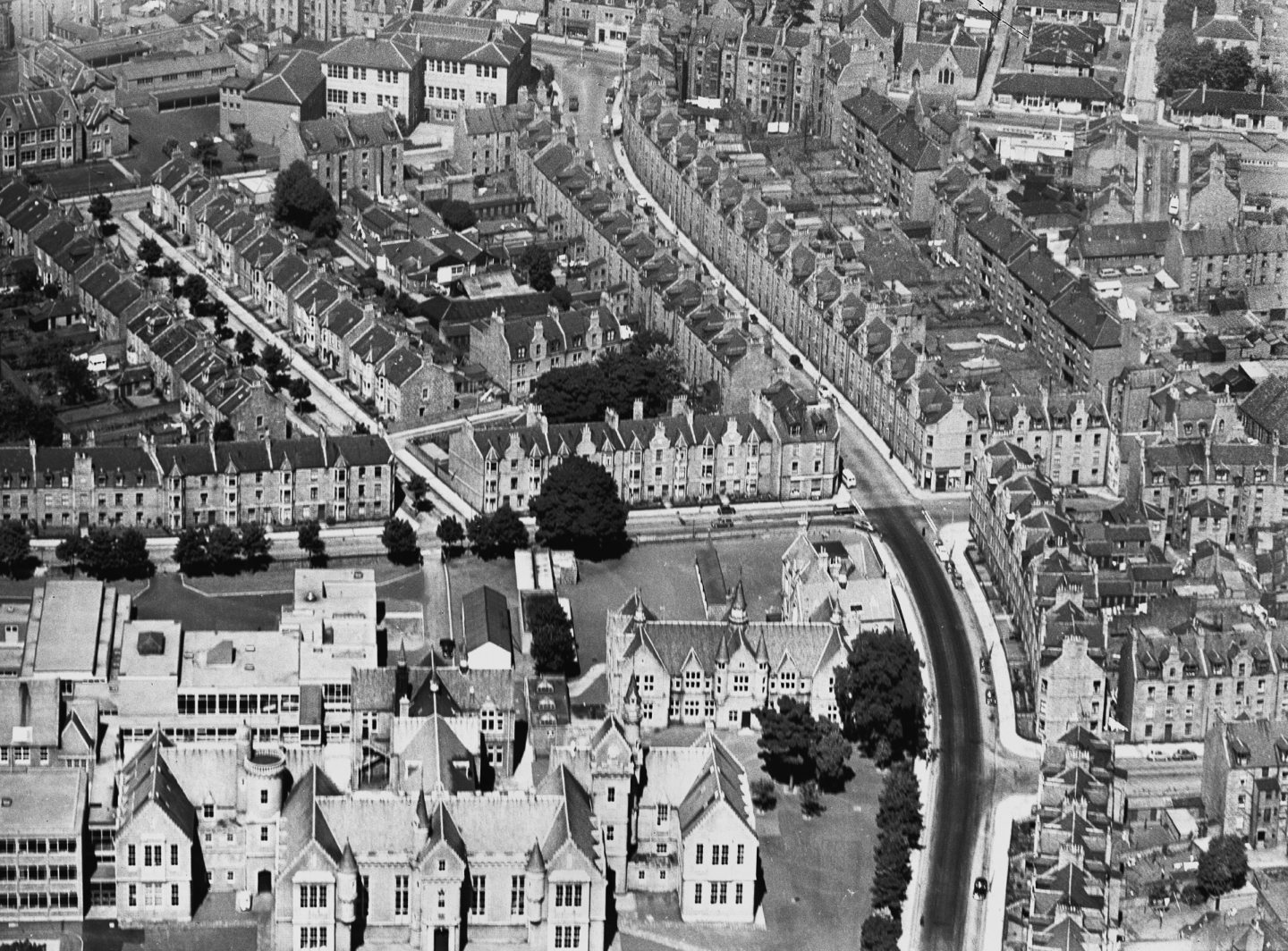
1966: Aberdeen Grammar School is in the bottom left, with Esslemont Avenue running from the bottom to the top of the photograph. The former Rosemount School is at the top centre. Image: DC Thomson
1966: A view looking along Great Southern Road to Holburn Street, with Great Western Road running across the top of the photograph. The College of Commerce is in the centre right. Image: DC Thomson
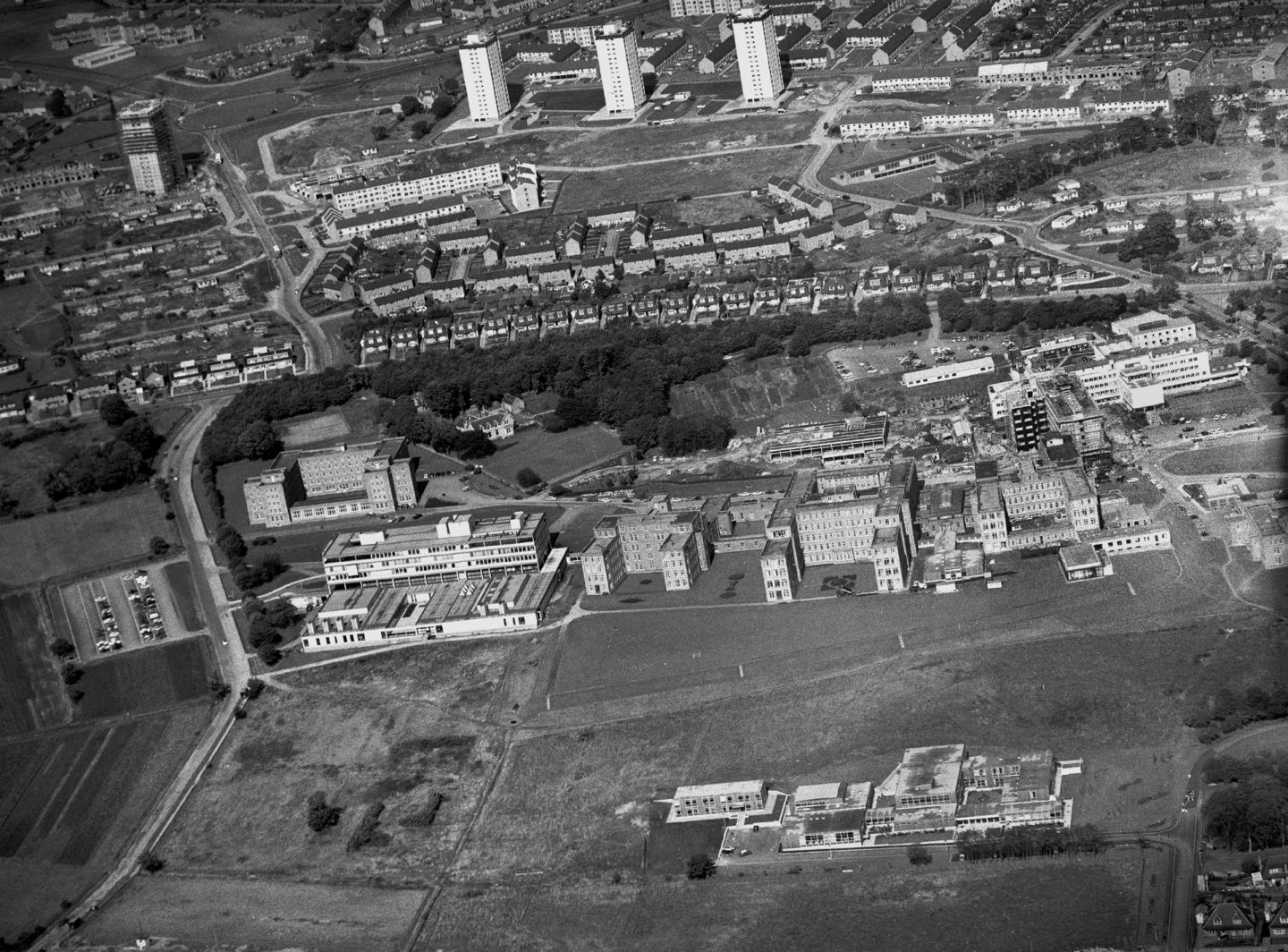
1968: Familiar but different, this aerial view of Aberdeen Royal Infirmary and Foresterhill shows the hospital before the open fields disappeared under a patchwork of extensions and buildings. Foresterhill Road is on the left, and Ashgrove Road West runs across the centre of the photograph with Stockethill and Cornhill behind and Northfield Academy in the top left. Image: DC Thomson
1966: This lovely view of Midstocket shows the attractive West End homes with their neat outhouses and gardens. Beechgrove Church and Beechgrove House are in the foreground. Beechgrove House was the home of the BBC in Aberdeen and Beechgrove Garden, but it was demolished in the 1990s for a new studio. Image: DC Thomson
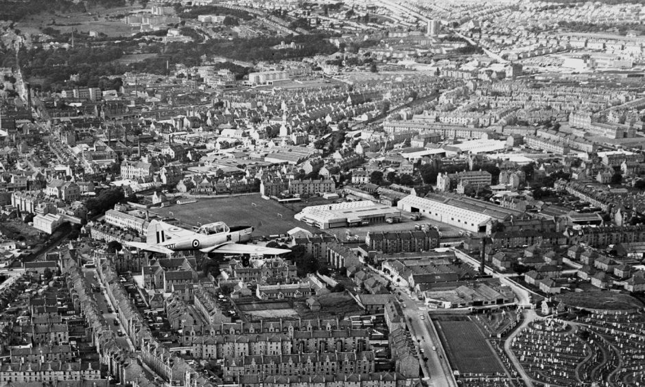
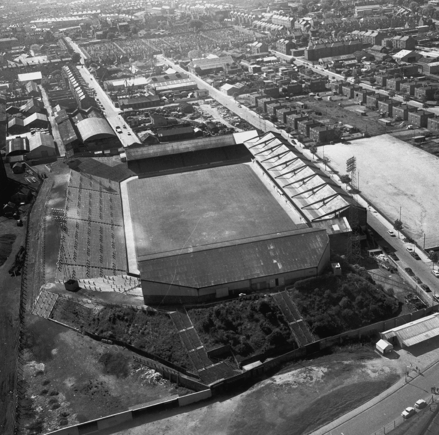
1969: This view of Pittodrie Stadium looking west looks like a model. The Main Stand looks the same these days, but the South Stand and Merkland Stand look a little different. And of course the Dick Donald Stand is located at the east end. Image: DC Thomson
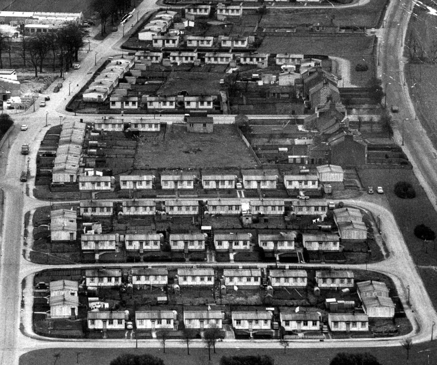
1966: This view is long gone, an aerial shot of some of Aberdeen’s postwar prefabs. These homes at Nigg are bounded by Hillview Road on the left and Wellington Road leading to Nigg Brae. Image: DC Thomson
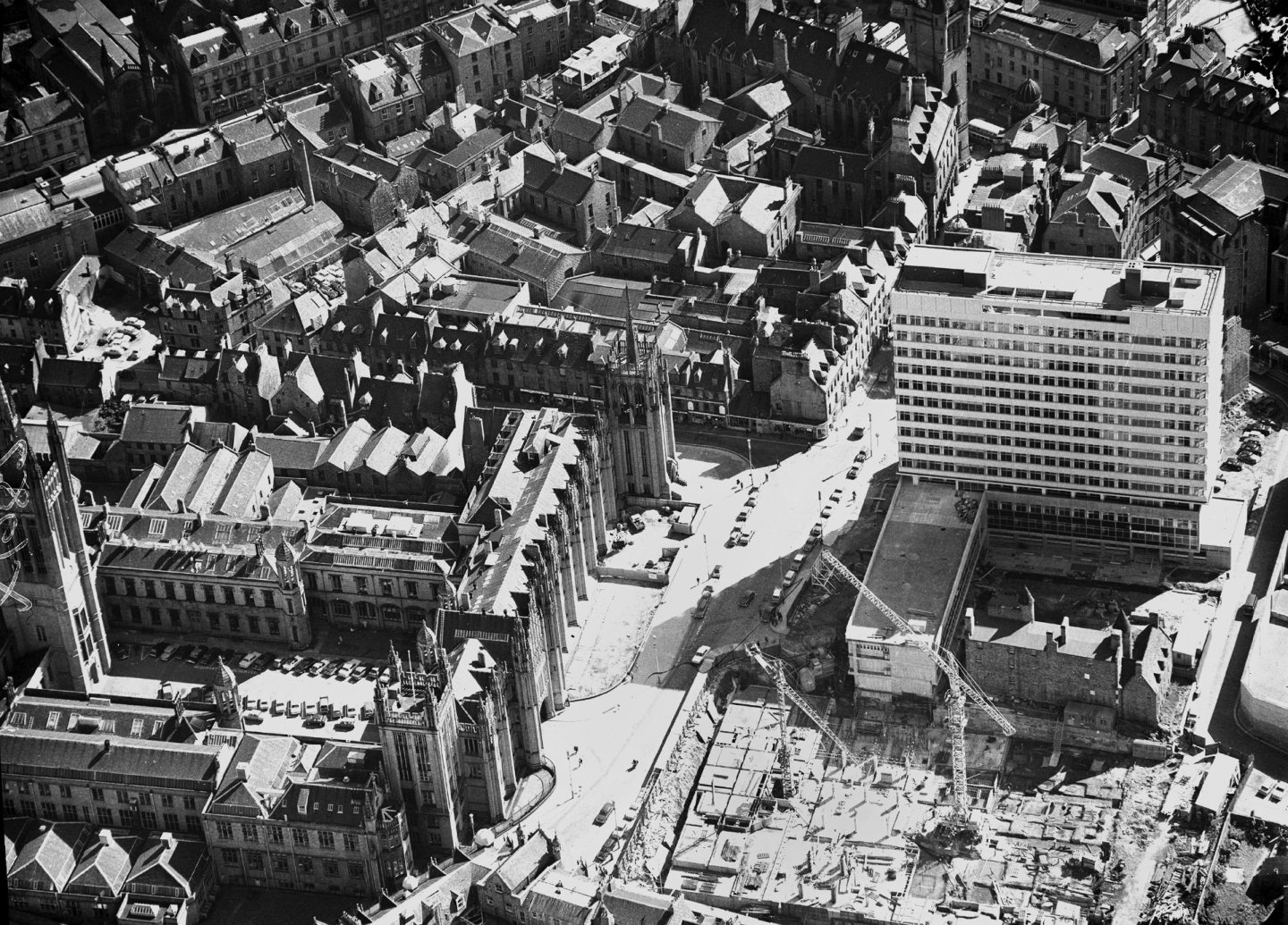
1968: This aerial view of Broad Street when Marischal College was still a university building. On the right, St Nicholas House was still under construction. You can see the Georgian buildings of Broad Street and Queen Street here before they were demolished in the 1970s. Image: DC Thomson
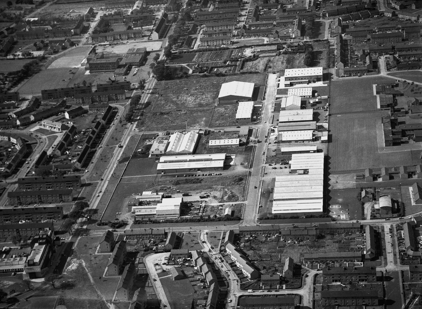
1968: This view of Mastrick looking west shows the Lang Stracht Hotel at the bottom left with the Lang Stracht running to the top of the photograph. Mastrick Industrial Estate is in the centre before the Aberdeen Journals building was built. Summerhill Academy can be glimpsed at the top left. Image: DC Thomson
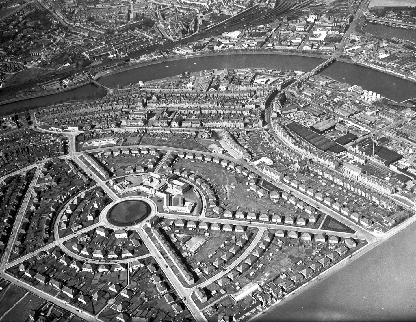
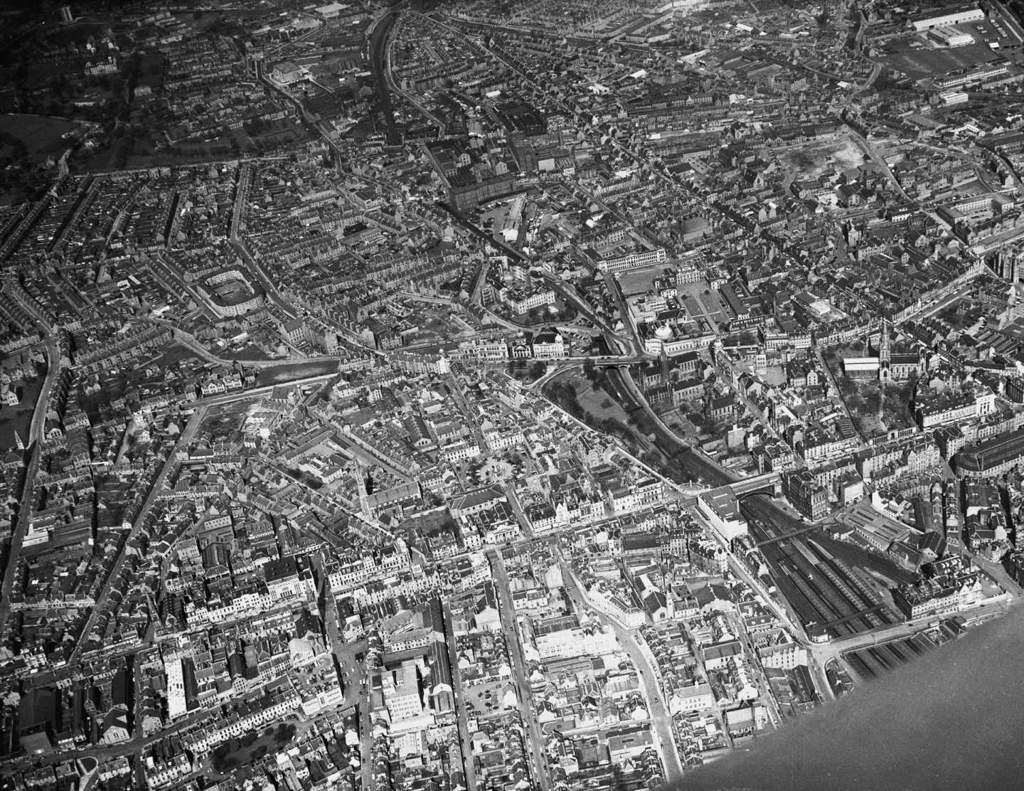
1961: Torry from above with Torry Academy in the centre with Wellington Suspension Bridge crossing the Dee on the left and Victoria Bridge on the right. Image: DC Thomson
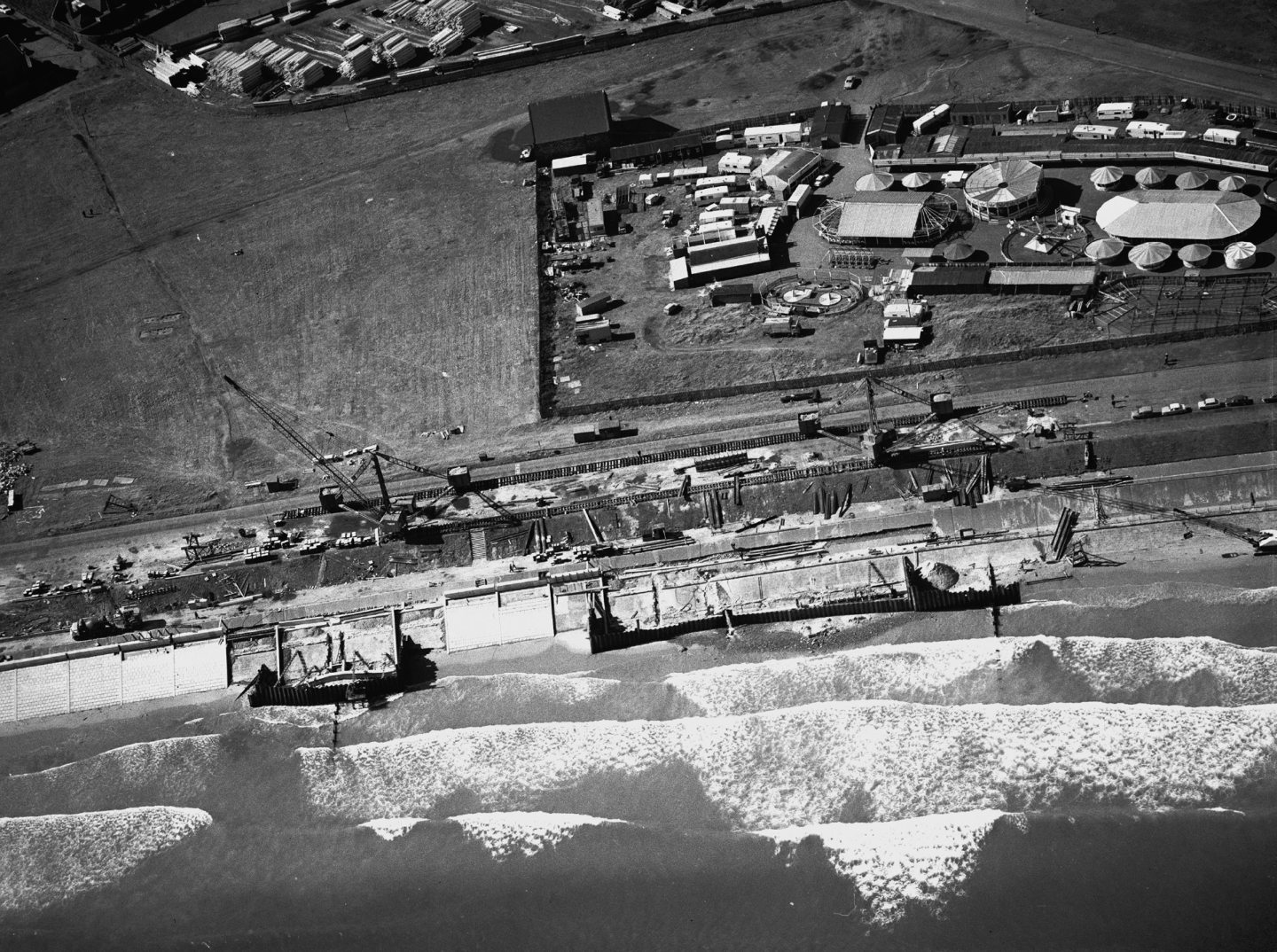
1968: This fantastic photo shows the sea wall under construction at Aberdeen Beach, with crashing waves in the foreground. The beach carnival stands behind. Image: DC Thomson
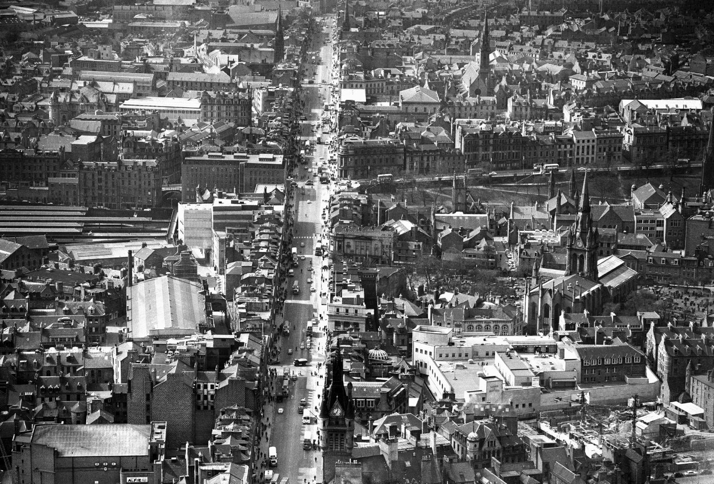
1966: Here we are looking west along Union Street in 1966. Union Terrace and Union Terrace Gardens are in the centre to the right of Union Street, but a few landmarks are long gone. The large roof on the centre left is the Victorian New Market which was demolished in the 1970s. While the street in front of St Nicholas Kirk was the old St Nicholas Street which was later flattened to make way for the St Nicholas Shopping Centre. Image: DC Thomson
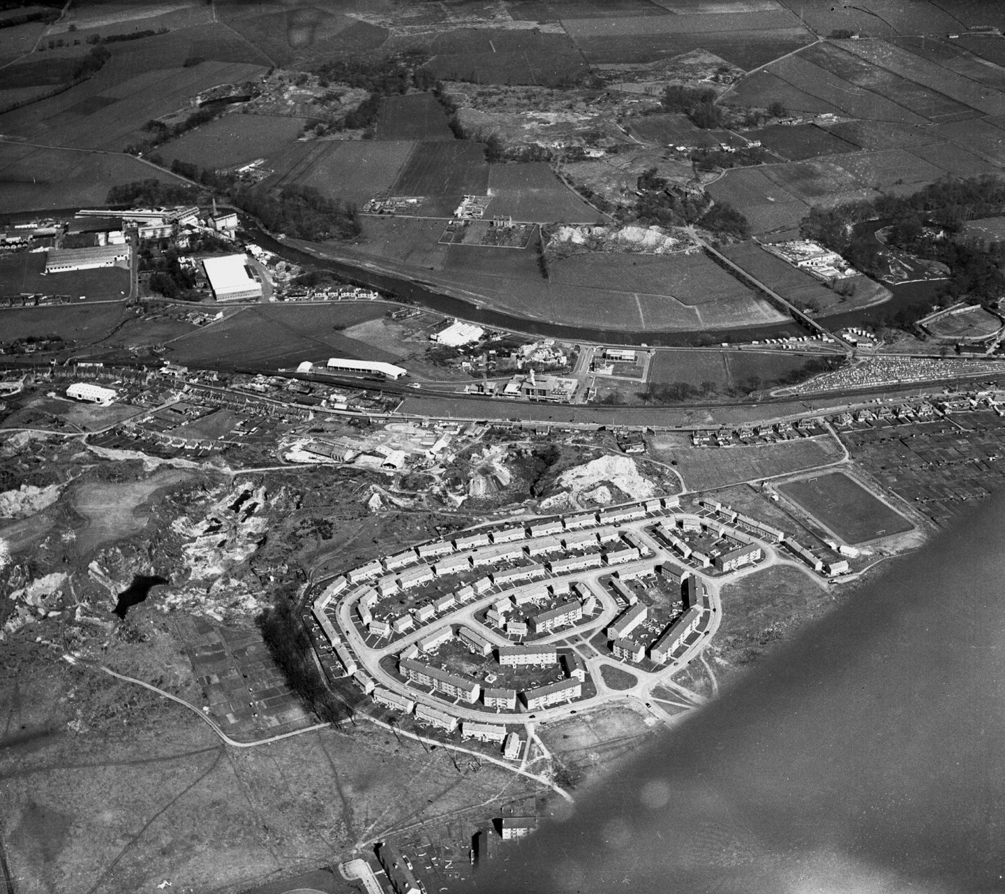
1961: Heathryfold and Dancing Cairns Quarry in the foreground looking towards Mugiemoss Mills on the left and Persley Bridge crossing the River Don on the right. The wind of the aircraft covers the lower right frame. Image: DC Thomson
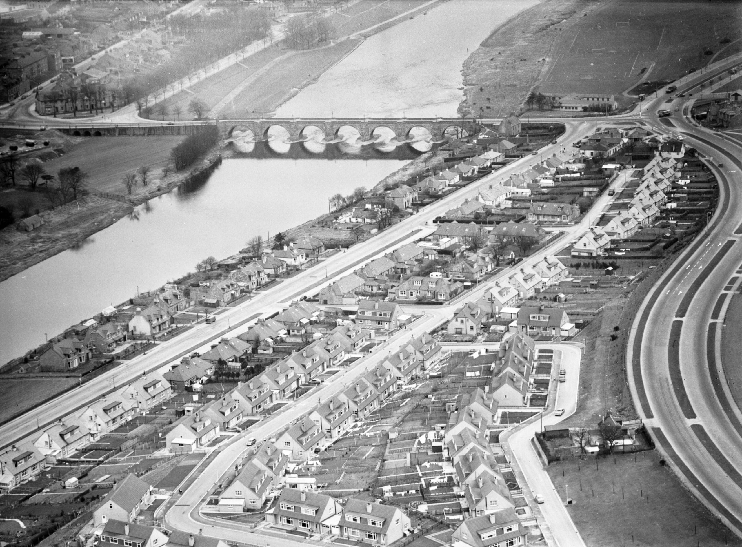
1966: An aerial view of the Bridge of Dee showing Leggart Terrace and Leggart Avenue in the foreground with the Stonehaven Road on the right, taken in 1966. Image: DC Thomson
1961: Union Street running left to right across the photograph, you can make out the puffin’ brig in the lower right area before the Trinity Centre development. In the top right you can see the lost streets demolished for the Bon Accord Centre. Image: DC Thomson
ALL IMAGES IN THIS ARTICLE ARE COPYRIGHT OF DC THOMSON. UNAUTHORISED REPRODUCTION IS NOT PERMITTED.
Comments are currently disabled as they require cookies and it appears you've opted out of cookies on this site. To participate in the conversation, please adjust your cookie preferences in order to enable comments.
Aberdeen from above: 16 aerial photographs of the Granite City in the 1960s
Conversation